Mountain range, region / State
Dolomites in Alps / Italy
Season
Summer
27. 07. - 28. 07. 2010
Difficulty
2 / 5
Elevation
↑ 2179 m
↓ 2179 m
Length
23.6 km
2 days
Altitude
max. 2787 m n.m.
min. 1532 m n.m.
Tips for hikes in the mountain range Dolomites in Alps
6-day crossing of the Dolomites along the Alta Via 1 route
Circular trek at the waterfalls in the Fanes Sennes Braies park in the Dolomites
Trek with the best ferrata in the Sexten Dolomites
Two days of relaxing mountain hiking in the Fanes-Sennes-Braies National Park
Starting point
Parking at the end of the Valle di Tamores by the Rifugi Pederu hut. The road into the valley starts in the village of San Vigilio di Marebbe. This village lies about 10 km south of Bruneck.
Description of the hike
1. day
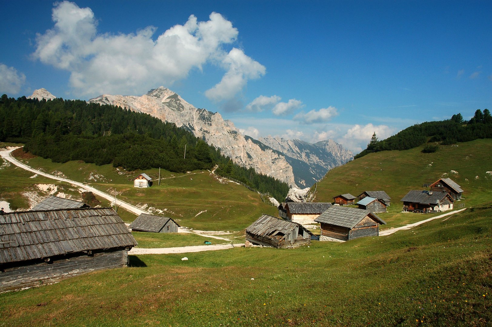
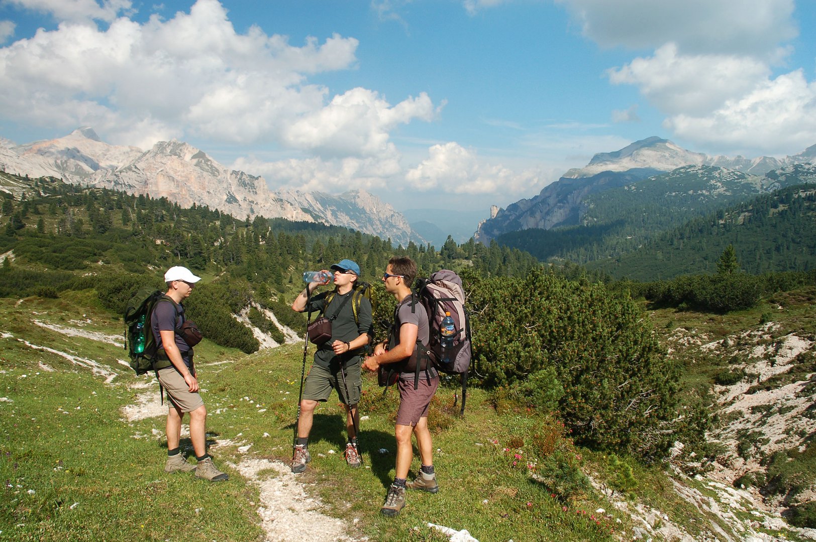
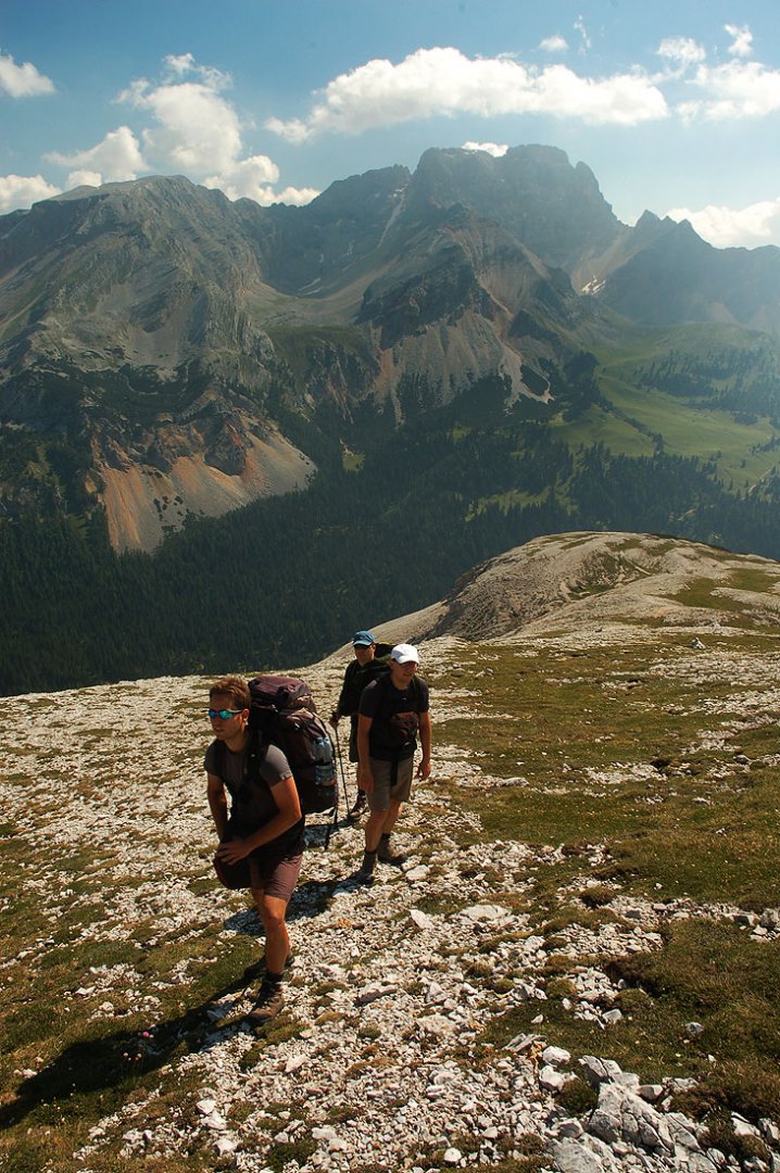
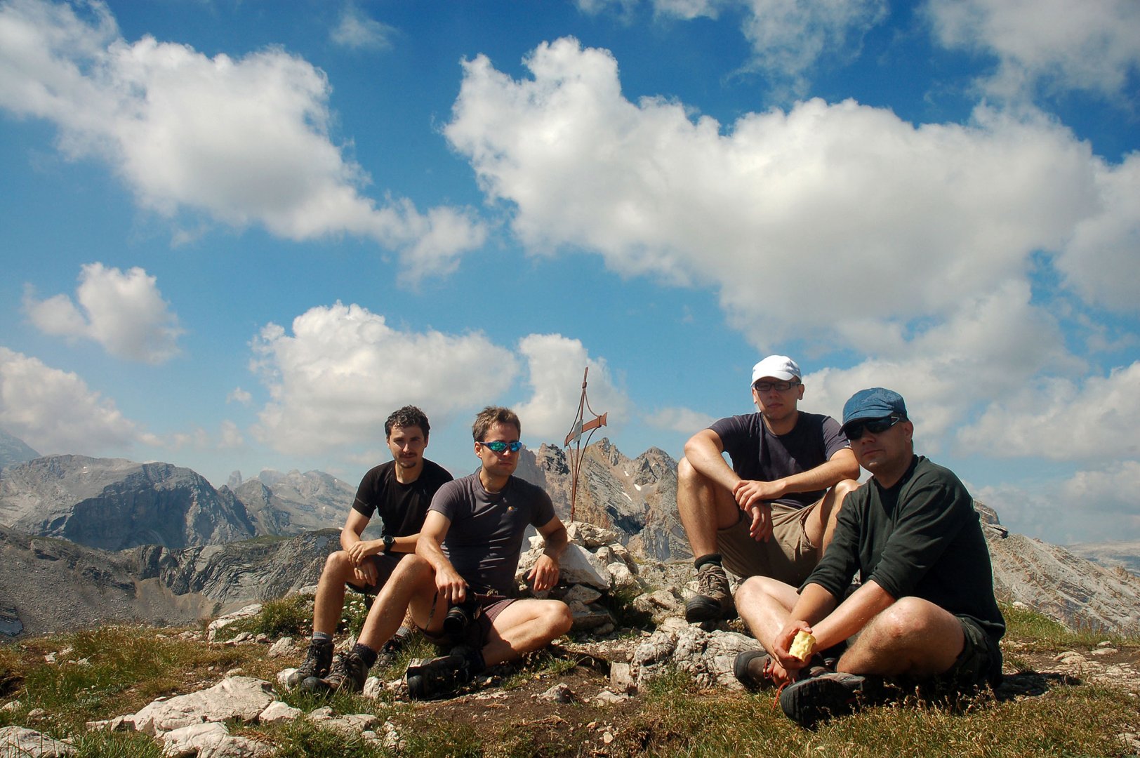
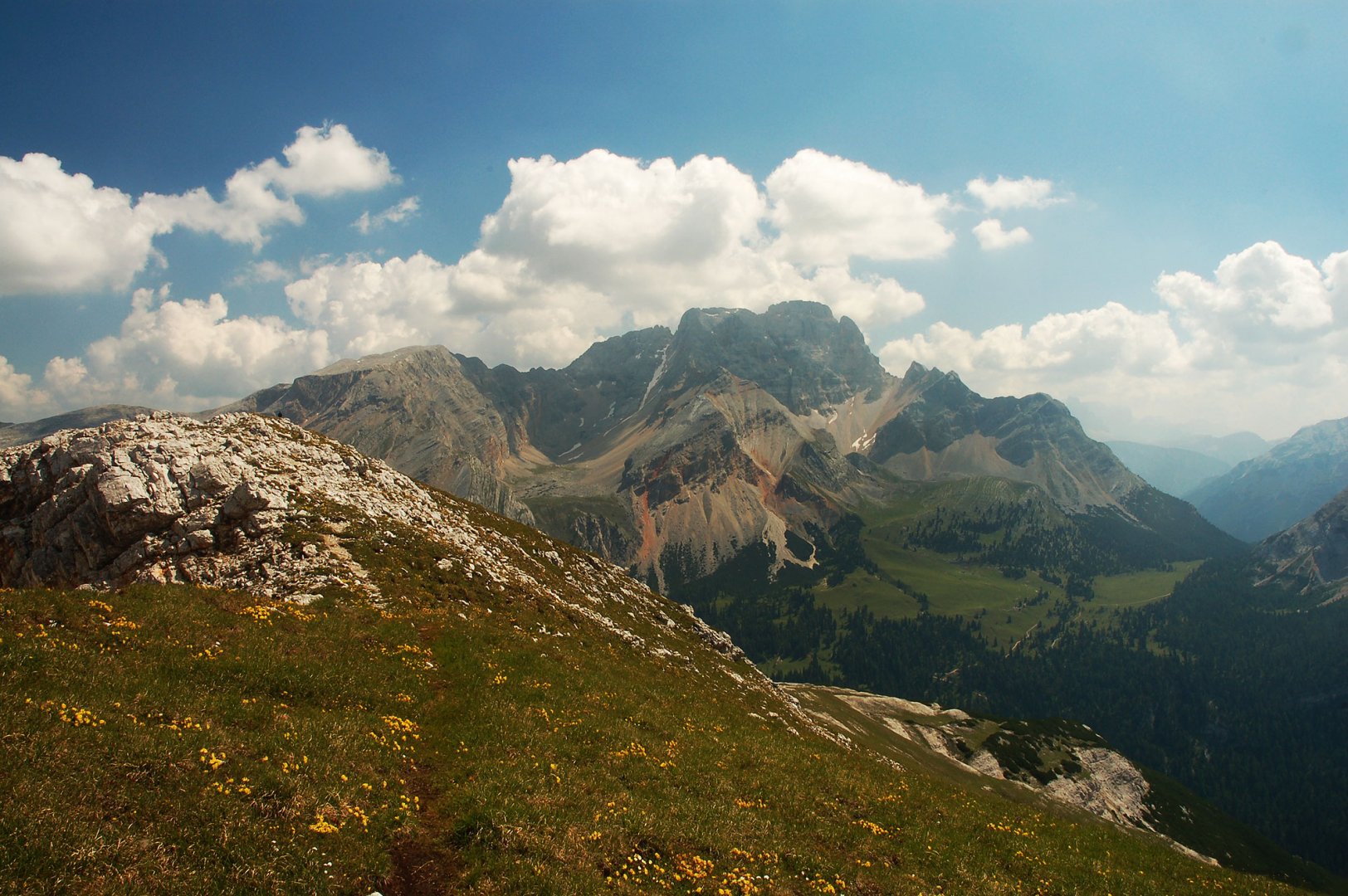
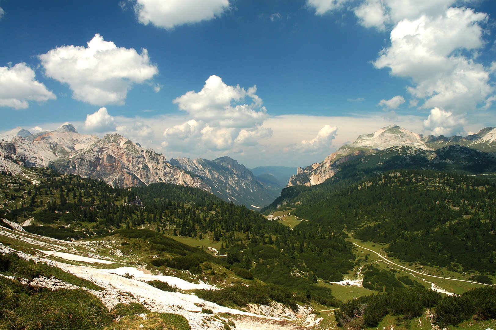
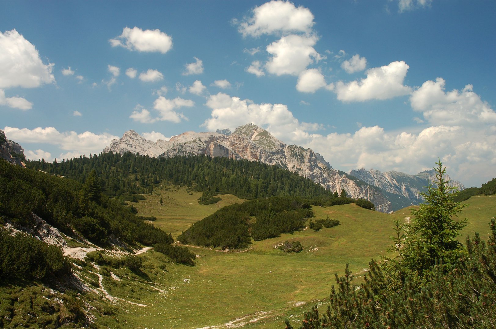
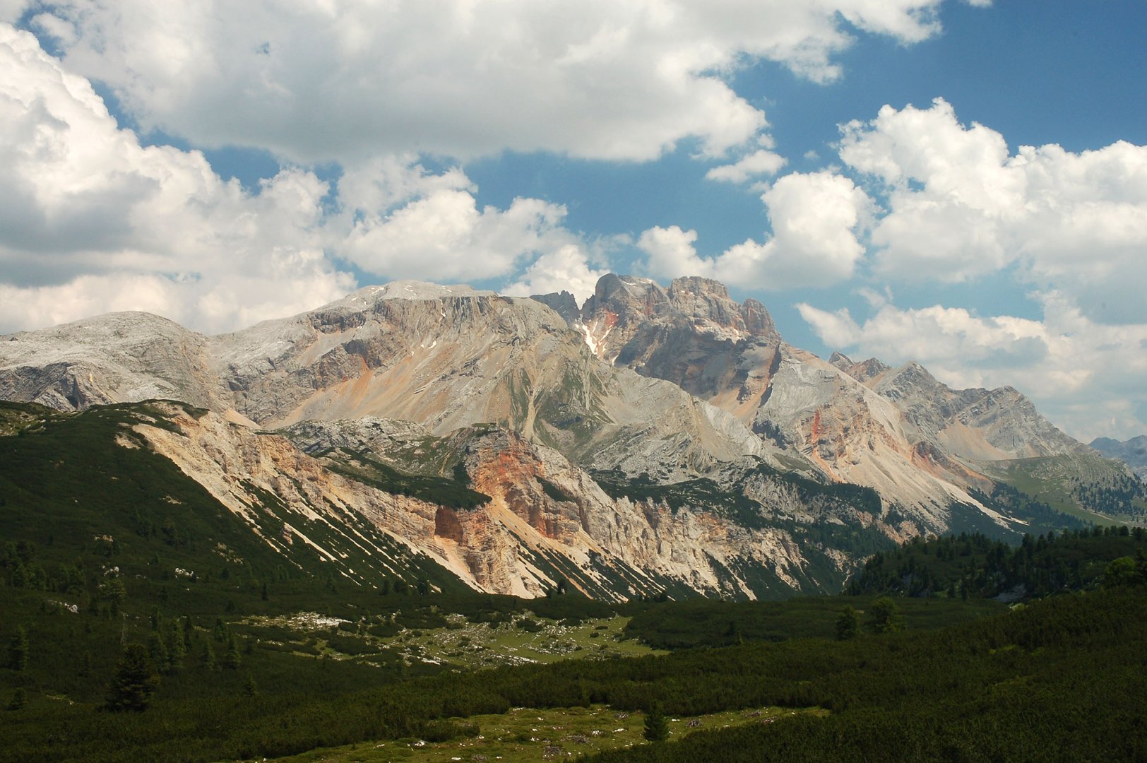
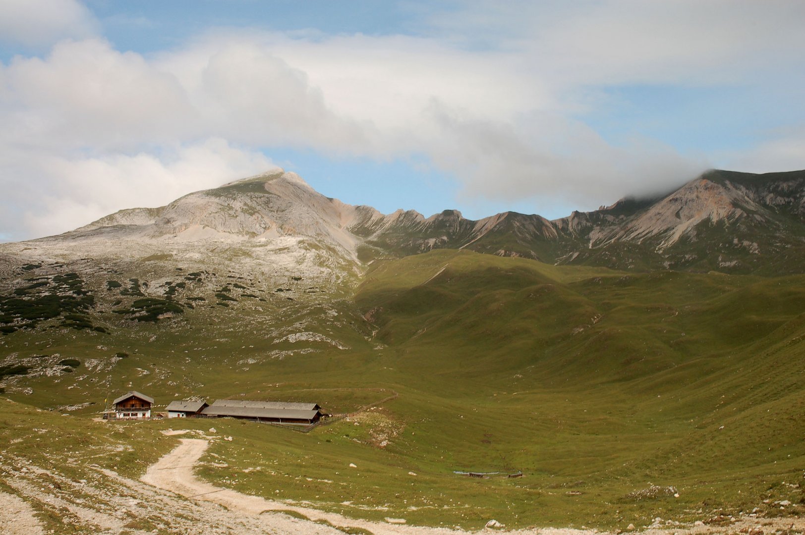
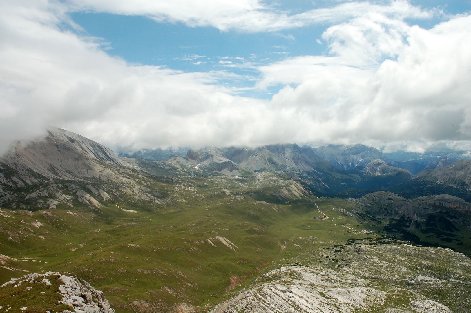
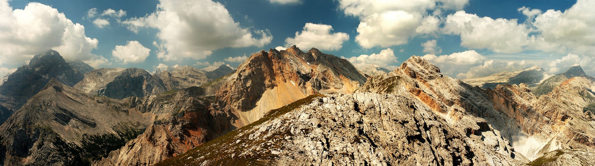
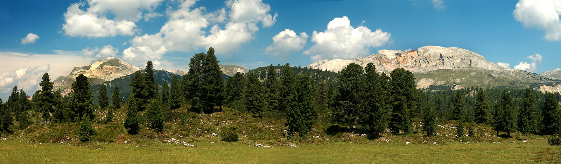
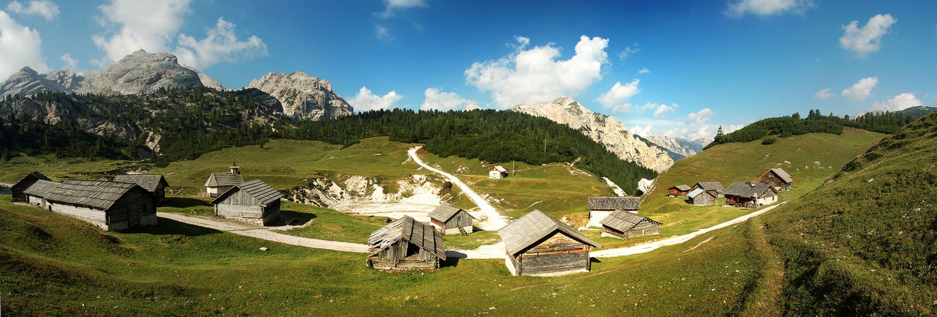
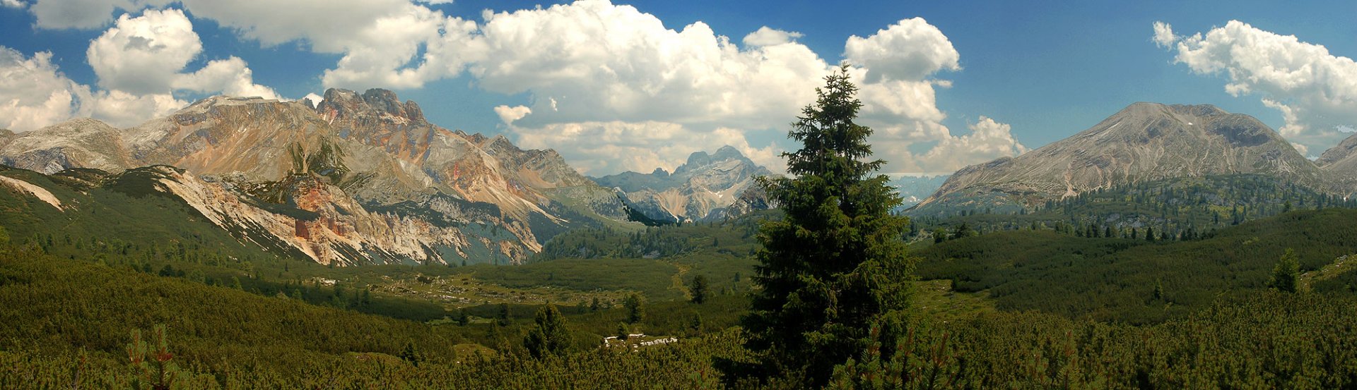
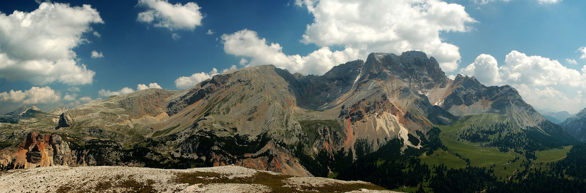
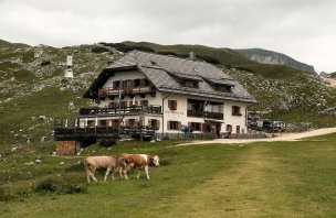
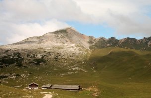
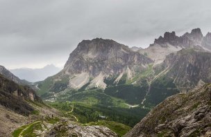
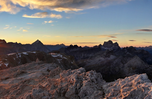
We started our journey to the Fanes-Senes-Braies National Park at the car park at the end of the Valle di Tamores. From the car park we set off along a signposted path that led along a wide track. This path eventually led us to the Fodara Vedla shepherds' huts. The going was very good, so we ran the elevation gain of about 400 meters in no time. We lingered at the shepherd's hut for a while, as it is a really beautiful place set in stunning natural scenery. (photo) At the same time we used one empty shepherd's hut and left our backpacks there. Our next destination was the Lavinores mountain 2 462 m above sea level. Since it was a round trip, we didn't want to lug heavy backpacks unnecessarily. So we proceeded lightly from the shepherd's huts towards Mount Lavinores. Here there was no longer a wide road, but a classic mountain trail. The path led through a beautiful landscape. (photo) The final part of the climb to the top is already on meadows and stones. From the summit of Lavinores there are beautiful views of the surrounding three thousand giants, including the Tofan group. (photo) After a short rest on the summit we returned to the Fodara Vedla shepherds on the same path.
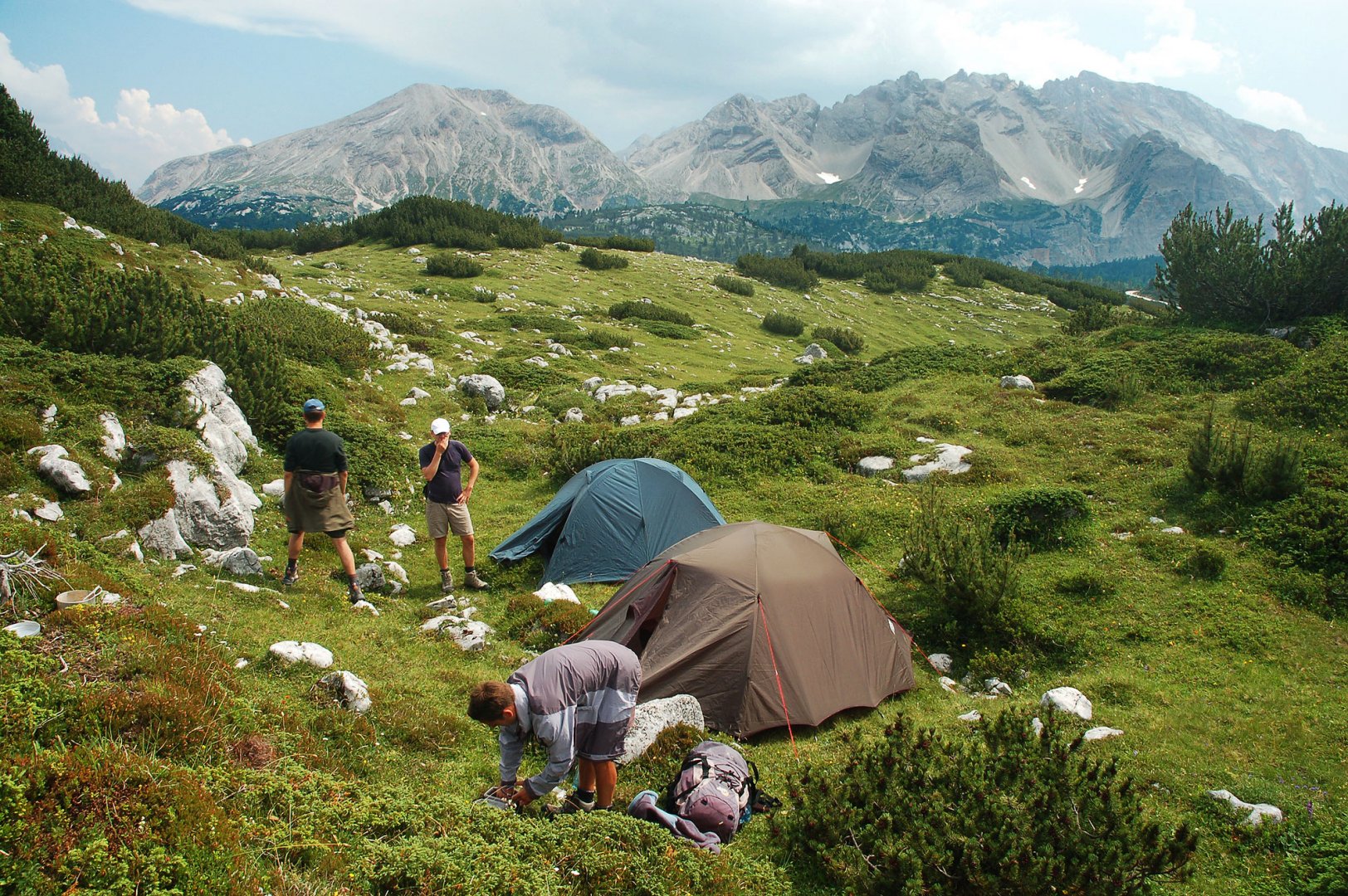
At the shepherd's hut we took our packs again and continued along the wide road No. 7 into the interior of the Fanes-Sennes-Braies National Park. This road took us to the Senneshütte hut. Here we had a few beers to refresh ourselves and in the evening we set up our tents about 200 meters from the hut. (photo) We spent the night among the slash and burn forest.
2. day
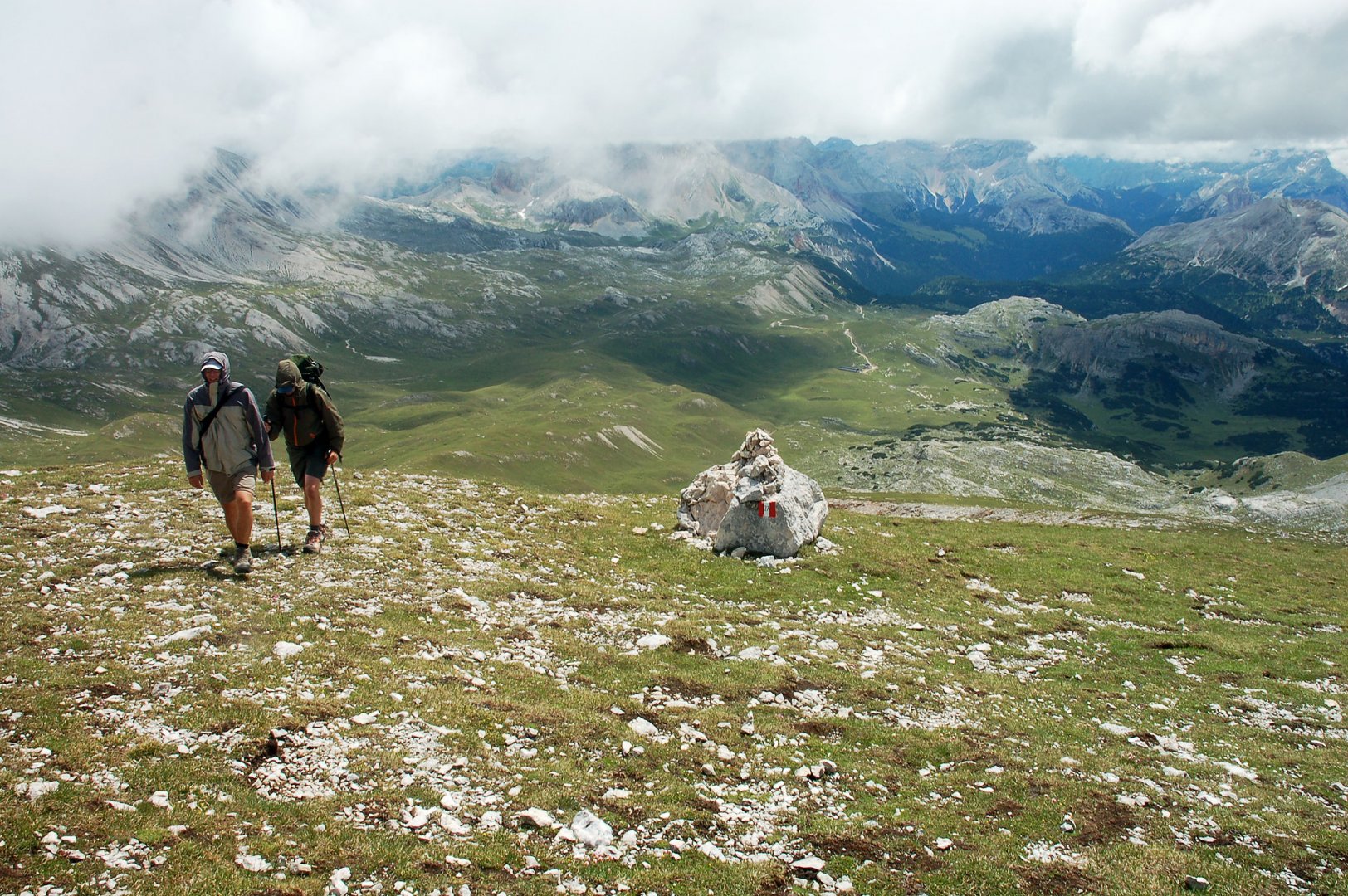
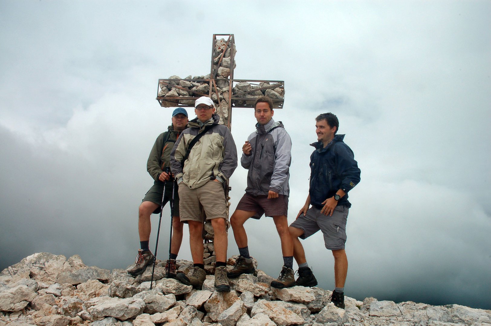
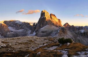
In the morning we cleaned up our tents and set off lightly to the top of Monte Sella di Sennes 2 787 m above sea level. We joined the marked path at the Senneshütte hut. From the hut we crossed a small ridge and a beautiful view of another hut, Rifugio Munt de Sennes, and our destination, Monte Sella di Sennes, opened up. The path led through a small gutter. Later, we turned up the mountainside and started climbing up the rocks to the summit. In the middle part of the climb we reached the meadows again, but the final part of the climb is on rocks. (photo) In the end we successfully reached the summit, although unfortunately the weather was bad and there was nothing to see. (photo)
That's why we didn't stay at the top for long and started to come back. The descent was along the same path as the ascent. We didn't linger too much and therefore were at our tents fairly quickly. We unpacked our packs and finally started our descent, the route was the same as the previous day. So we reached the Fodar Vedla salahs and descended back down the wide path to the údoli where our car was waiting for us at the parking lot.
Difficulty
A beautiful journey in the unusual landscape of the Dolomites. Most of the walking is on meadows and among the slash and burn. Only the highest parts are bare. However, this is a classic walk, there is no climbing or other difficulties.
Water availability
You can get water at the Fodara Vedla Hütte and the Senneshütte and Rifugi Munt de Sennes huts along the way.
Sleeping options
We spent the night among the pine trees about 200 meters from the Senneshütte hut. Otherwise it is possible to stay overnight at the huts on the route - Senneshütte and Rifugio Munt de Sennes.
Mountain peaks
On the route we climbed the mountains Lavinores 2 462 m above sea level and Monte Sella di Sennes 2 787 m above sea level. From Mount Lavinores there are beautiful views of the Tofan group, Mount Croda Rossa and other rock giants in the Dolomites.
Danger
There is no dangerous section on the route. There are no dangerous trails or mountain meadows. These are easy ascents which, even at the end below the peaks, are led along wide ridges.
Equipment
For this trek, all you need is some good mountain equipment. Sturdy boots, good rain gear. We decided to sleep outside the huts, so we had a tent, sleeping bags and gas cookers. Telescopic poles are also useful.
Food
Meals are available in the huts Fodara Vedla Hütte, Senneshütte and Rifugio Munt de Sennes. We made do with our own supplies and cooked on gas stoves. We only had beers at the huts.
Attractions
This is a relaxing easy trek in a magical landscape. It's actually a plateau that drops steeply into a valley. There used to be more shepherds here as there were pastures for livestock.
Photos