Mountain range, region / State
Radstat Tauern / Austria
Season
Fall
25. 09. 2021
Difficulty
3 / 5
Elevation
↑ 1721 m
↓ 1721 m
Length
18.1 km
8 hours
Altitude
max. 2680 m n.m.
min. 1192 m n.m.
Tips for hikes in the mountain range Radstat Tauern
Circular hike in the Radstadt Tauern with ascent to Grosser Pleisslingkeil and Glöcknerin
Three-day trek around Lake Tappenkarsee to Mount Mosermandl
Styrian Dolomites - Mosermandl from the north
Starting point
Car park of the petrol station at the Tauernalm Raststation tunnel on the A10 motorway.
Description of the hike
Styrian Dolomites - Mosermandl from the north The Mosermandl (2 680 m) is a distinctive massif of the Radstad Taurus Mountains situated on the border of the Low and High Taurus Mountains. It is a limestone mountain and plateau, which is also called the Styrian Dolomites. When the weather is good, it offers breathtaking views of the best of the Austrian Alps - Grossglockner, Dachstein, Hochkönig, Schladming Tauern. The ascent of the Mosermandl is possible from several directions. Probably the most frequented routes are from the south from Zederhaus and the ascent from the west around the lakes Tappenkarsee and Zaunersee.
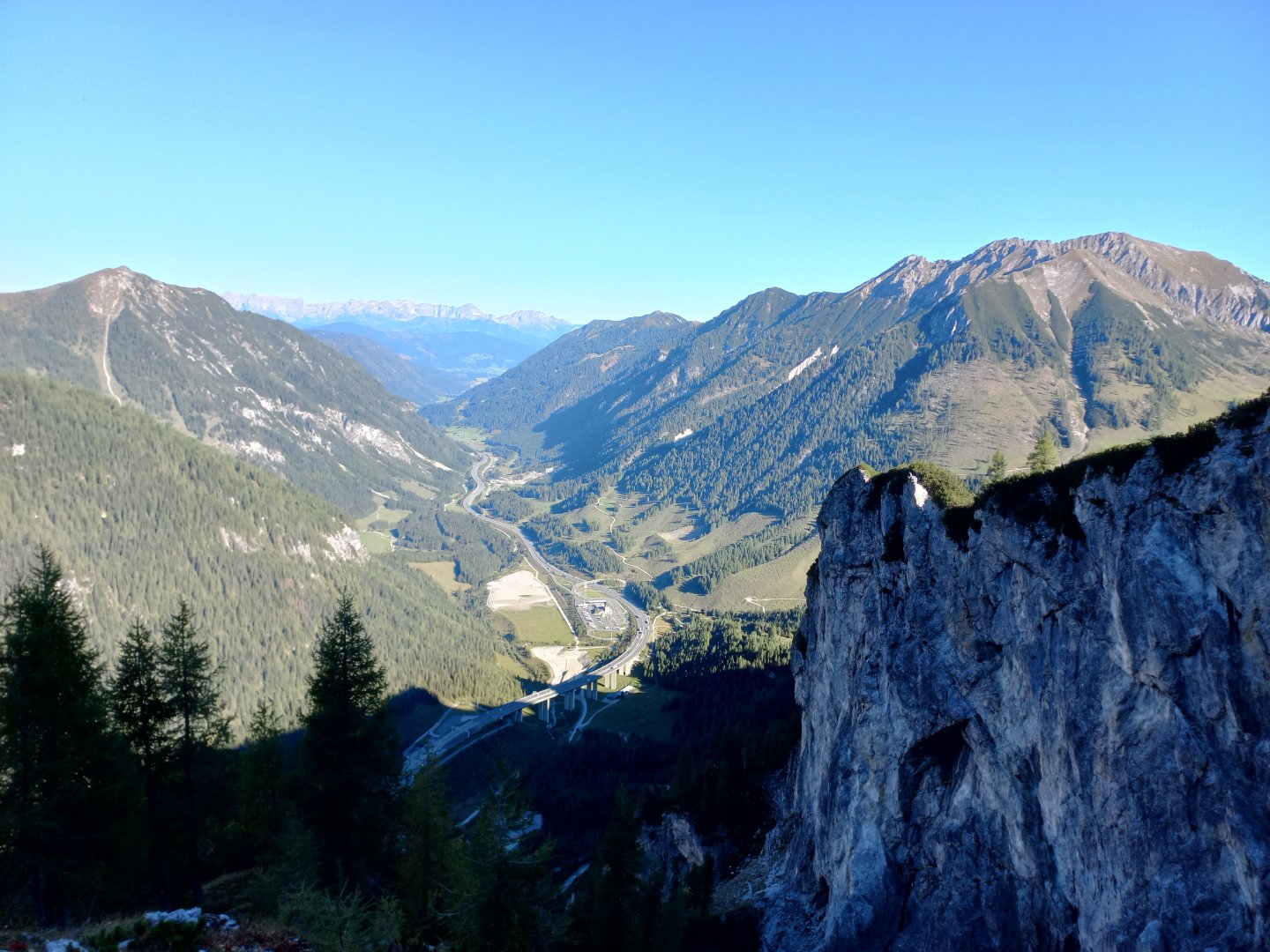
I took it from the north through limestone cliffs and plains. The starting point of the trek may be the Tauernalm Raststation on the A10 motorway, just before the entrance to the Tauern Tunnel, at an altitude of about 1200m. I leave my car here and head from the car park under the high bridge over which the motorway runs, to the nearby quarry. There is a signpost in front of the quarry - the route to Mosermandl takes 5 hours, the difficulty marked with a black dot. The entrance to the quarry is blocked by a barrier, but there is no traffic in the quarry on Saturday around 9am, when I start the trek. The asphalt road goes through the quarry to the next signpost, Mosermandl is marked to the right, but I want to return this way, so I choose the way up (No. 711). The ascent begins with a narrow path between larches and kneelers. But the path is well signposted, passes through woods, occasionally crosses a stream bed, and opens up views of the motorway, the Tauern Tunnel and the Tauernalm Raststation, with the Tennengebirge visible in the distance.
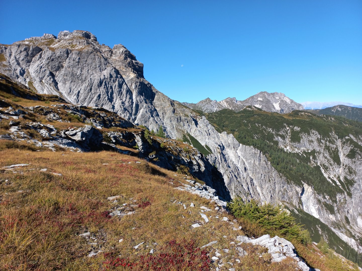
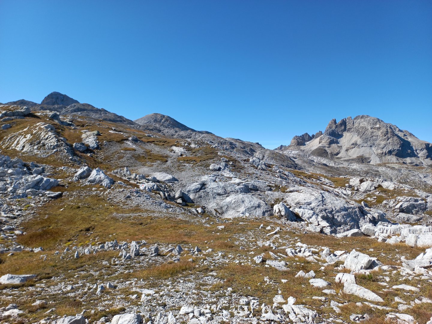
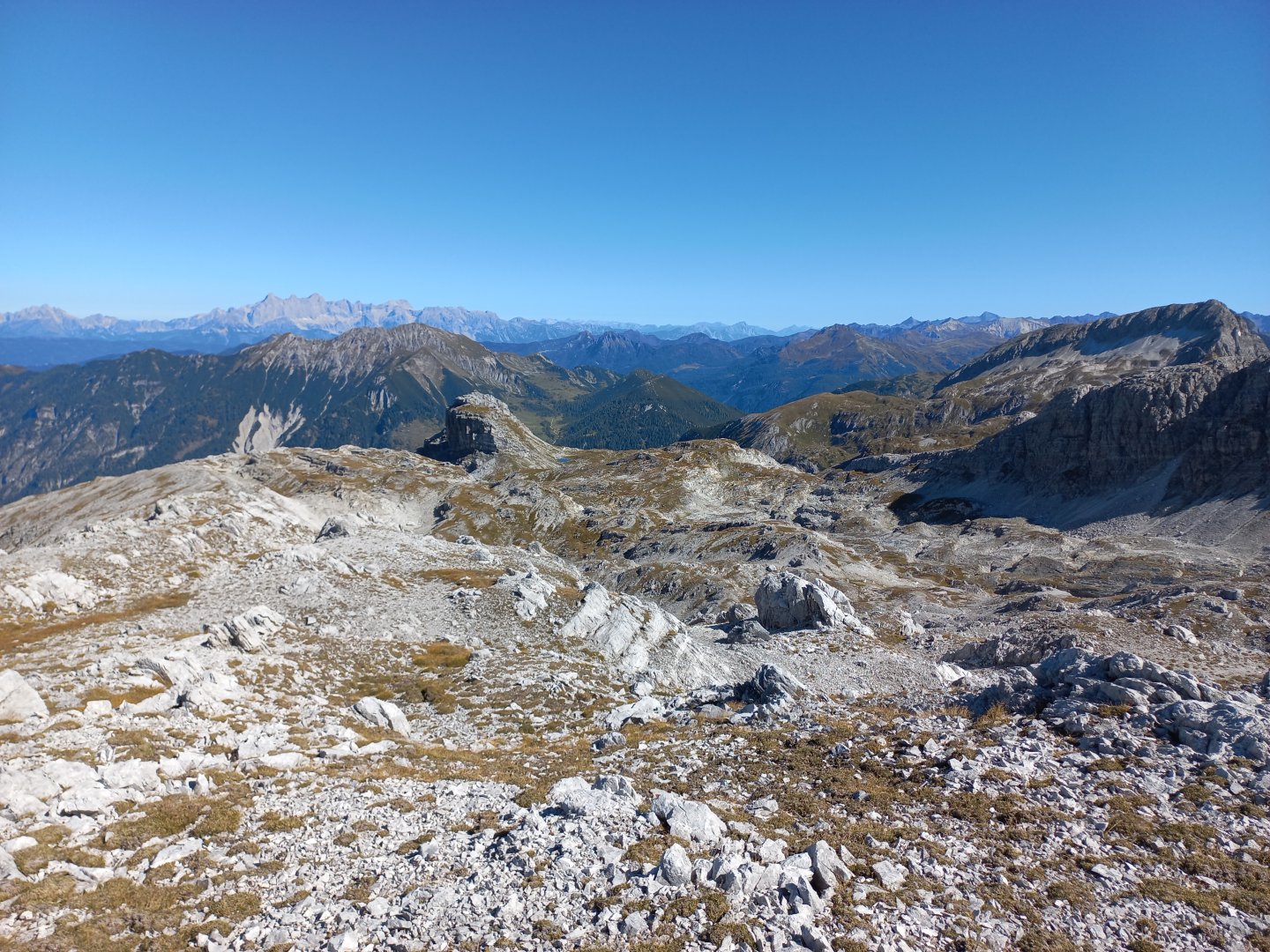
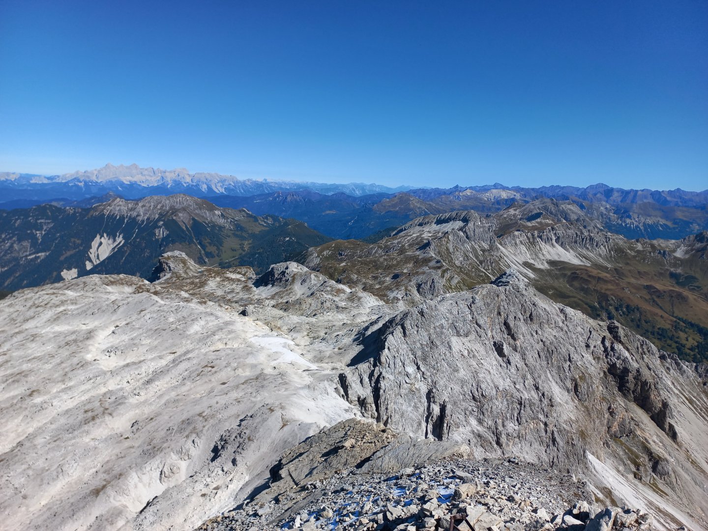
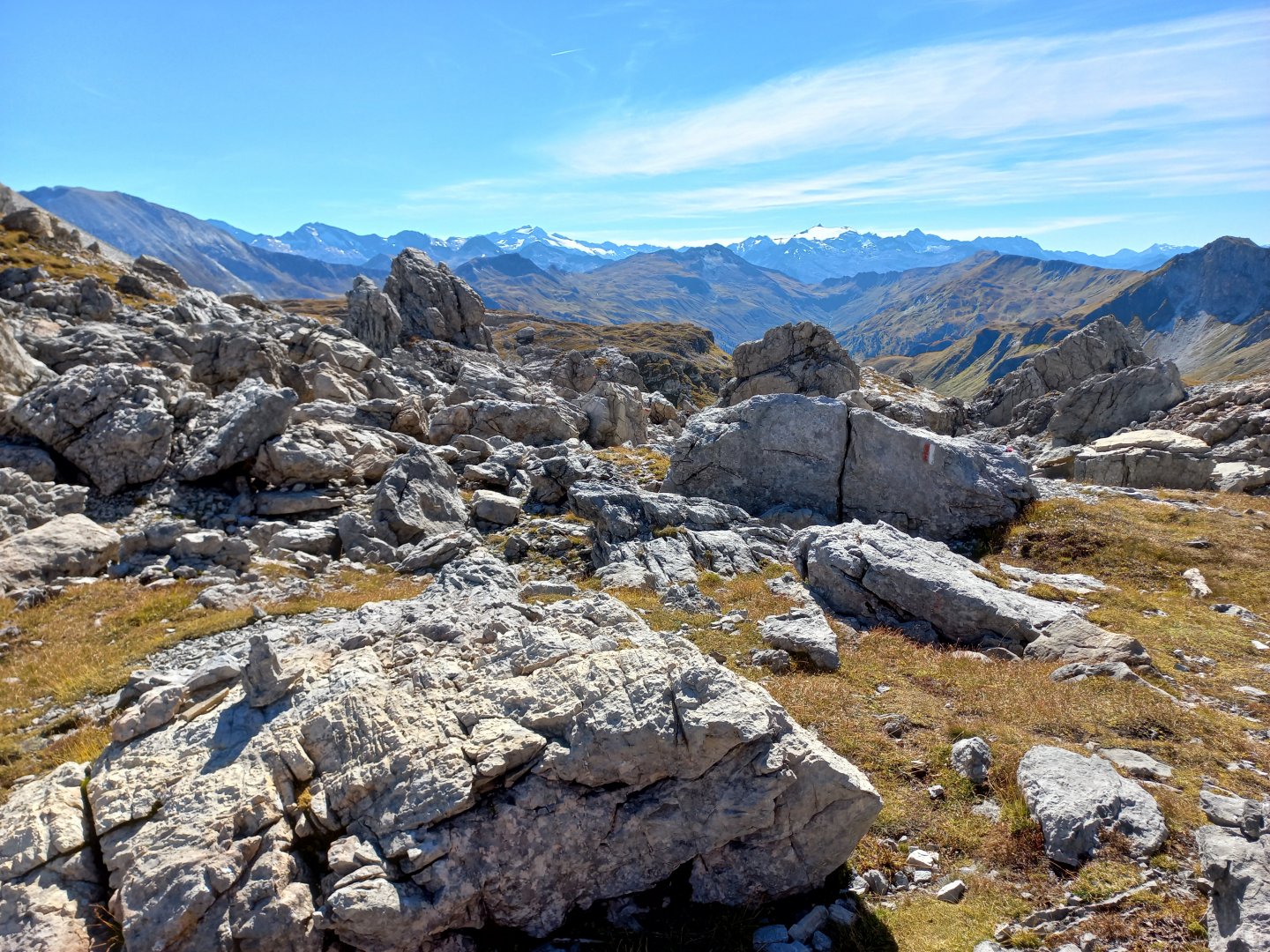
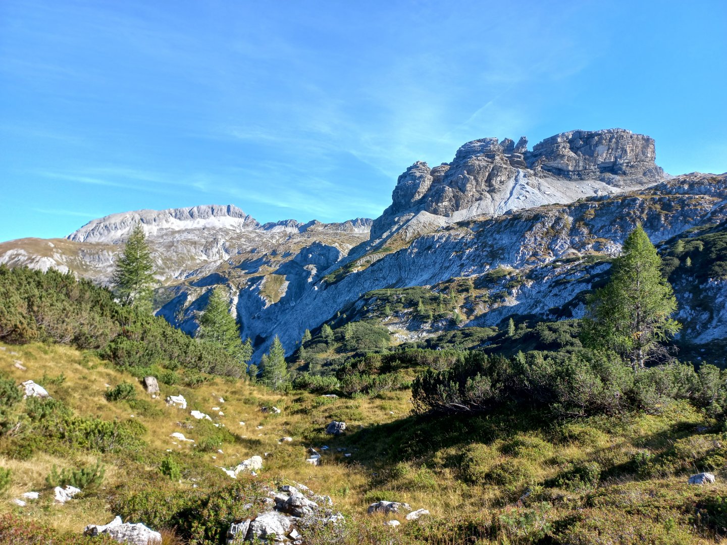
After about an hour I finally get above the forest line, the trail continues through grassy terrain between white boulders and rocks. The tip of Mosermandl appears, but still far enough away. I'm beginning to understand why the Dolomites analogy, white limestone cliffs with many stone spires jut out to the left and right. The flat massif of the Hochbirg (2,319m) looms up in front of me with a small lake nearby. And finally the expected views - the first to appear in a northerly direction are the trident of the Dachstein and the adjacent ridge of the Gosaukamm with the jagged Bischofsmütze. Beyond Hochbirg I come across a signpost that turns me left along route 731 to Mosermandl, only 2 hours away according to the signs. I take a break and enjoy the views - the Dachstein to the left of Hochbirg, the Schladming Tauern to the right, the tip of Höchstein and the Hochwildstelle next door are clearly visible.
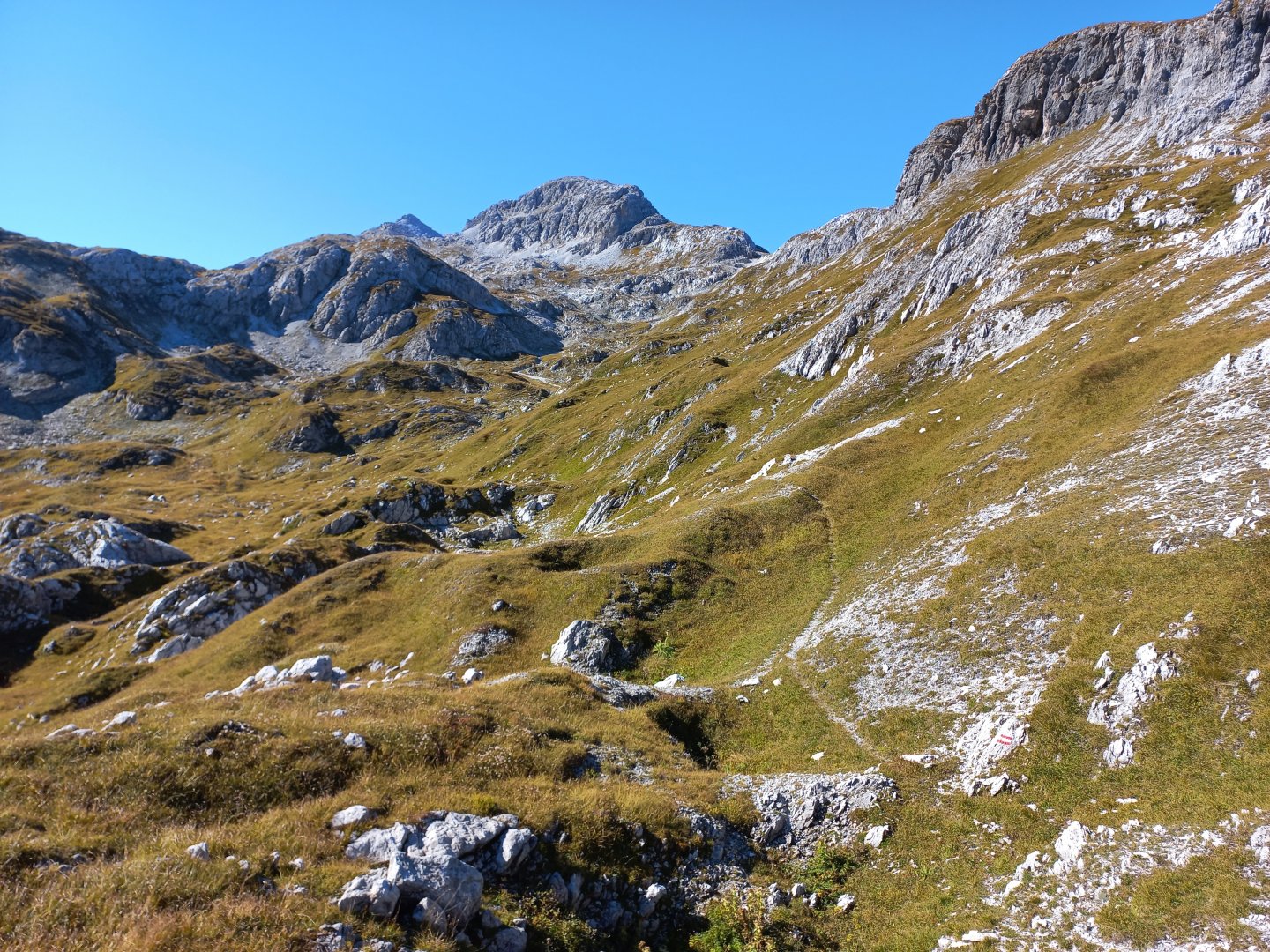
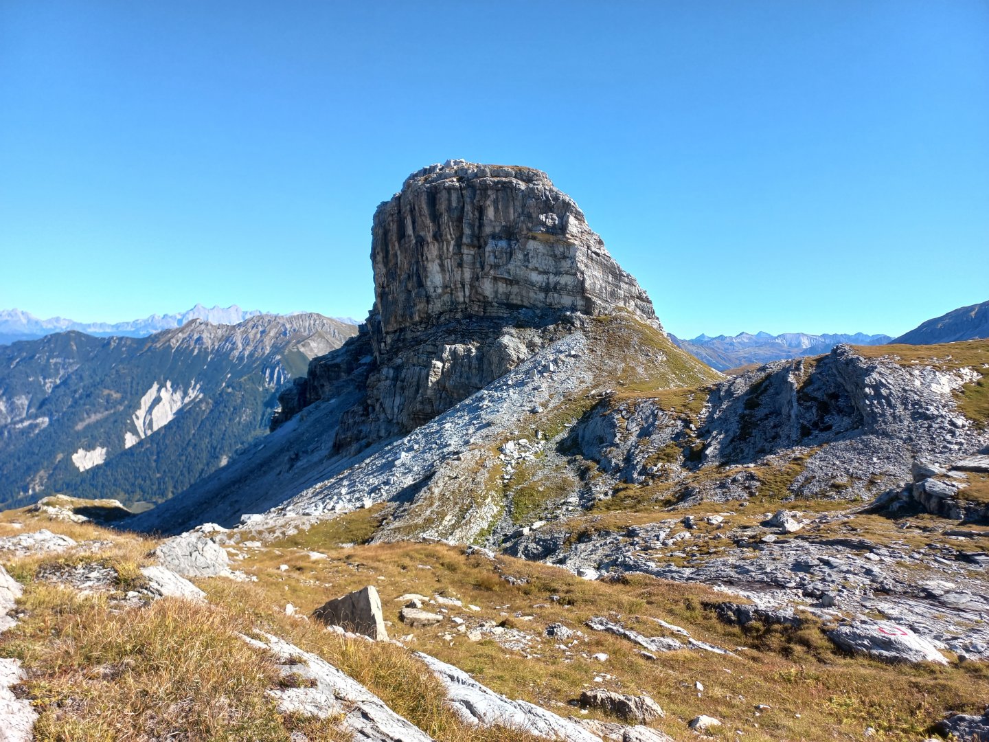
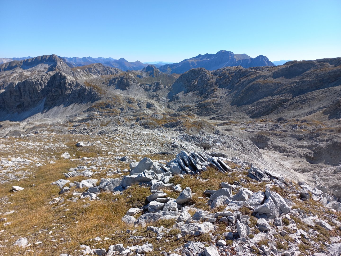
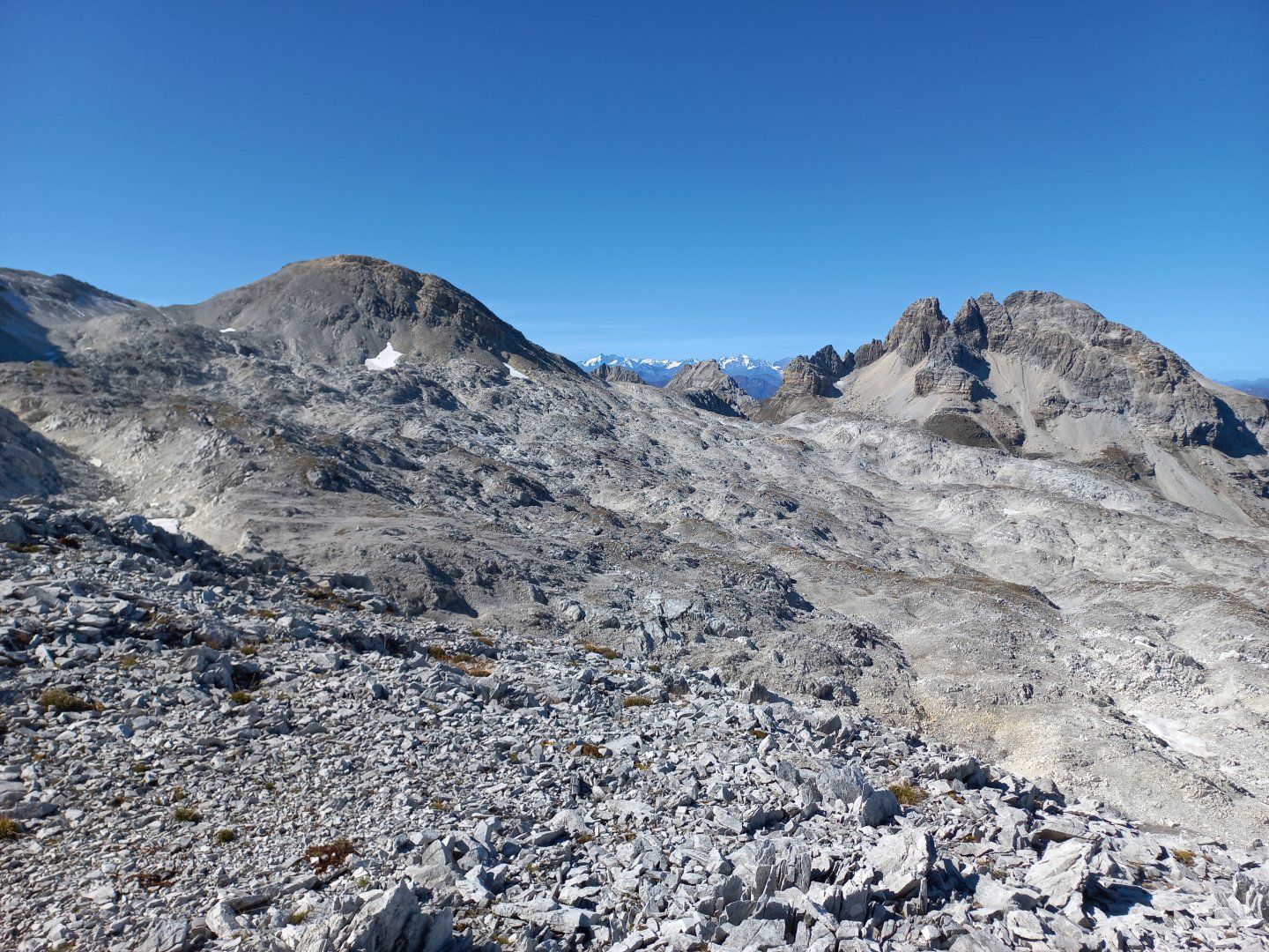
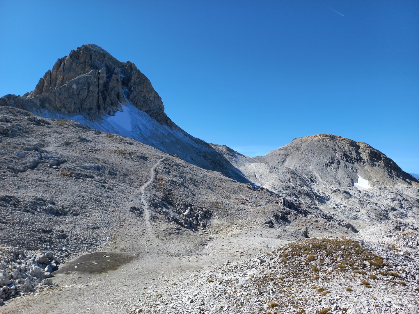
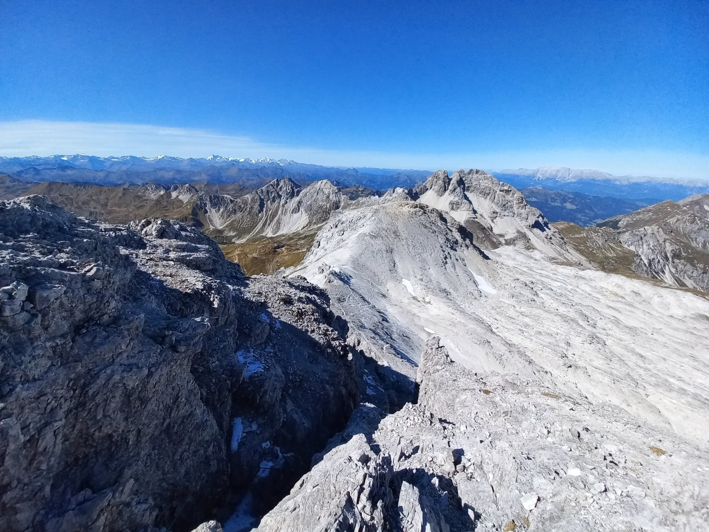
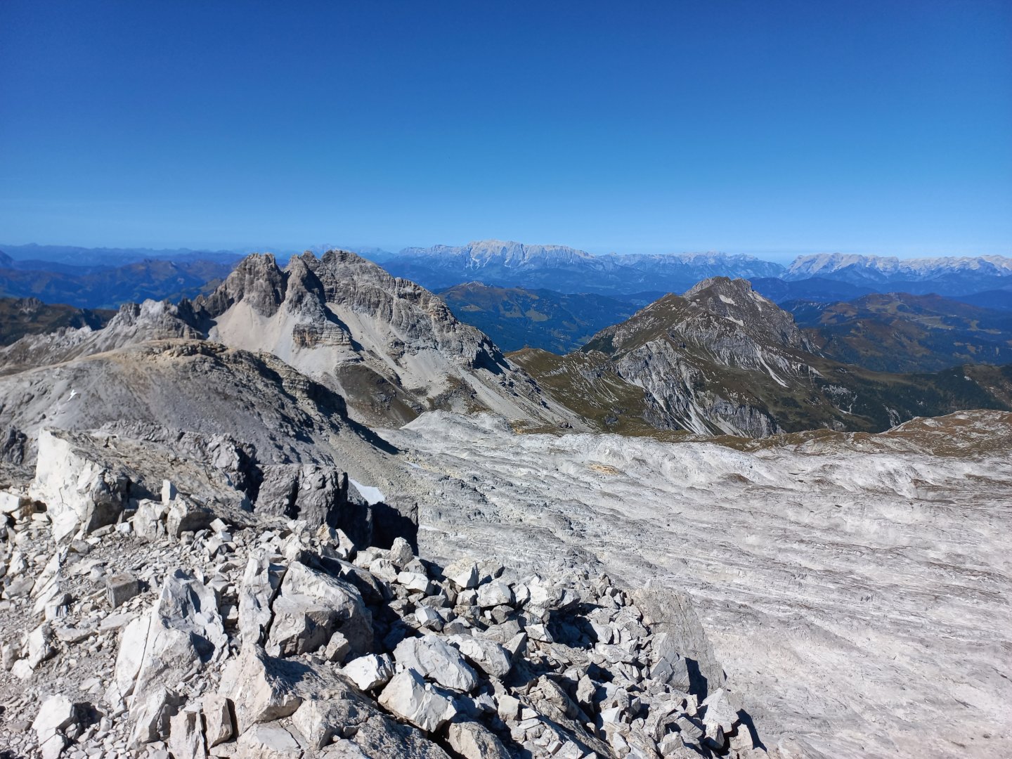
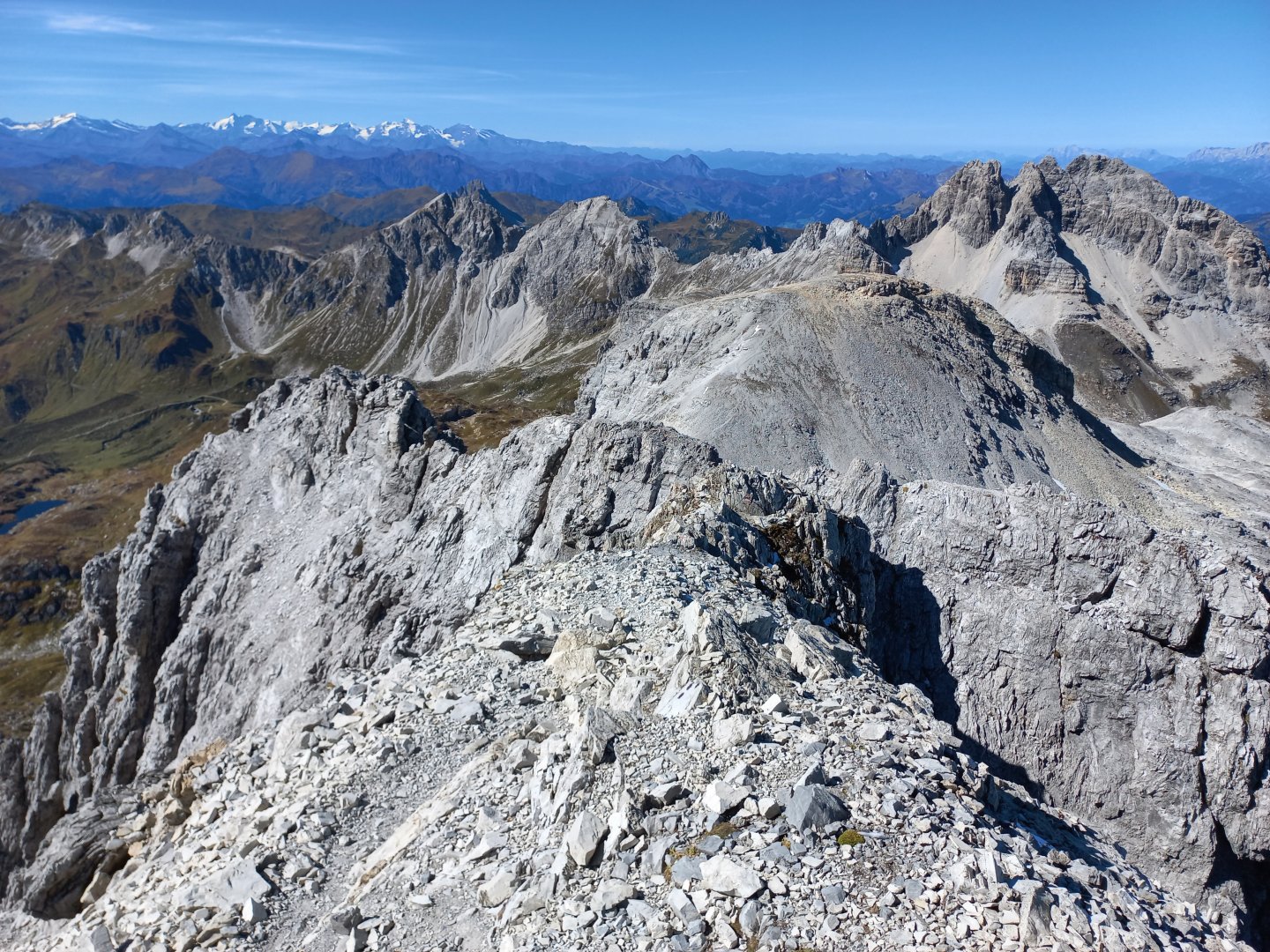
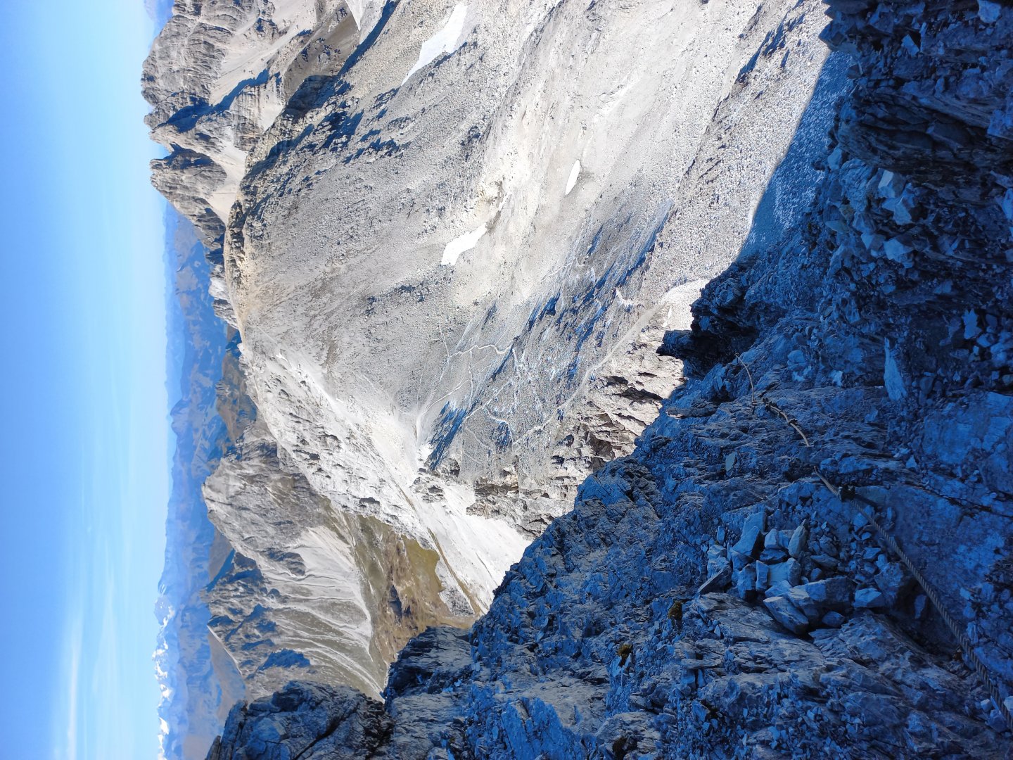
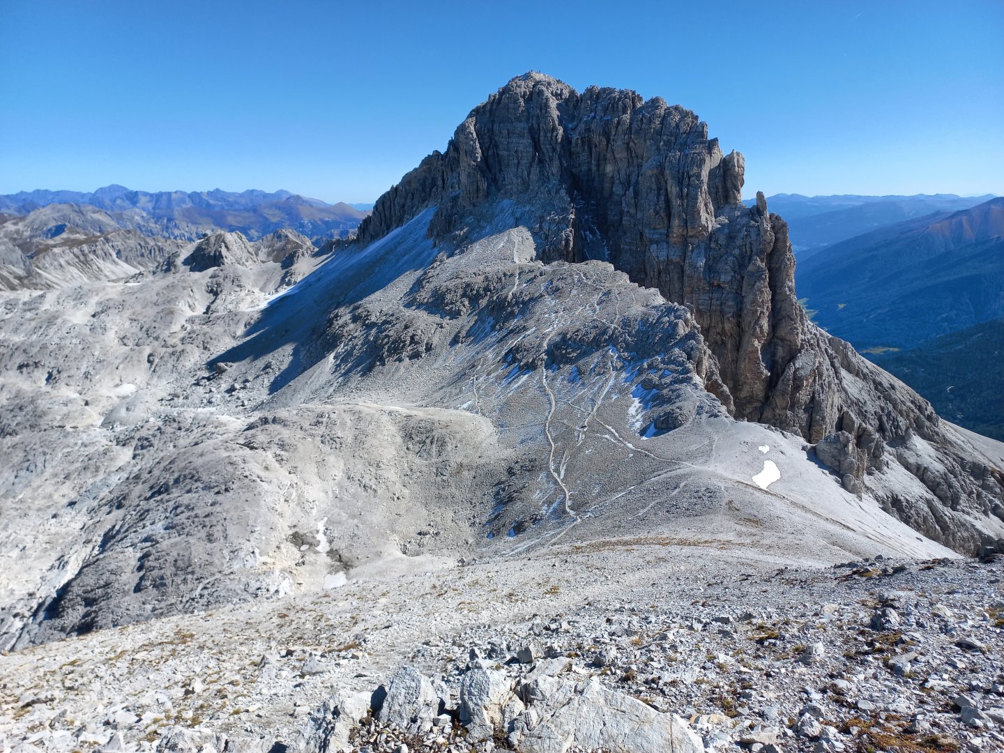
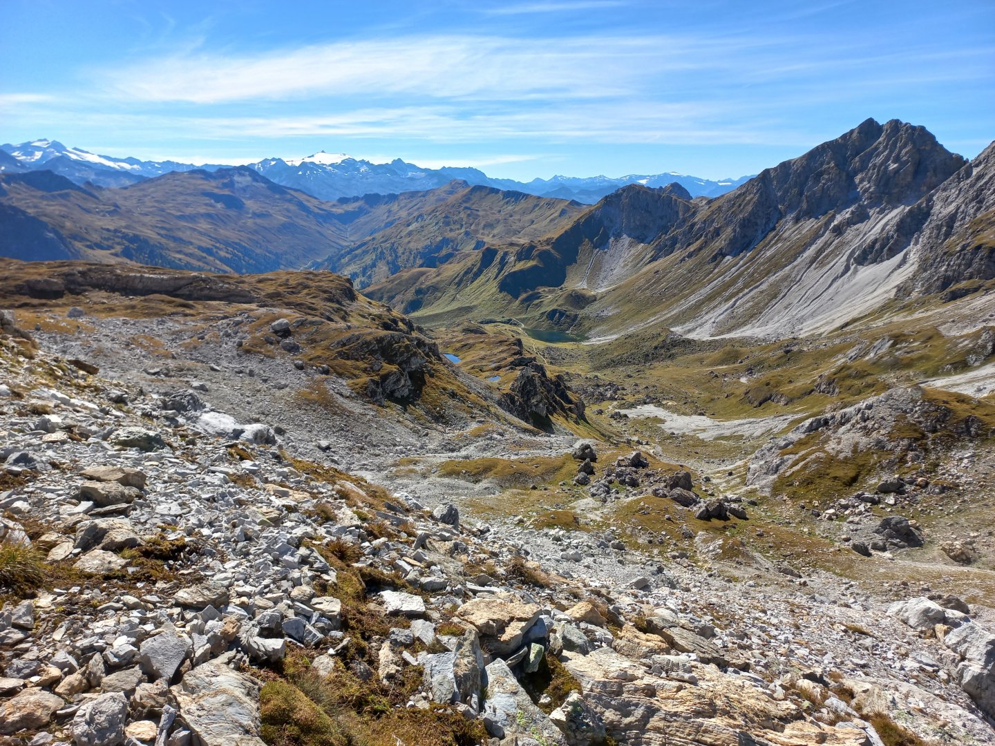
The path continues to climb on the limestone plateau, I climb over rocks and my legs start to protest, after all they have already climbed over a thousand metres. Mosermandl disappears at times, but to the right rises another prominent mountain Faulkogel (2 564 m). And behind it another reward - views of Hochkönig and the Grossglockner massif with its white-glowing glaciers. I reach the base of Mosermandl, the path traverses the north face and is already snow-covered in places (it's late September), but I pass easily into the saddle between Mosermandl and the adjacent Windischkopf (2 609 m). Another beautiful view - the three thousanders of the High Taurus Hochalmspitze and Ankogel.
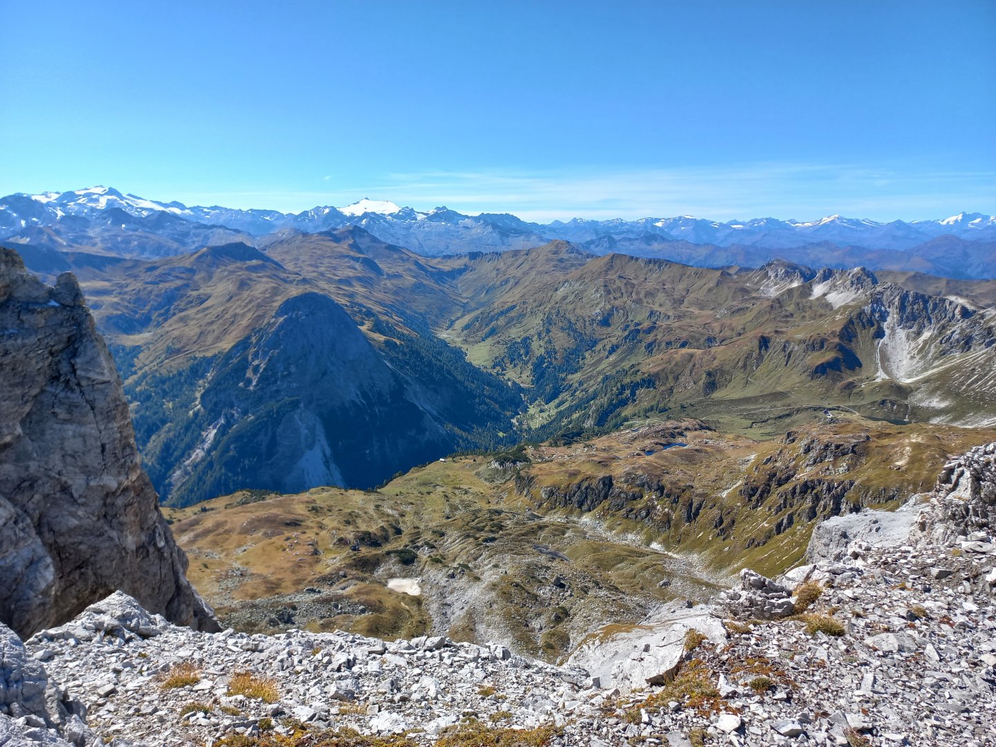
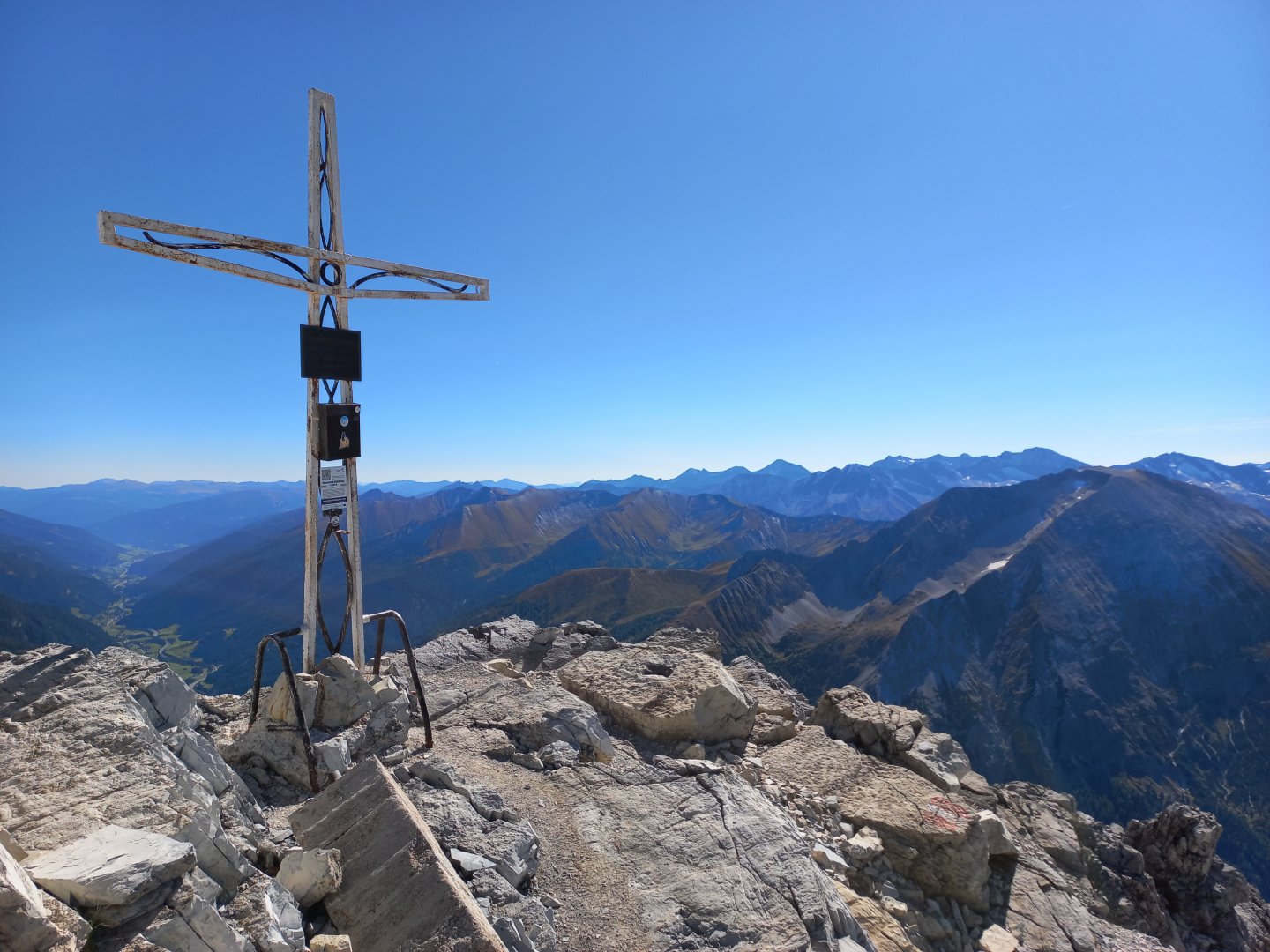
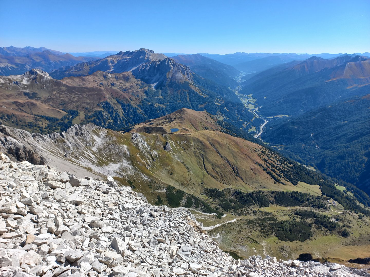
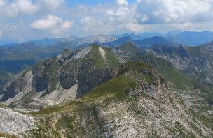
I have a final steep climb to the summit. The trail narrows, leads through a narrow chimney, I have to help myself with my hands in some places and the last 100 metres or so are secured with a rope. Occasionally a downward plunge, a glimpse of a gravel cliff, a bit dizzy. Finally I see a metal summit cross. The summit is spacious and safe, there are already a few people standing and sitting, I take photos, sit down for a while and enjoy the views - the blue and shimmering lake to the south, the snow-capped three-thousanders of the Hochalmspitze to the west, the Ankogel next to it and the Grossglockner massif even further away. To the north Hochkönig, Tennengebirge, der Dachstein and in the distance I can even make out the Totes Gebirge with the peak of Grosser Priel. To the east, the dark Schladming Tauern and the Obertauern mountain resort.
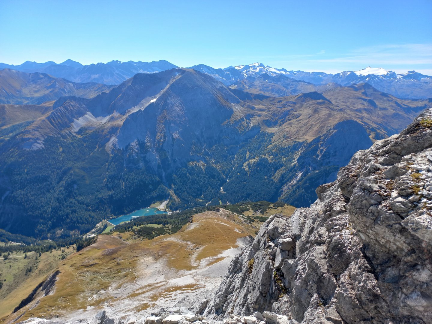
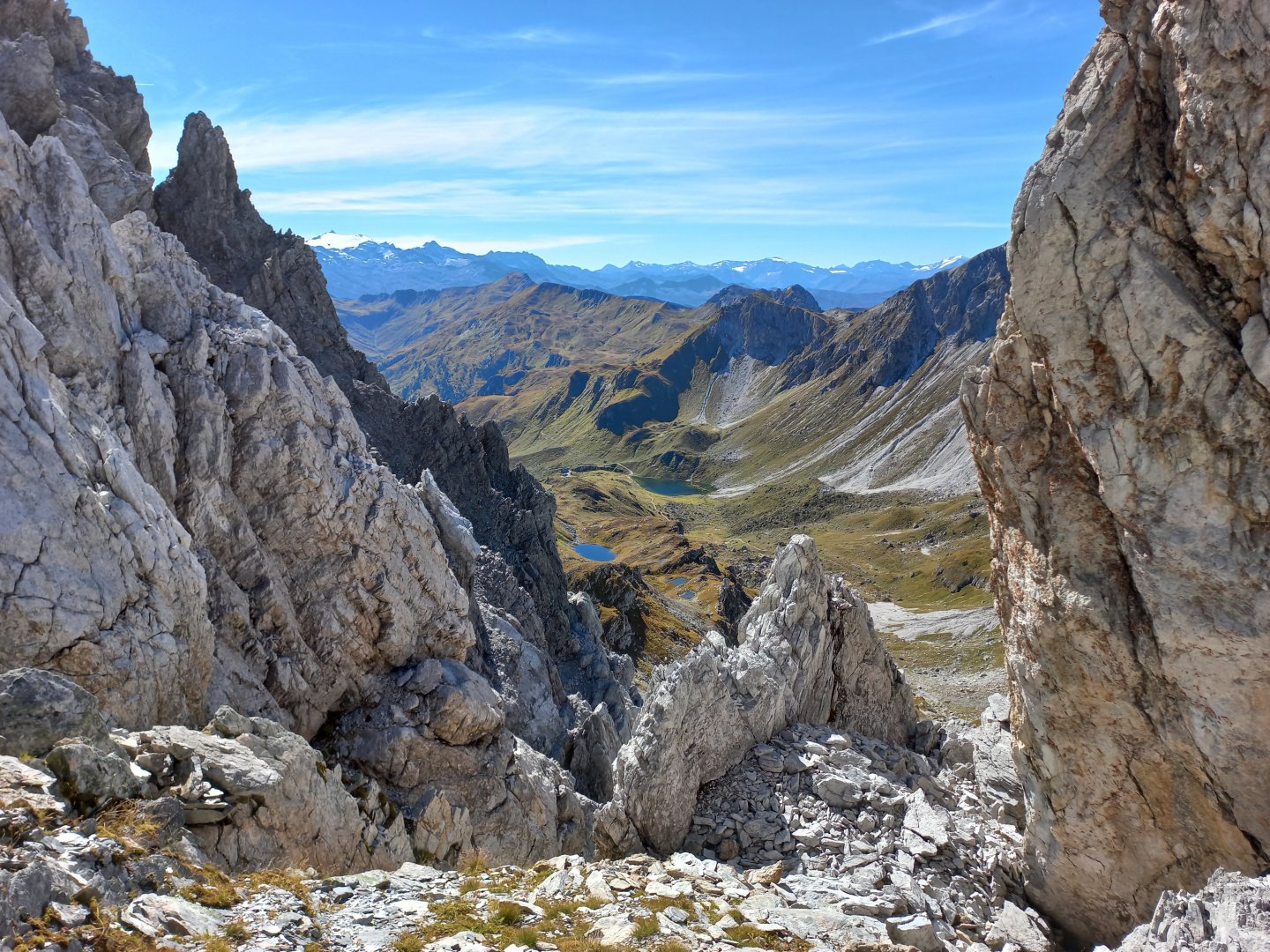
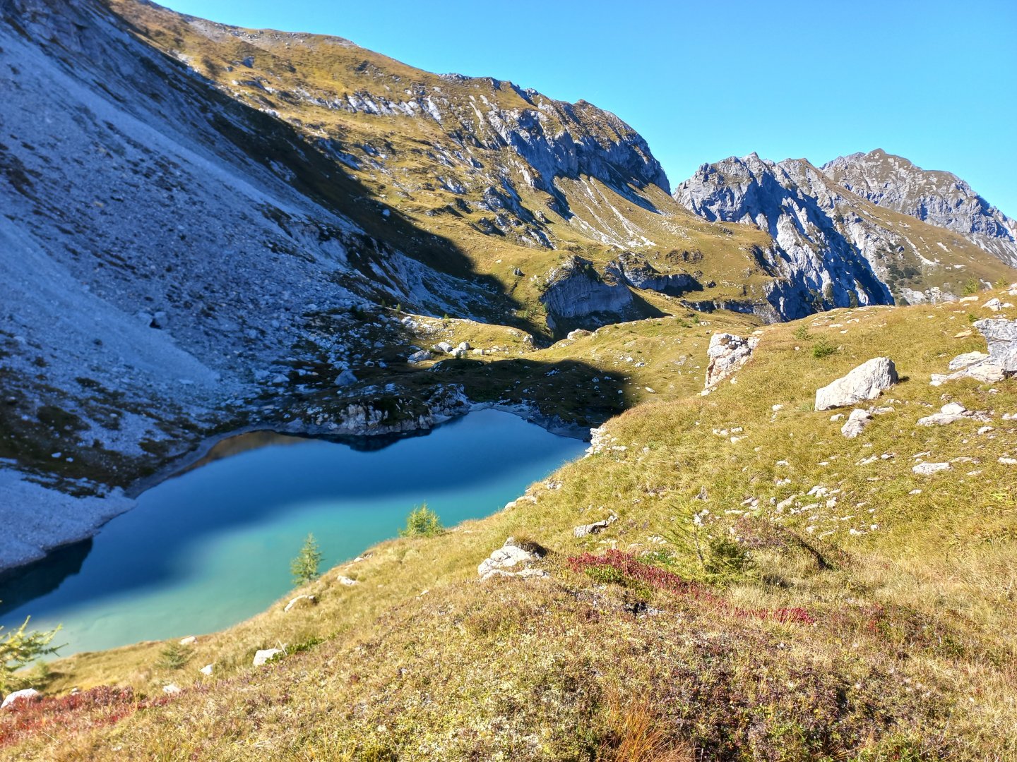
After a while I leave the summit and cross to the next Windischkopf. The marked path descends to the right below the summit, but I don't want to go down yet, so I decide to extend my trek over the Windischscharte saddle (2 298m) to the Neukarsee lake. I don't see AV markings, but there is a noticeable path and occasional stone men. The footpath disappears and reappears until after a while I come across the sign again. The path drops down to Windischscharte, where huge boulders are strewn about. The Franz Fischer Hütte at Zaunersee can be seen to the west, but I turn back to the north on route 733 and after about 30 minutes arrive at the blue lake Neukarsee.
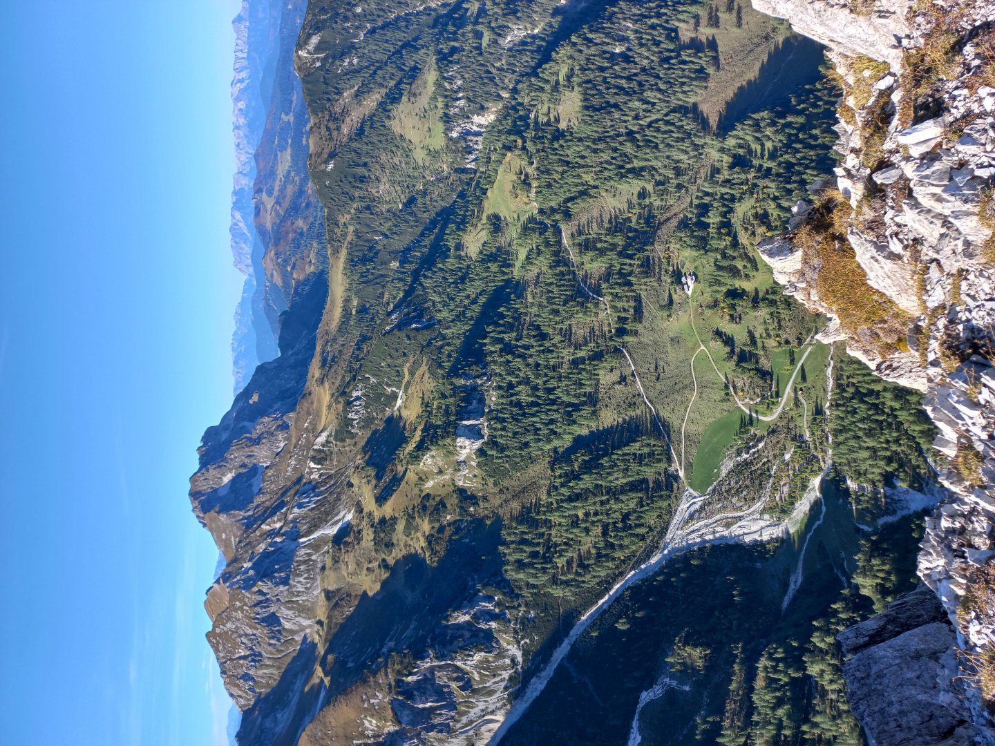
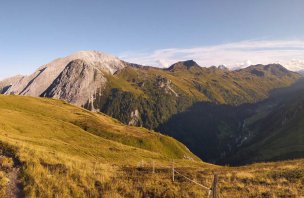
The descent to Flachauwinkel is separated, the steep downhill is visible from the next hill, where route 711 takes me. After a while the path from Windischkopf joins, I head down past the original Obere Gasthasthaus, now just rubble. Then it's just an hour's descent on a path through a forest that will delight botanists - there are gravity-bent trees, alpenroses, blue gentians and other alpine flora on the slope. After five I am back at the car, 8 hours on the road, the maps show me some 16 km and 1,600 m of elevation gain.
Difficulty
Most of the route is not difficult, climbing through the forest and across alpine meadows, the last part of the climb to the top of Mosermandl is more difficult, but it is not necessary to do it if you don't feel like it. The route is a protected route with difficulty A - B. Fortunately, the ascent is through a glass chimney, so it is not too airy. For more experienced hikers, belaying on the ferrata is not necessary. There are also beautiful views from the saddle below Mosermandl.
Water availability
There is no hut or stream on the way, it is necessary to have a sufficient supply of water for the whole day. There are springs marked on the Compass map, but they were dry in late summer.
Sleeping options
The only hut in the area is Franz Fischer Hütte, but it is off the trail. It is forbidden to camp south of the Mosermandl mountain, it is a protected area.
Mountain peaks
Mosermandl 2 680 m above sea level, Windschkopf 2 609 m above sea level, off-trail ascent to Faulkogel (2 654 m, ferrata). The views are of Dachstein, Hochkönig, the High Tatras or the Tennengebirge.
Danger
Only the final part of the ascent to Mosermandl is more difficult (not necessary, there is a one-way turn to the summit), the route is secured by a rope, no equipment is necessary. But it is already an easy rock climb. Otherwise the route is without exposed places.
Food
There is no hut on the trek, take supplies with you.
Attractions
The hike can be shortened (do not go to Windischscharte and Neukarsee), branch below Windischkopf.