Mountain range, region / State
Rottenmann and Wölz Tauern in Alps / Austria
Season
Fall
14. 10. 2023
Difficulty
3 / 5
Elevation
↑ 1601 m
↓ 1601 m
Length
21.3 km
8 hours
Altitude
max. 2345 m n.m.
min. 1059 m n.m.
Tips for hikes in the mountain range Rottenmann and Wölz Tauern in Alps
Circular trek over the Schreinl peak in the Wölz Tauern
Climbing the Schoberspitze in the Wölzer Tauern
Trek in the Rottenmann Tauern with ascent to the Hochrettelstein
Autumn trek in the Wölzer Tauern
Starting point
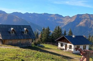
Parking lot behind the village of Donnersbachwald at the end of the road leading to the valley. The car park is free of charge, spacious.
Description of the hike
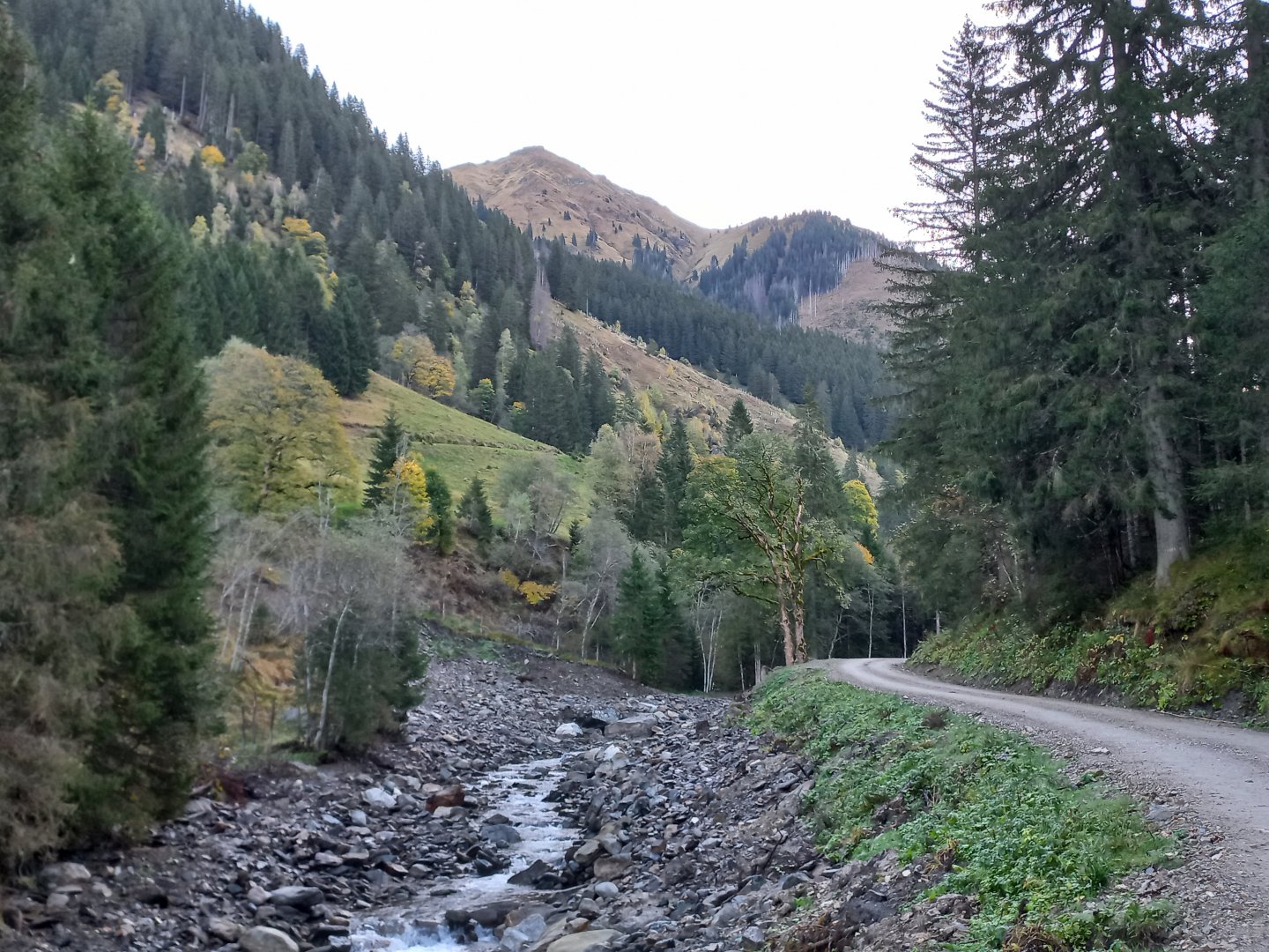
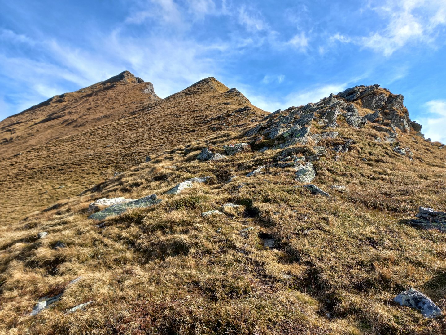
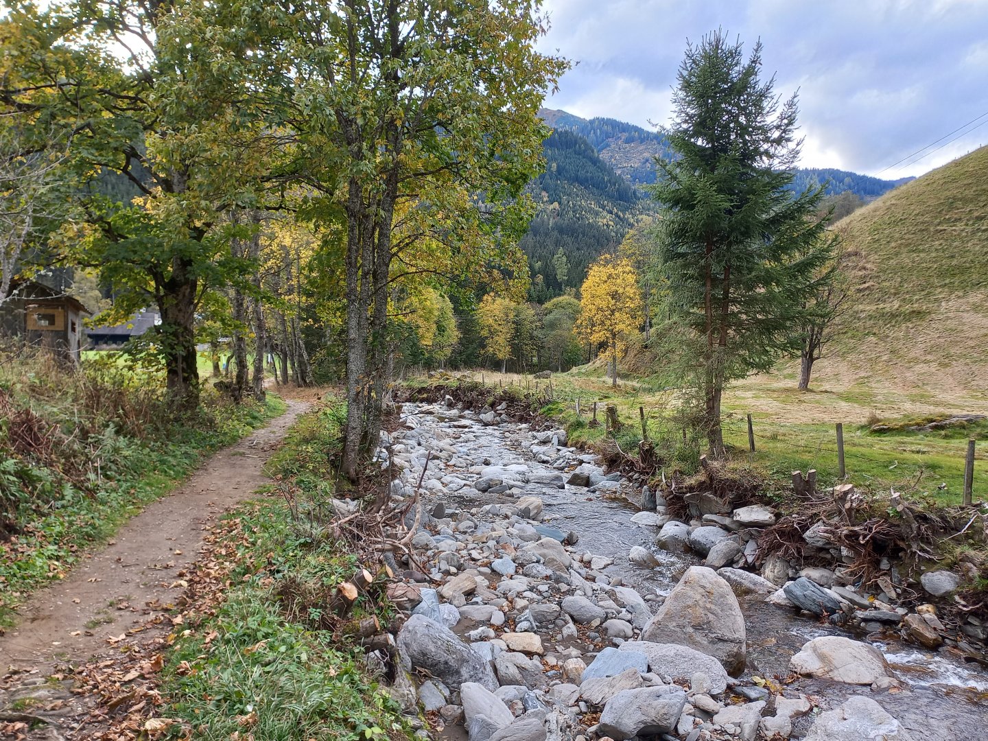
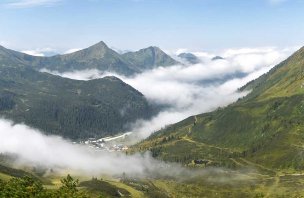
I leave my car at the parking lot for the Lärchkaralm at the end of the road after Donnersbachwald. I walk back along the road to the signpost and then along the Donnersbach stream towards the Glattjoch saddle (3 hours). The wide forstweg climbs up a long valley and passes several huts. After about an hour a forest path turns off. The climb is more pleasant, the path leads through meadows rusted with ferns, yellow birch and larch trees shine between dark spruces. The first peaks appear, the rocky ridge between Donnersbachwald and Sölktal. After less than 3 hours, I am standing in the Glattjoch saddle, which absolutely captivates me.
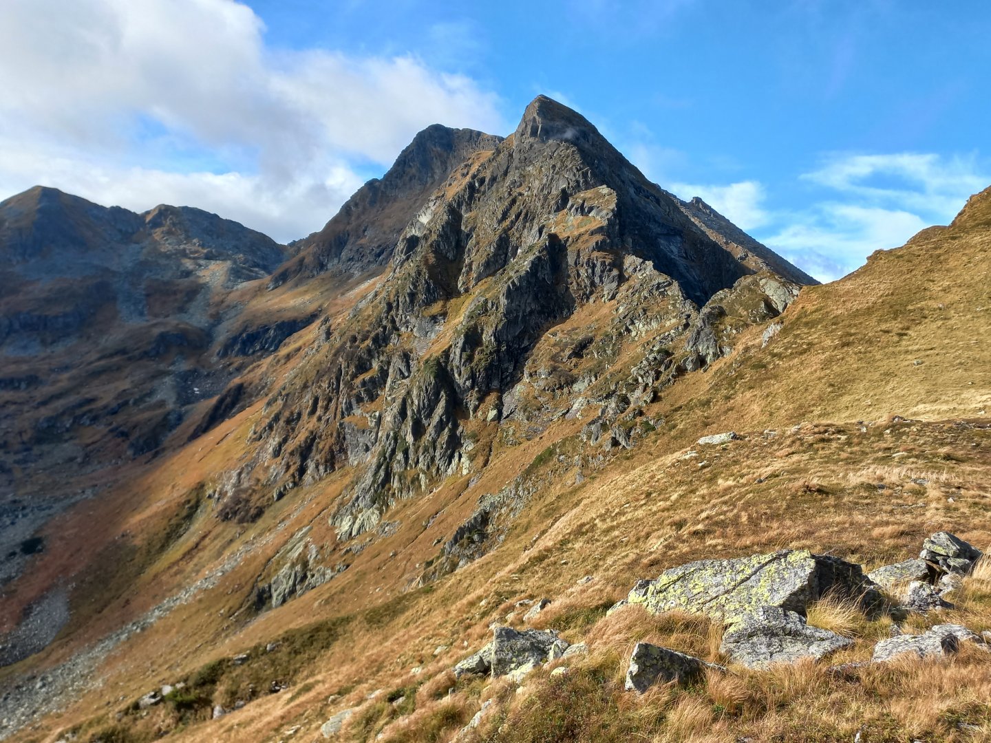
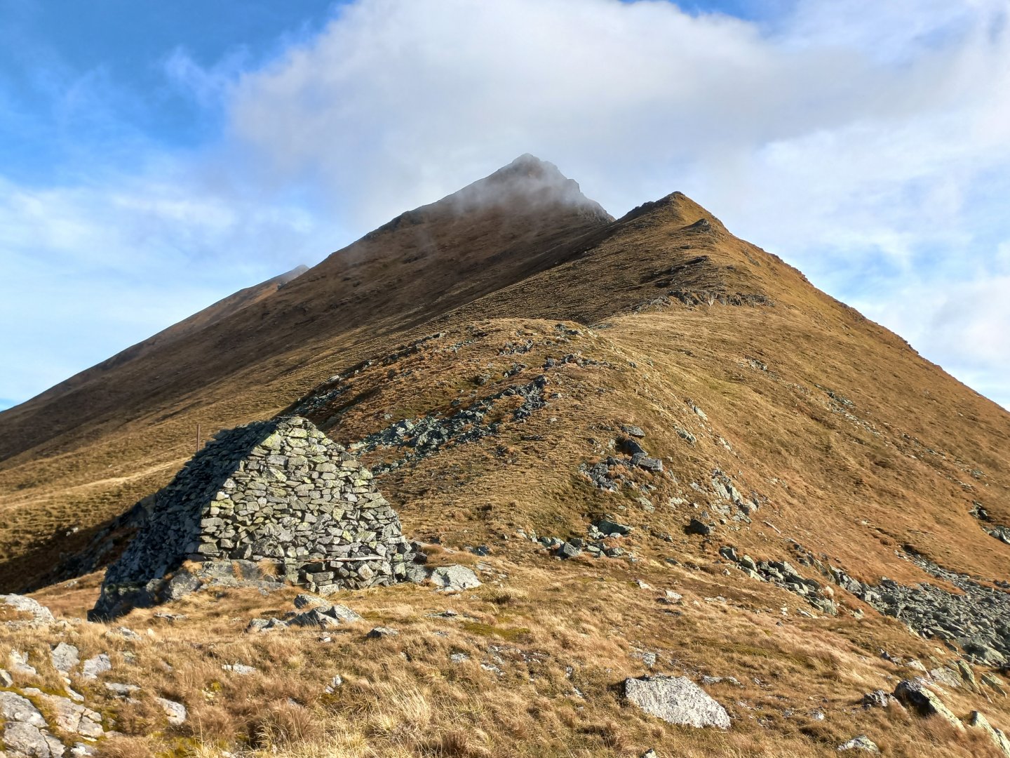
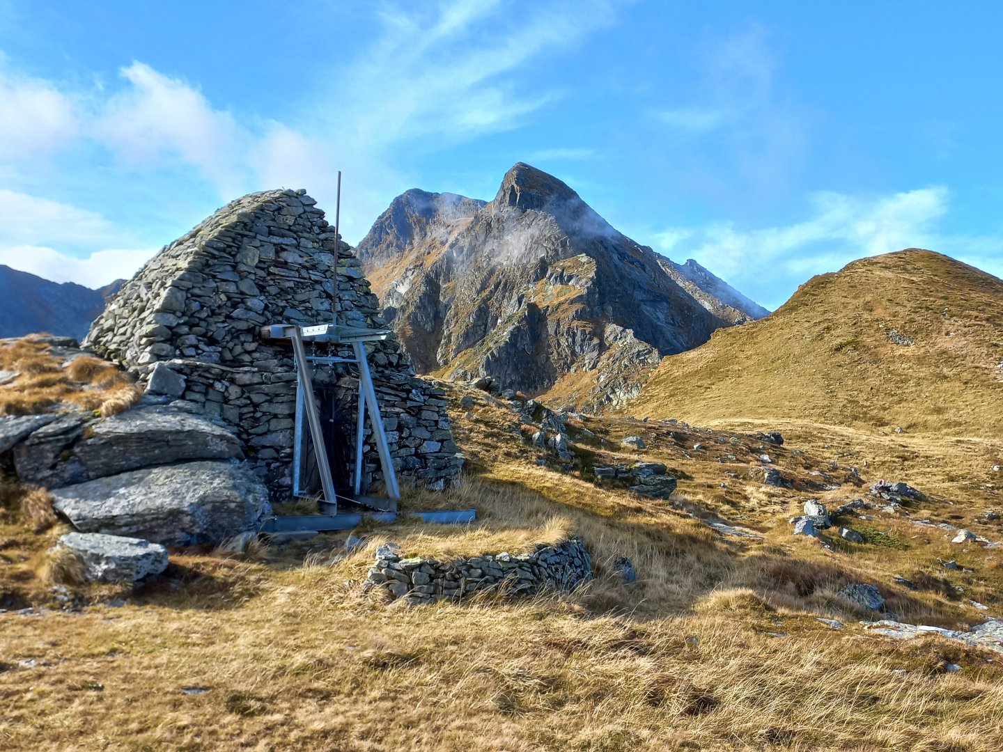
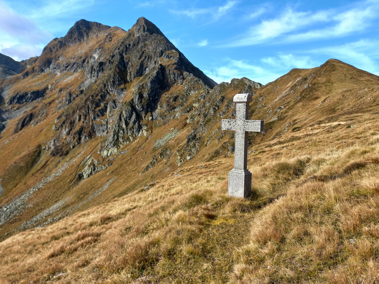
On the right is the massive dark rock Hochweberspitze (2375 m), on the left the grassy pyramid Eiskarspitz (2350 m). In between is the unusual structure of the Glattjochkapelle. An information board informs that the arched chapel was built of dry-stacked stones, without the use of mortar, and probably dates back to early Christian times. A salt trail passed through the saddle and the small platform was a stopping point for trade caravans and pilgrims. There is still a massive stone cross a short distance below the chapel overlooking the valley opposite.
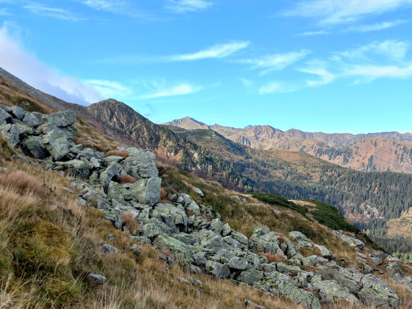
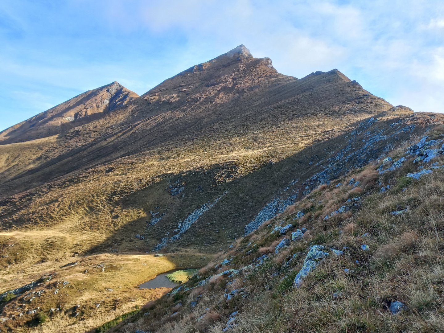
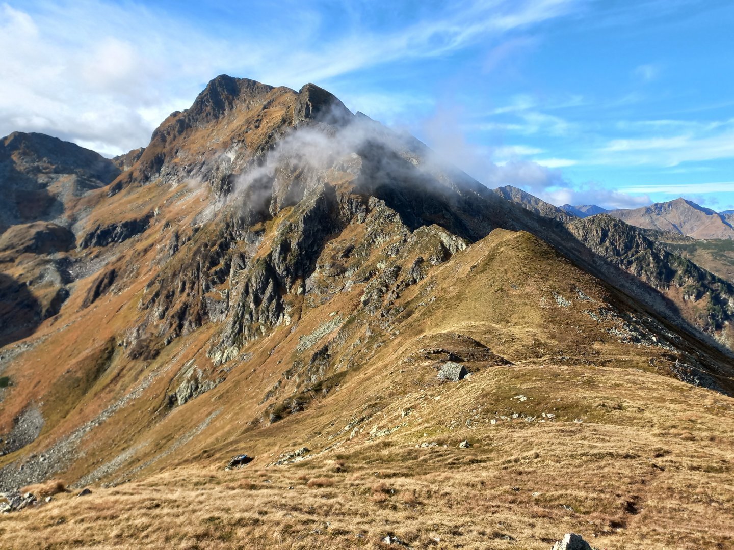
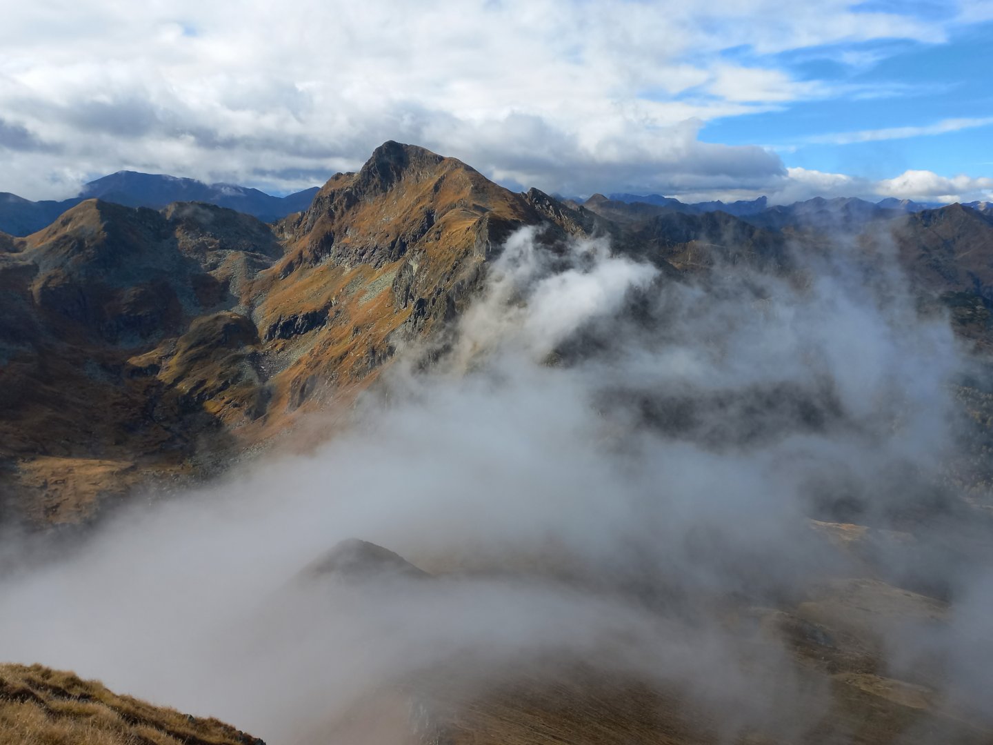
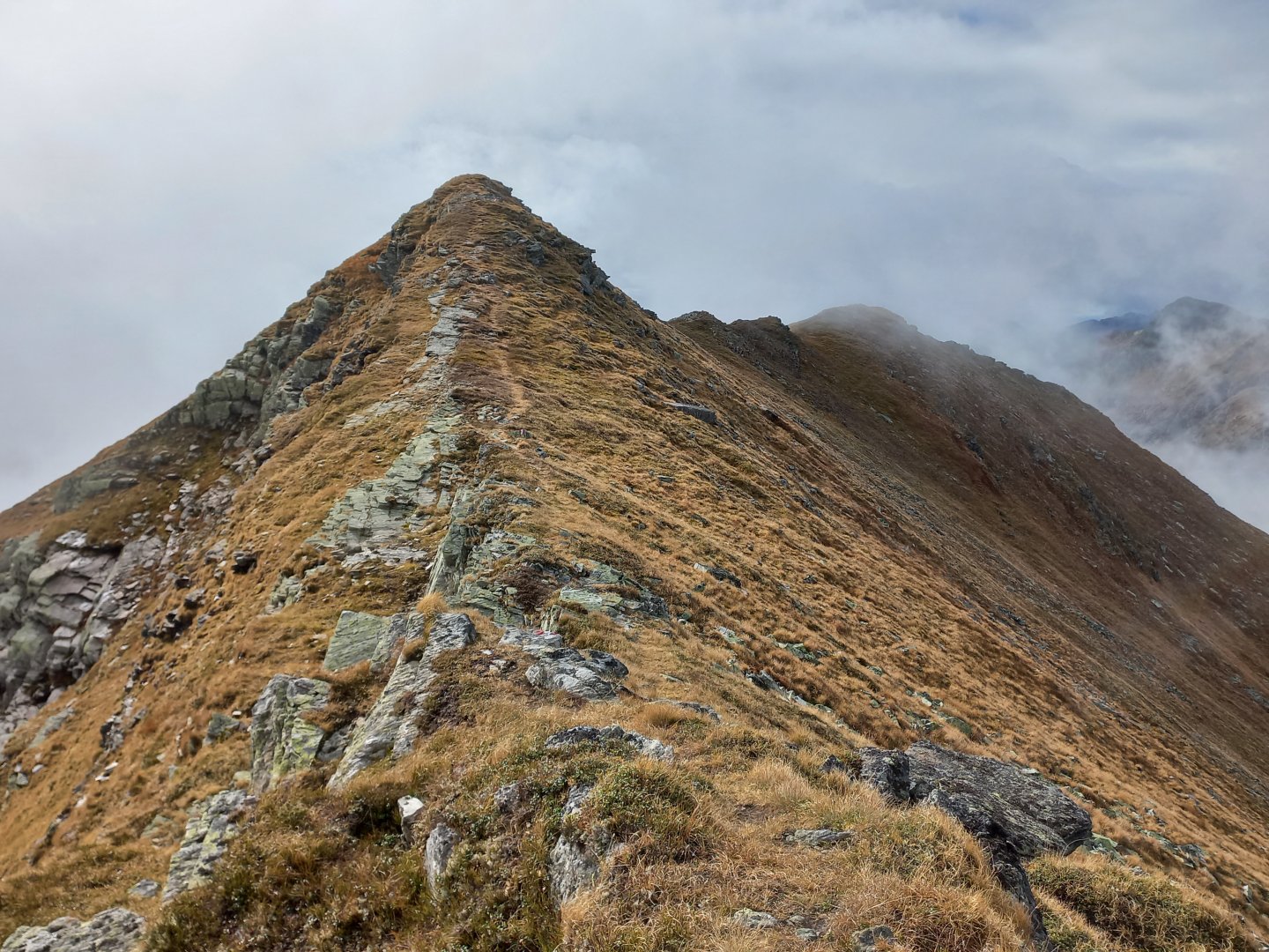
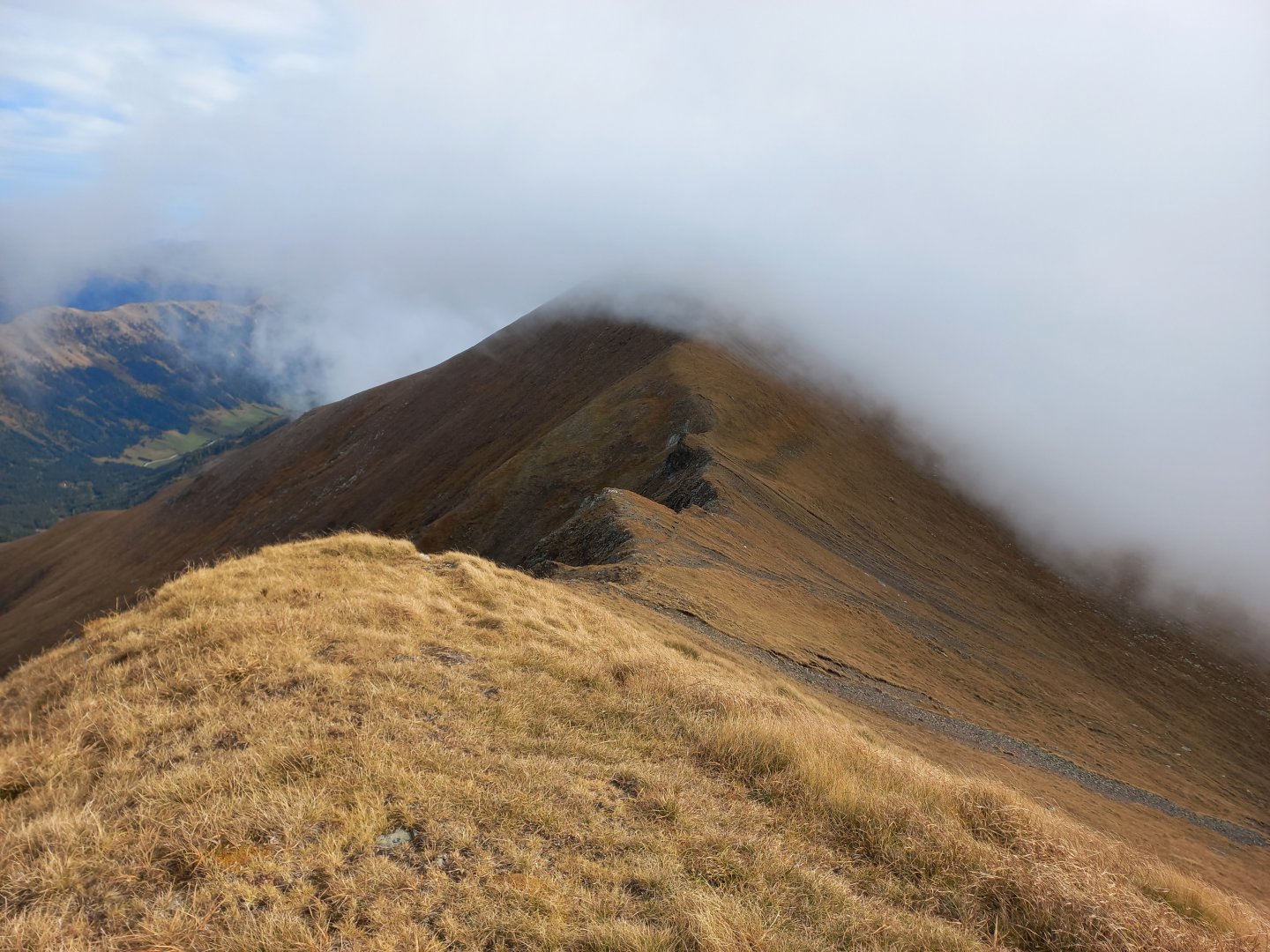
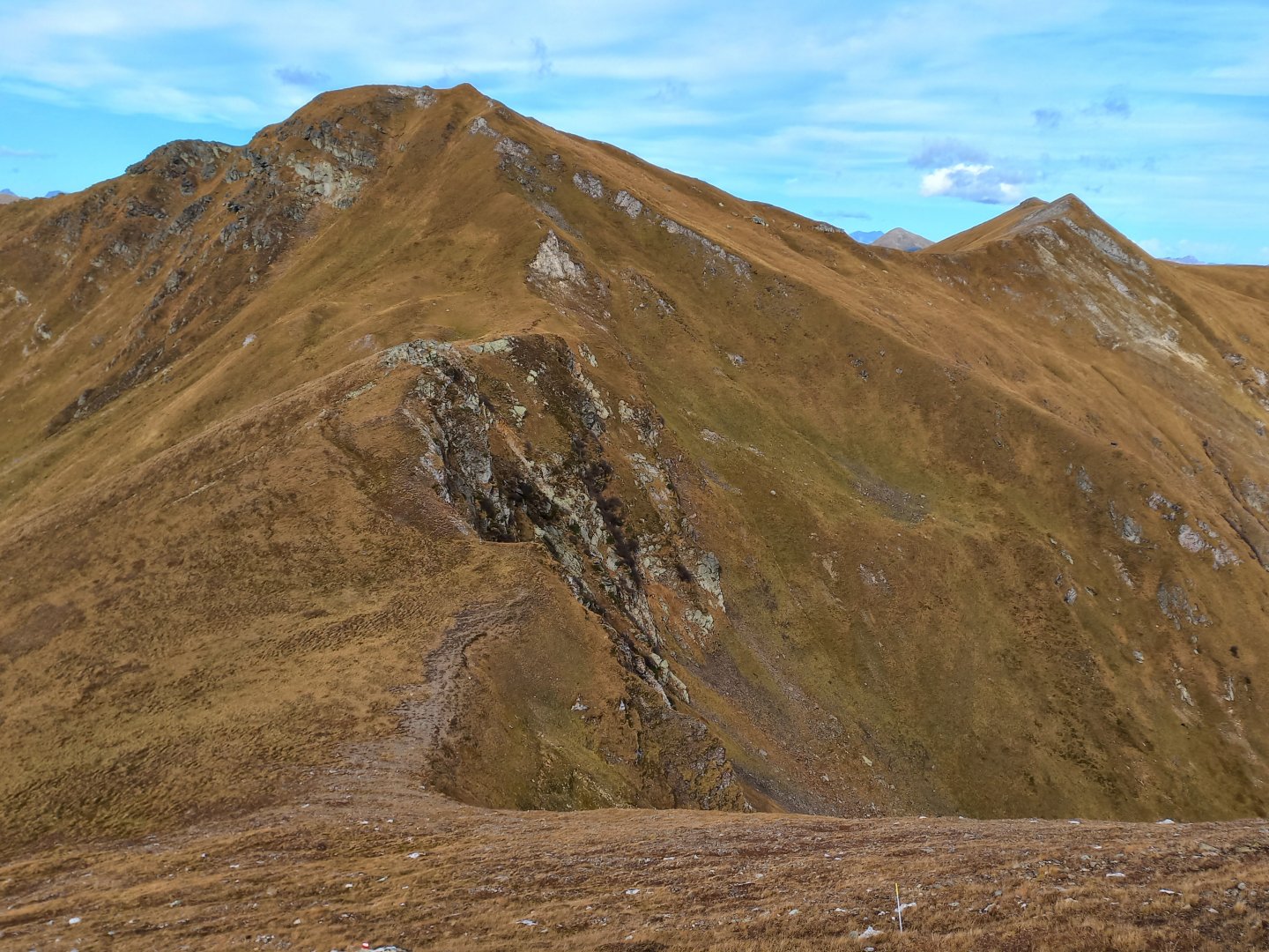
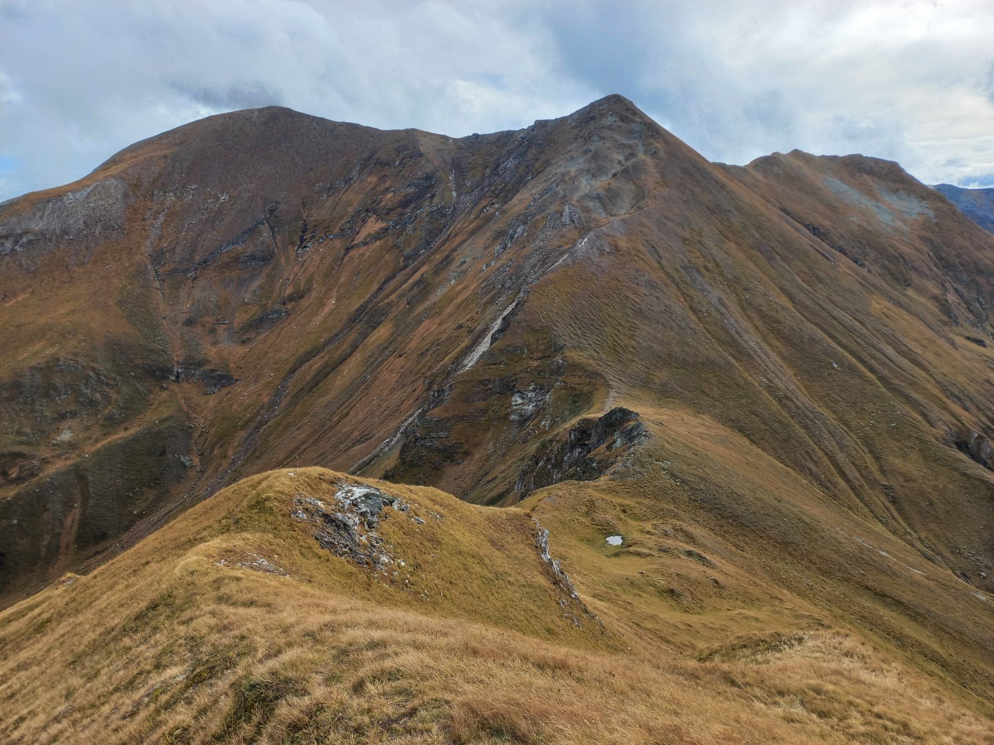
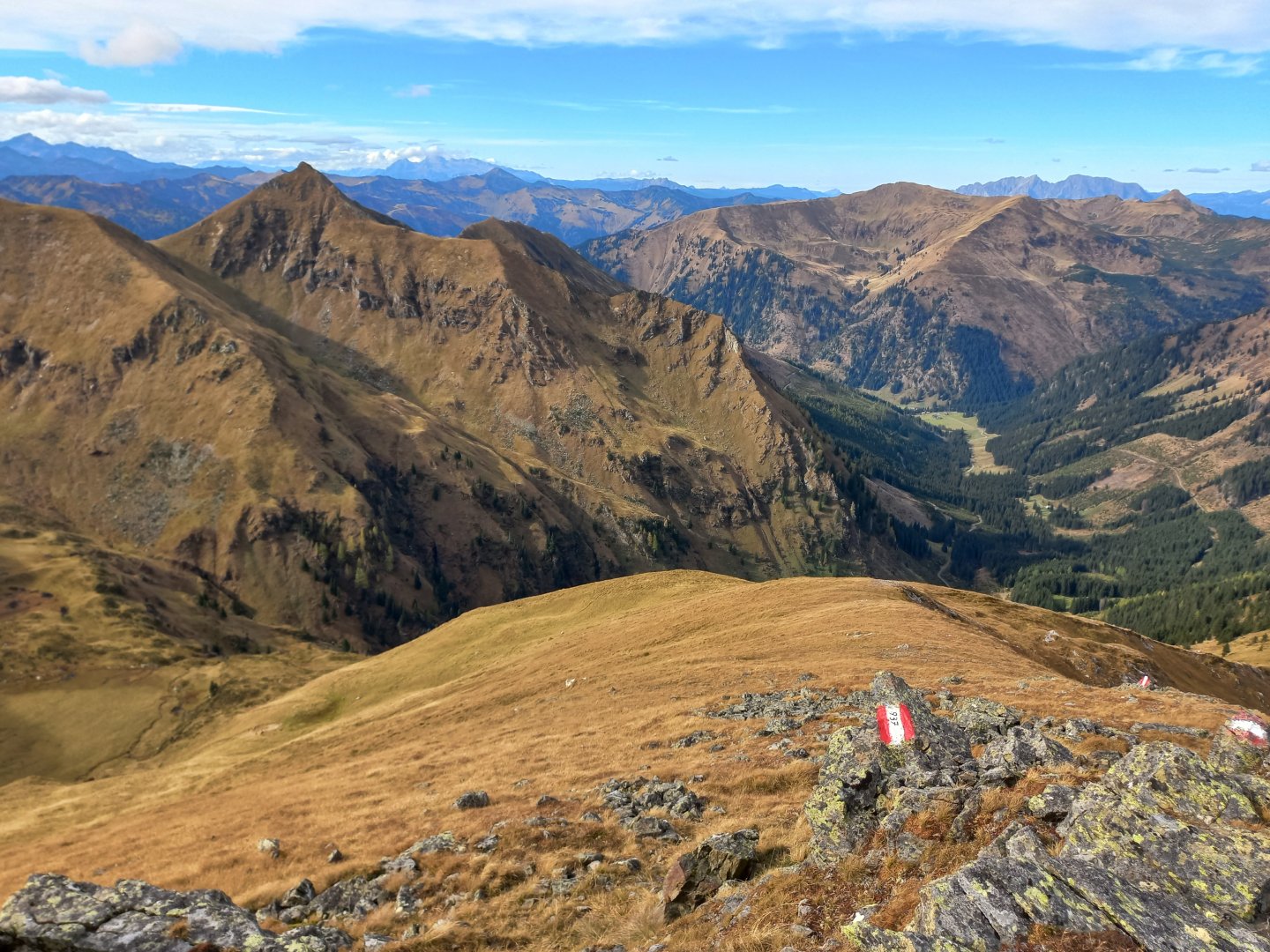
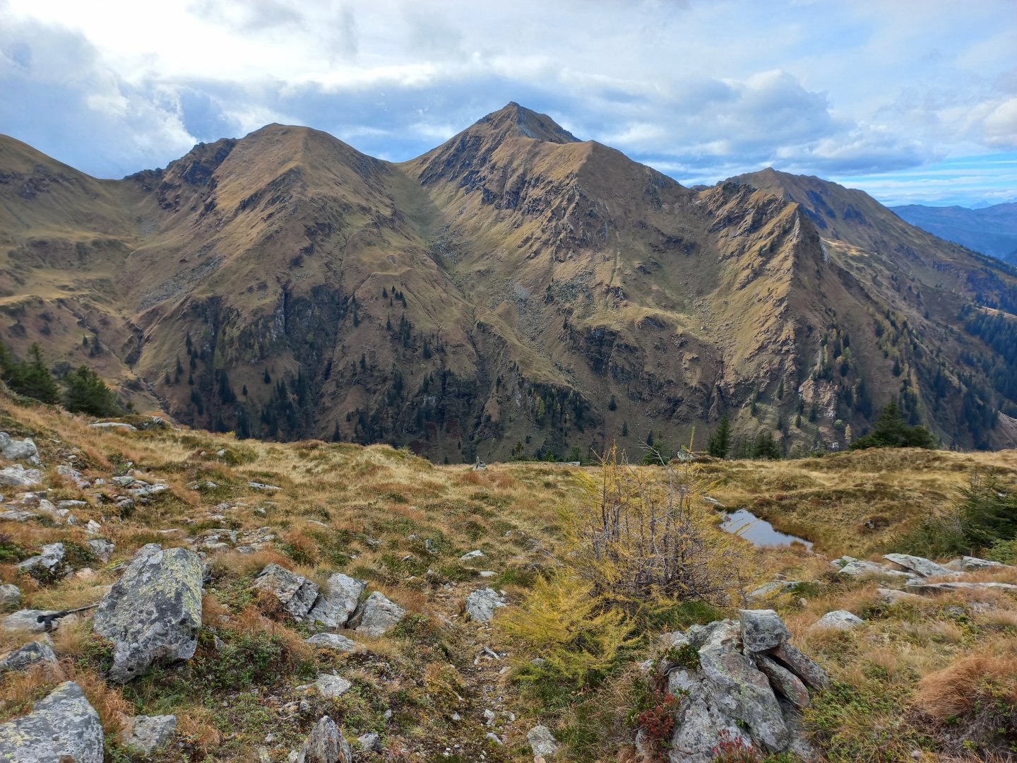
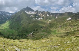
After a rest I turn left and climb the ridge leading to Eiskarspitz. The path follows a grassy edge, there is a cliff to the right, but there is no danger. At the top, the wind, which drives the clouds from the south with it, leans against me. The Eiskarspitz ridge alternately disappears in the cloud and reappears in the sun, a beautiful sight. At the top I turn right to the highest point of the route, the Hohenwart (2363 m). It too disappears in a few seconds into the clouds, but fortunately it clears up at the top and I can enjoy views from the Sölktal Alps in the west, through Dachstein, Grimming, Totes Gebirge in the north to the Rottenman Tauern and Gesäuse in the east. To the south are the Lachtal Alps and the Murtal, but these are hidden in the clouds.
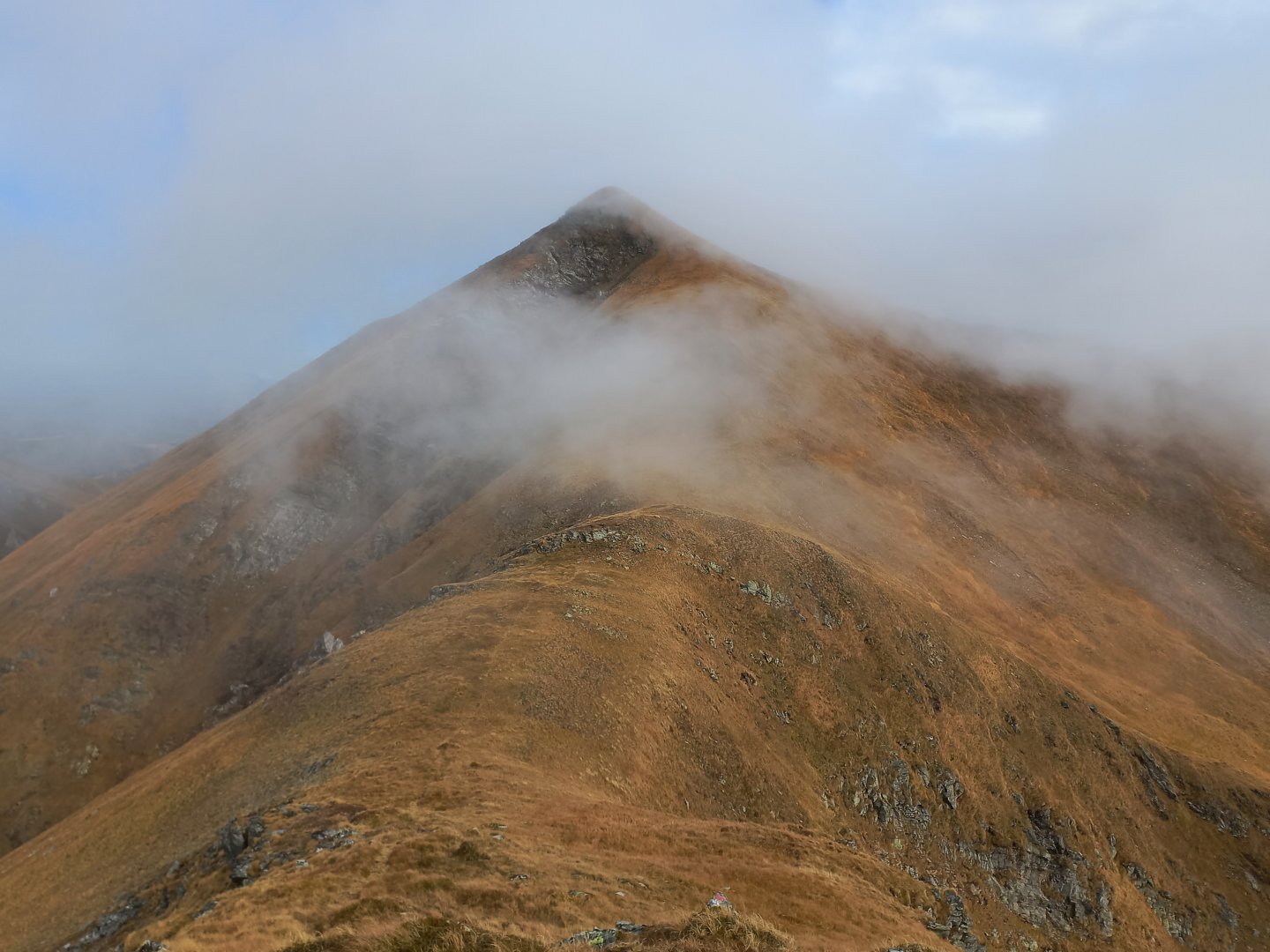
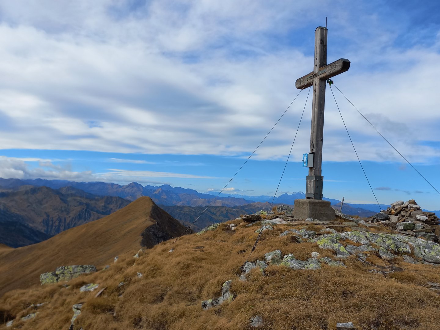
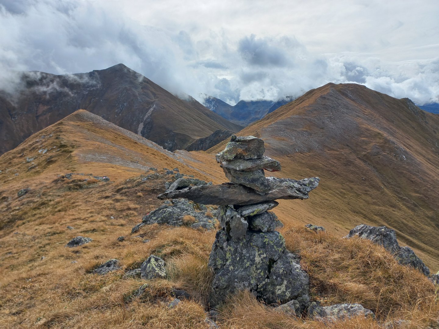
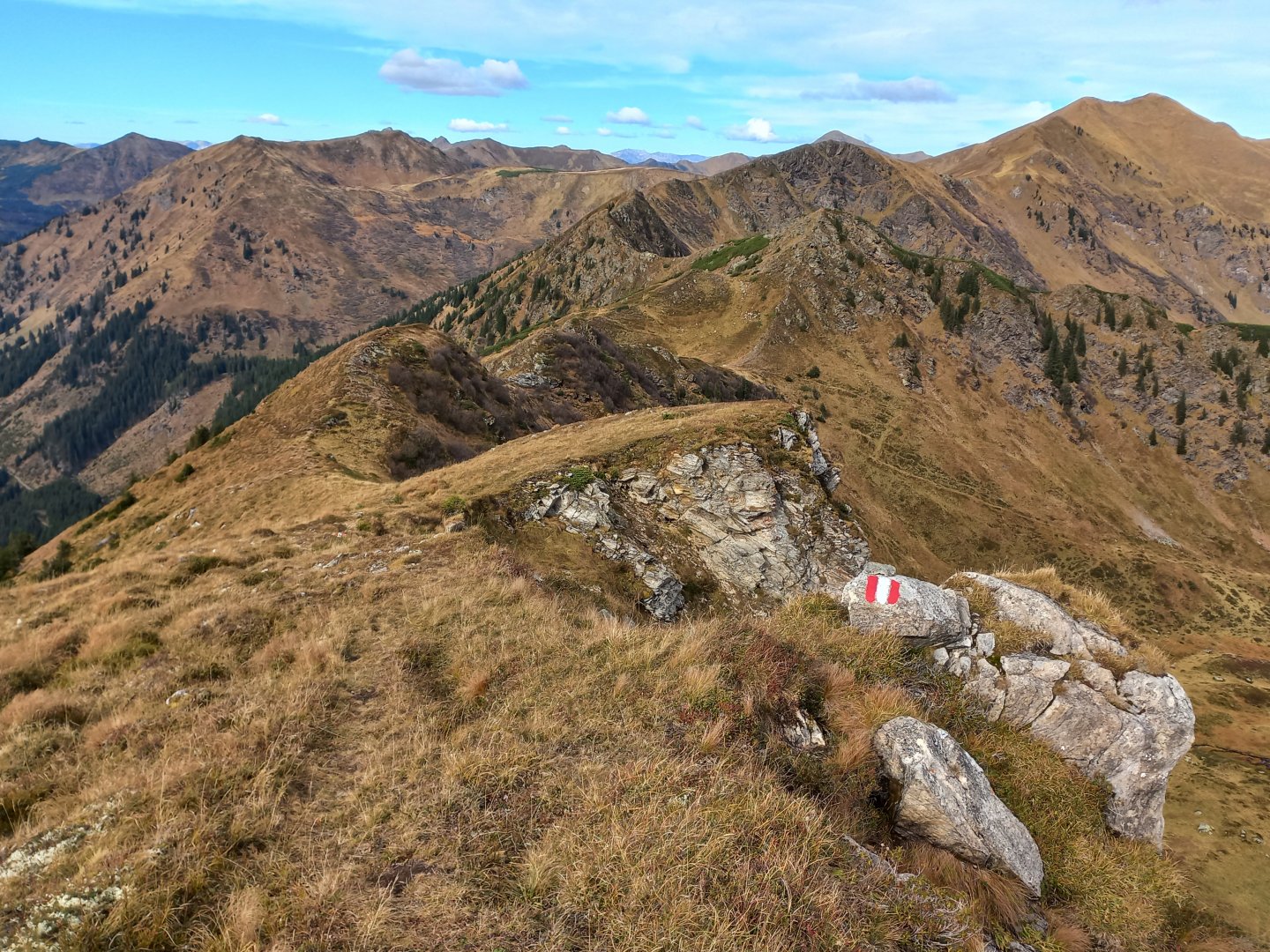
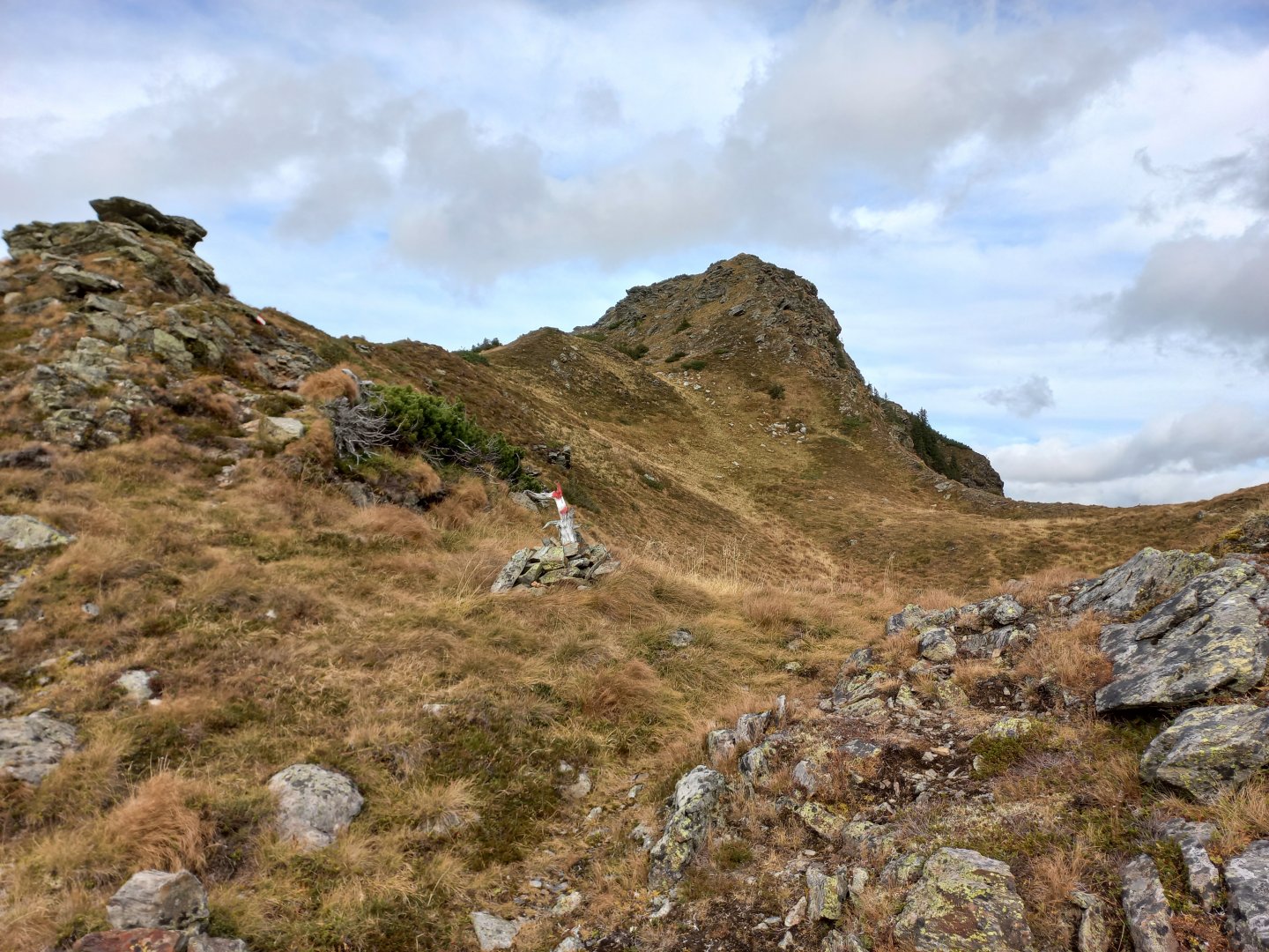
I return to Eiskarspitz, the path crosses the summit and drops 200 vertical metres down to the saddle in front of Schönfeldspitz (2202 m). The ascent to the third summit of the route is already a bit painful, the reward is a nice cross on the top piled up with rough stones. From Schönfeldspitz you can see the continuation of the grassy ridge to the Pustereckjoch saddle and into the Siebenhüttental valley, which is where I want to return. At Pustereckjoch (1913 m), heather and blueberries alternate with grass, knees and the first dwarf spruces appear.
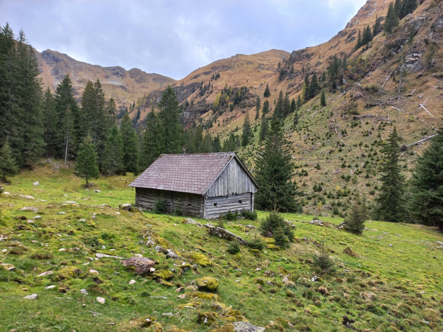
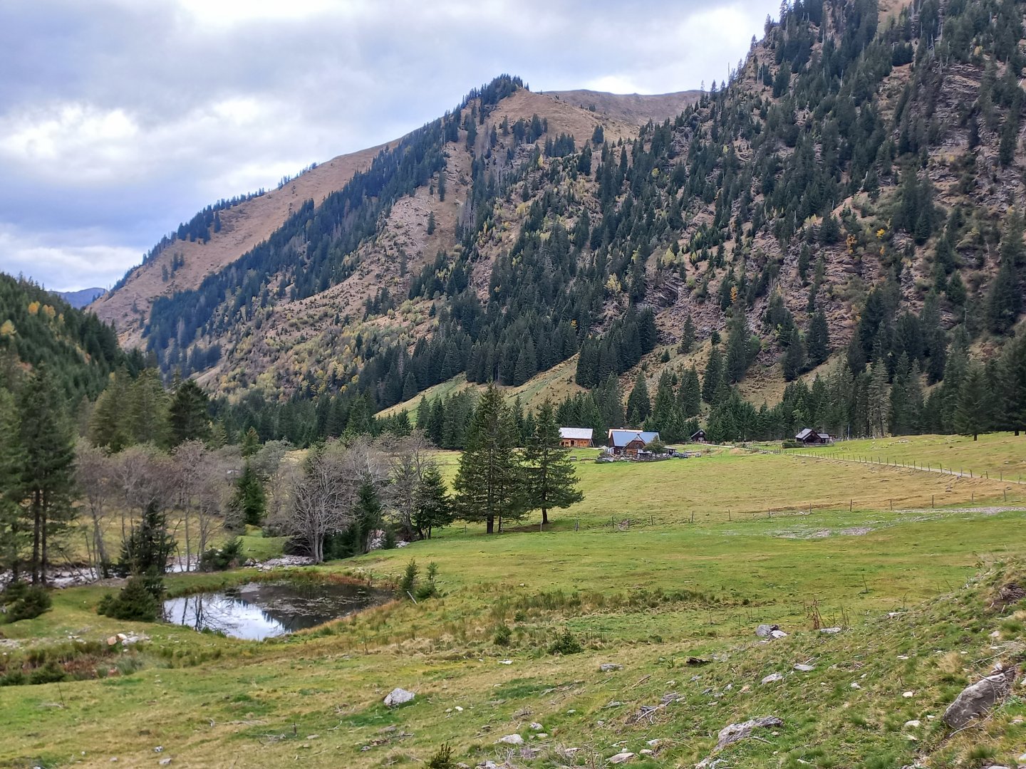
From the saddle, an unmarked path descends on both sides into the opposite valleys. I turn left. The descent is on a beaten path, the orientation is facilitated by stone men. The descent is fast, in about half an hour I am at a half-decayed hut above the Siebenhüttentalbach stream. Below the hut there is already a wide forest path that leads me to the Lärchkaralm huts. From the almo I continue along the stream back down to Donnersbachwald. On the road for 8 hours, sunny beautiful Saturday, not a soul except one chamois, the first people I met only in the valley.
Difficulty
The trek follows a marked AV route, the unmarked route is a shortcut between Pustereckjoch and Siebenhüttental, but the path was clearly visible, with little men. There are no technical spots, a classic alpine walk mostly on mountain meadows. The elevation gain is 1,600 metres, so good fitness is desirable.
Water availability
Water to go, or streams in the valley. There is no hut on the road. There is an inn at the end of the trail to Lärchkaralm and at the parking lot, but it is closed in the off-season.
Sleeping options
Accommodation in Donnersbachalm, no hut on the way. Semi-dilapidated bivouac in Glattjoch and on Hohenwart.
Mountain peaks
Climb to the Eiskarspitz, Hohenwart and Schönfeldspitz mountains, with a path between them along the ridge. Views from the Sölktal Alps in the west, through Dachstein, Grimming, Totes Gebirge in the north to the Rottenman Tauern and Gesäuse in the east. To the south are the Lachtal Alps and the Murtal Valley.
Danger
The path mostly follows marked trails on grassy slopes, there are no exposed sections.
Food
I had food with me, refreshments are available at the end of the road to Lärchkaralm or at the car park, but closed out of season.
Attractions
In the Glattjoch saddle there is an unusual building called the Glattjochkapelle. The information board states that the vaulted chapel was built of dry-stacked stones, without the use of mortar, and probably dates back to early Christian times. A salt trail passed through the saddle and the small platform was a stopping point for trade caravans and pilgrims. There is still a massive stone cross a short distance below the chapel overlooking the valley opposite.
The spring crossing of the Wölzer Tauern and the ascent of the Hohenwart from the opposite valley are described in the narrative.