Mountain range, region / State
Dolomites in Alps / Italy
Season
Summer
23. 06. 2011
Difficulty
C
Elevation
↑ 821 m
↓ 821 m
Length
8.4 km
5 hours
Altitude
max. 2727 m n.m.
min. 2019 m n.m.
Tips for hikes in the mountain range Dolomites in Alps
6-day crossing of the Dolomites along the Alta Via 1 route
Circular trek at the waterfalls in the Fanes Sennes Braies park in the Dolomites
Trek with the best ferrata in the Sexten Dolomites
Intermediate ferrata near Marmolada
Starting point
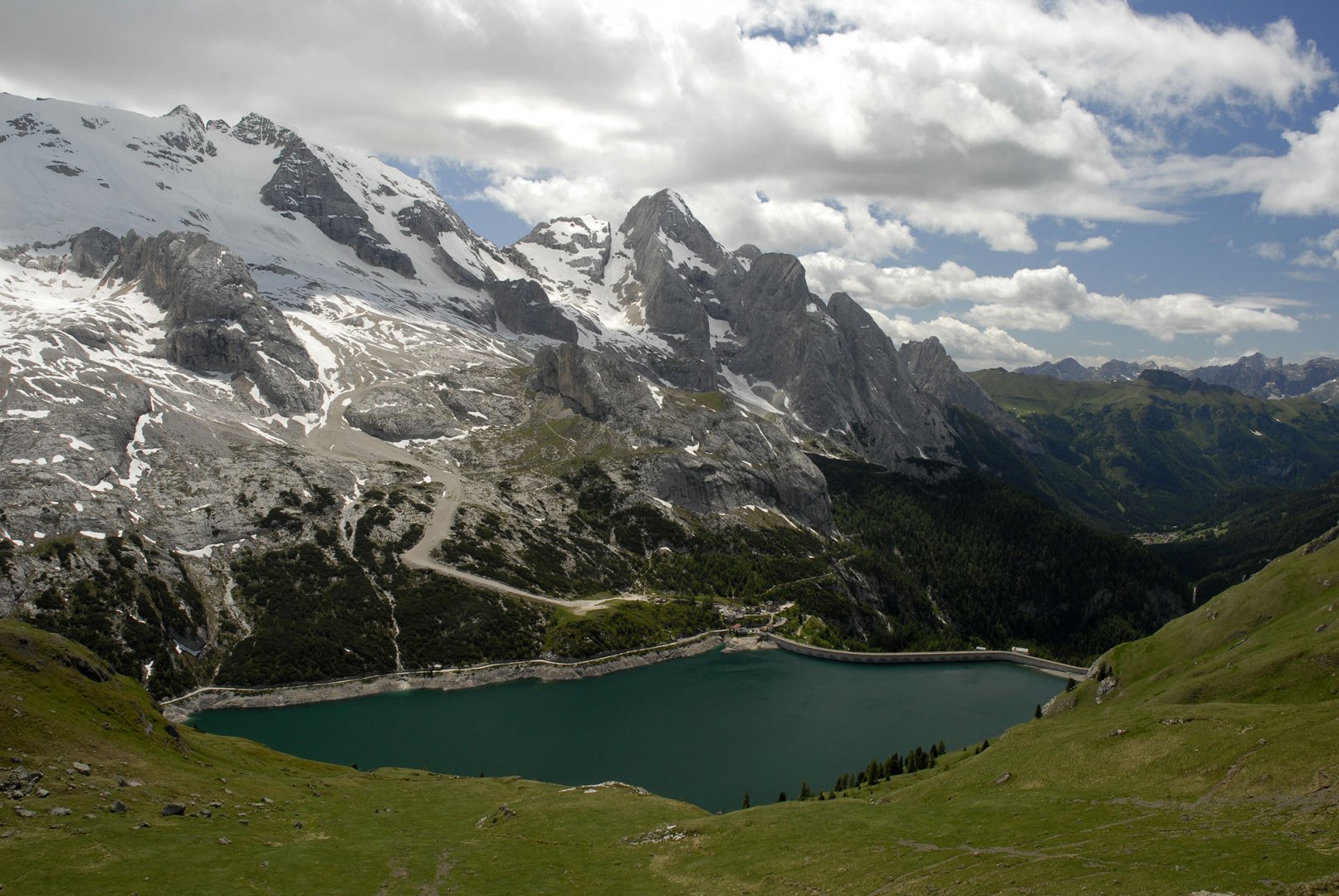
Car park at the Lage di Fedaia dam near the Rifugio E. Castiglioni hut below the northern slopes of the Marmolada.
Description of the hike
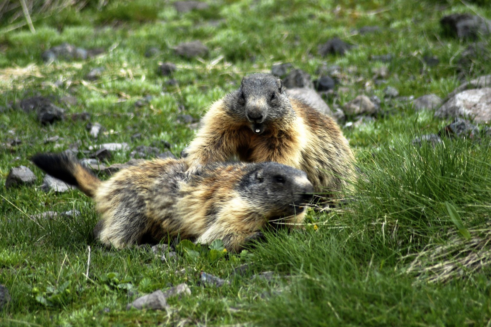
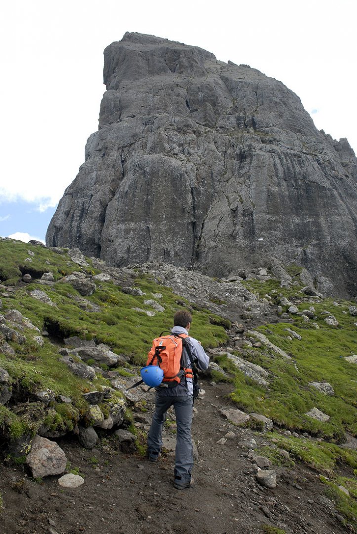
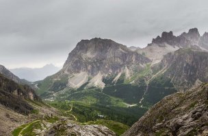
For the ascent to the start of the ferrata Delle Trincee we decided to take the route from the south, i.e. from Lago di Fedaia. We left the car at the parking lot of the Rifugio E. Castiglioni hut. From the parking lot we started to climb up the meadows along the marked route 698. (photo) The ascent was without the slightest problems, on the contrary, it was made more pleasant by the marmots, which were abundant in the meadows. After reaching the saddle to which the cable car goes from the north, we continued along the path to the beginning of the ferrata. After a few tens of meters we reached the beginning of the sheltered path. (photo)
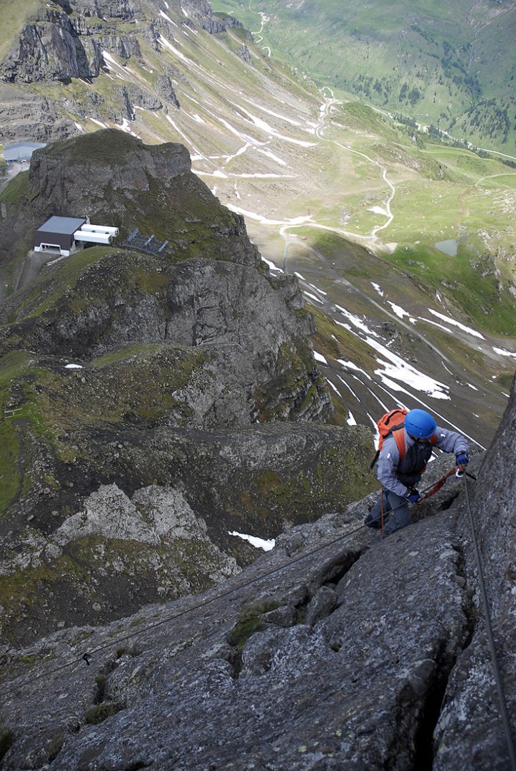
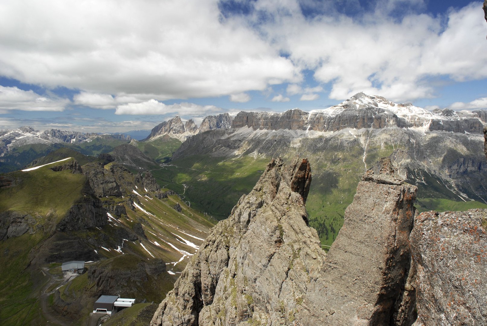
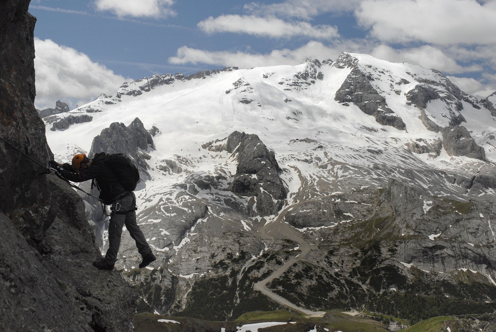
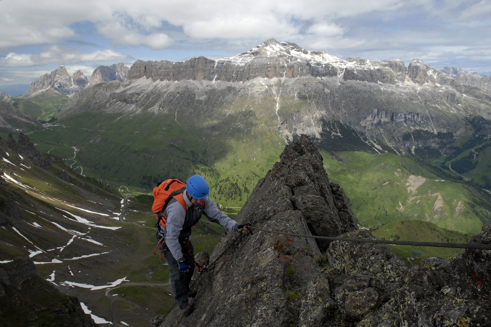
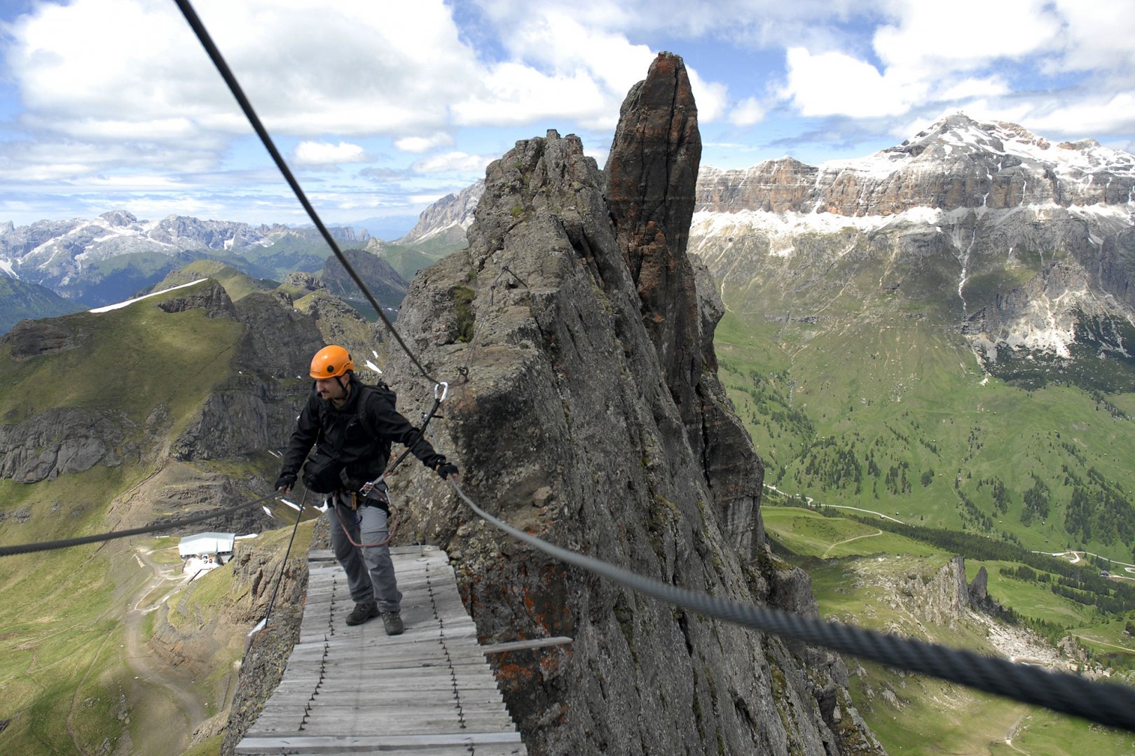
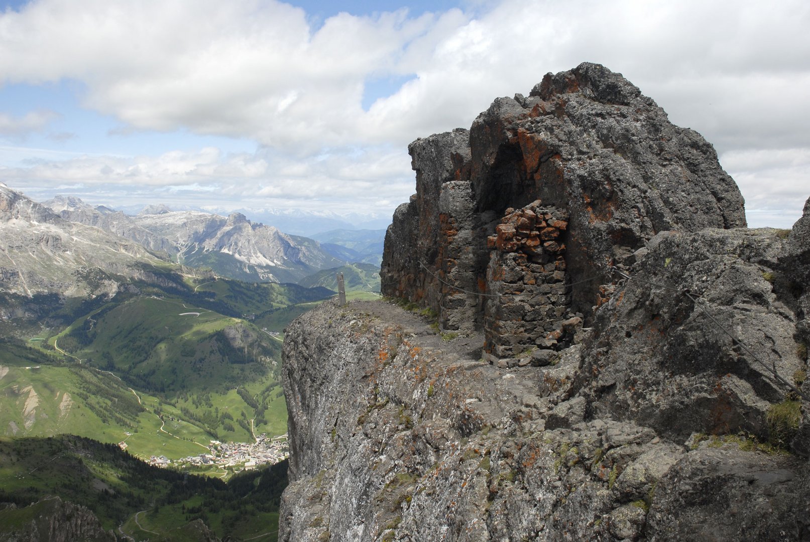
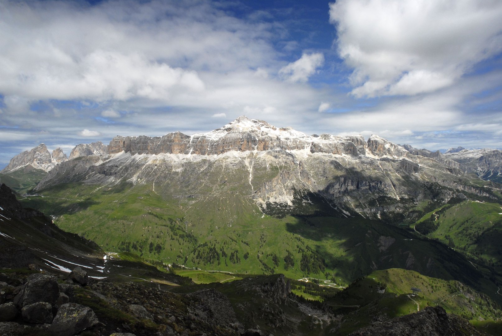
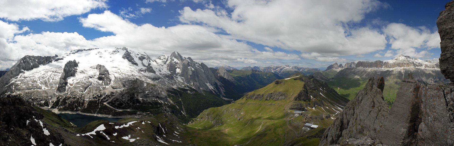
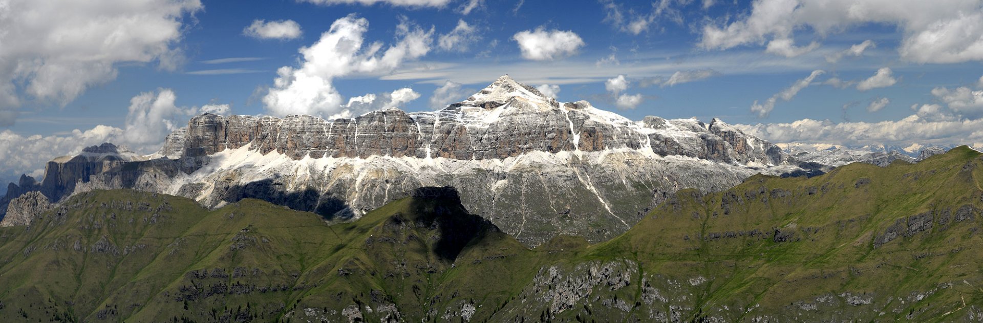
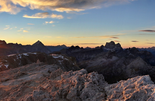
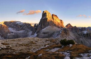
And the very first part is actually the hardest part. We started climbing up the almost perpendicular rock. These few dozen meters are really the hardest. But the belay is very good, so it was no problem. (photo) After climbing this section we found ourselves on the ridge. Here we were in a maze of different rock towers and for variety we crossed a footbridge which creaked sympathetically. (photo) The path still leads along the jagged ridge. There are a number of WW1 remains here. (photo) After crossing the summit of Sas de Mezdi 2,727 m above sea level, we started to descend. The views from the ferrata are truly breathtaking on all sides. (photo)
Gradually we left the sheltered places until we reached the saddle of Passo Padon. Here we left the protected trail and started to descend back to the Lago di Fedaia dam. (photo) We descended through the meadows to the road by the lake without any problems. We crossed the road and followed the lake shore back to the parking lot of the Rif hut. E. Castiglioni.
Difficulty
Moderately difficult ferrata, the most difficult is the immediately perpendicular entry to the wall. The length of the belayed route is not that difficult, the belayed passages are mixed with the walkway - the original WW1 walkway. The ascent to the ferrata is also not a big problem, you walk from the dam to the saddle along the paths.
Water availability
The length of the ferrata is not long, so we had all liquids with us (1.5 liters of water per person). It was not necessary to refill along the way.
Mountain peaks
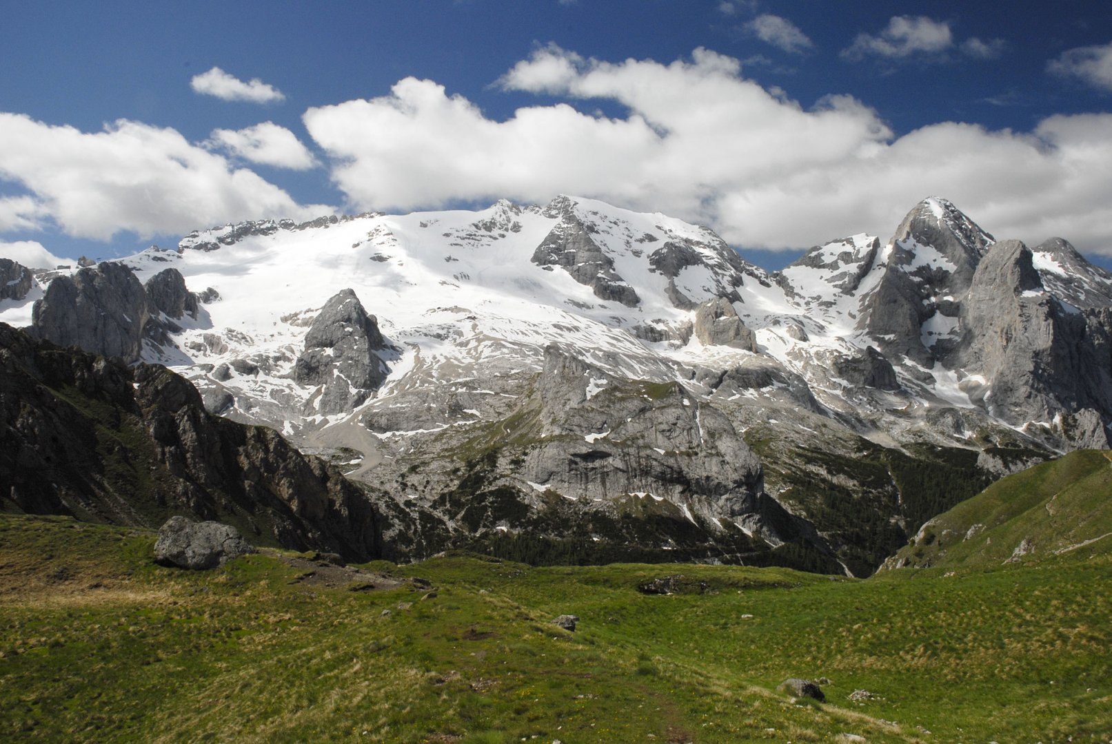
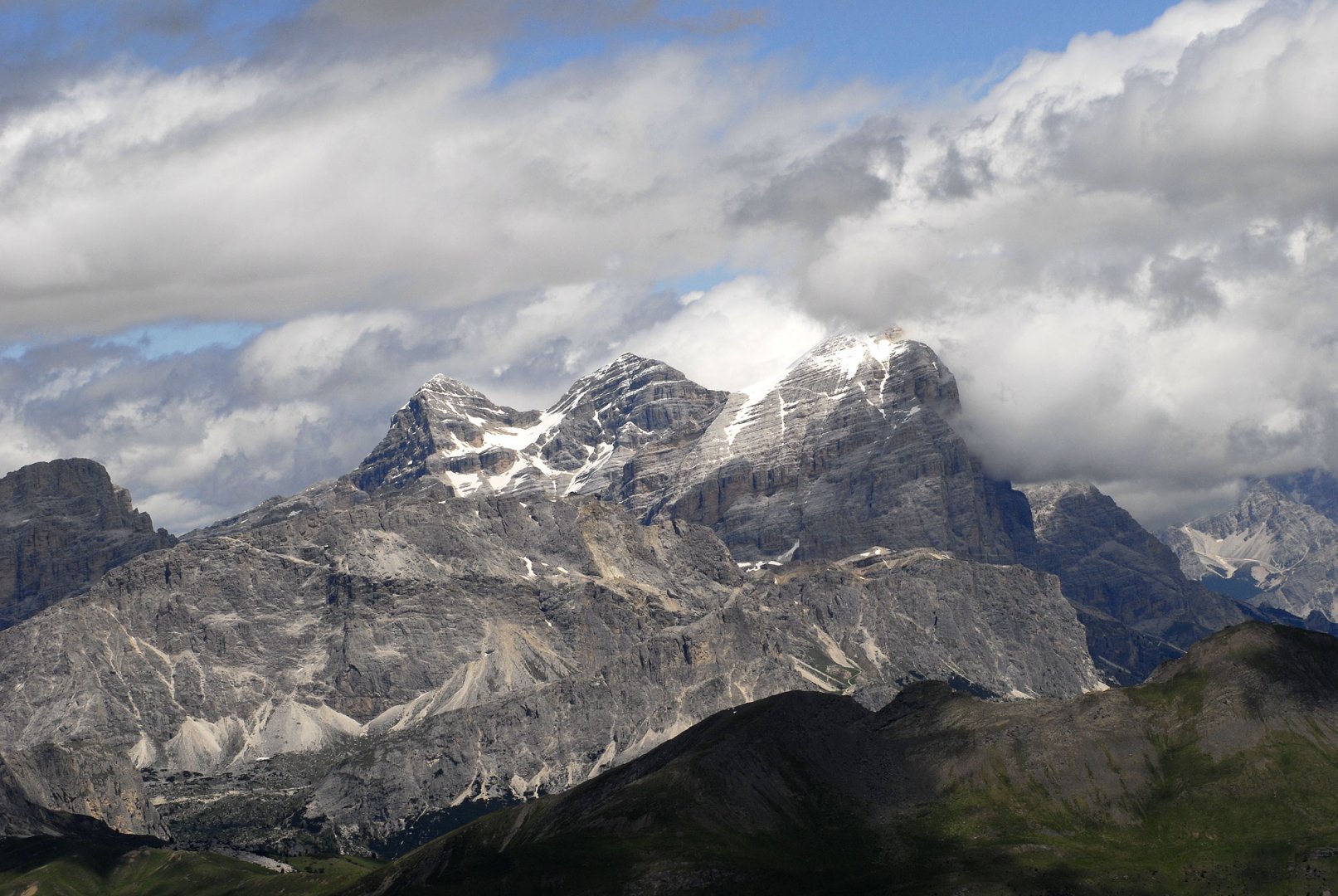
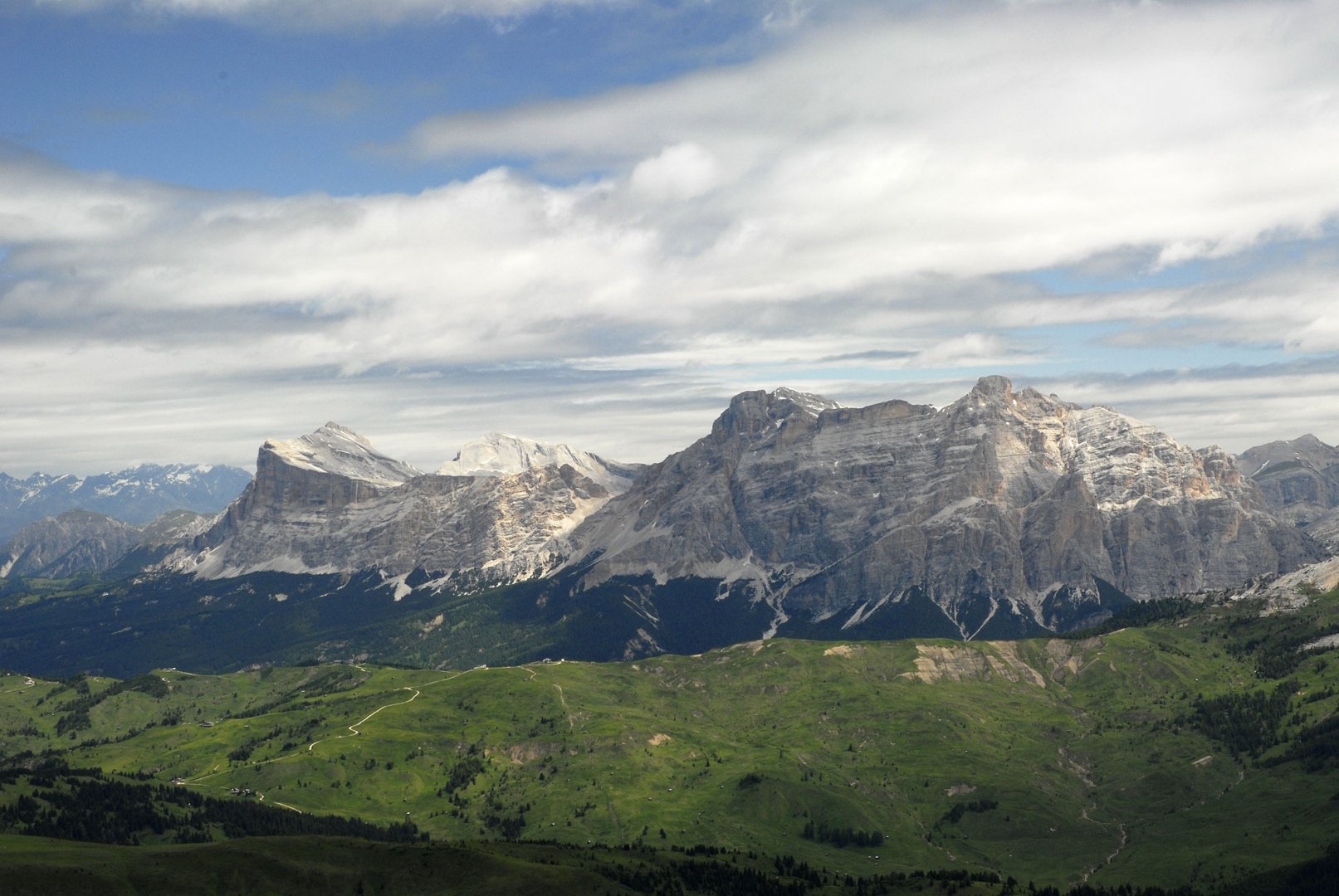
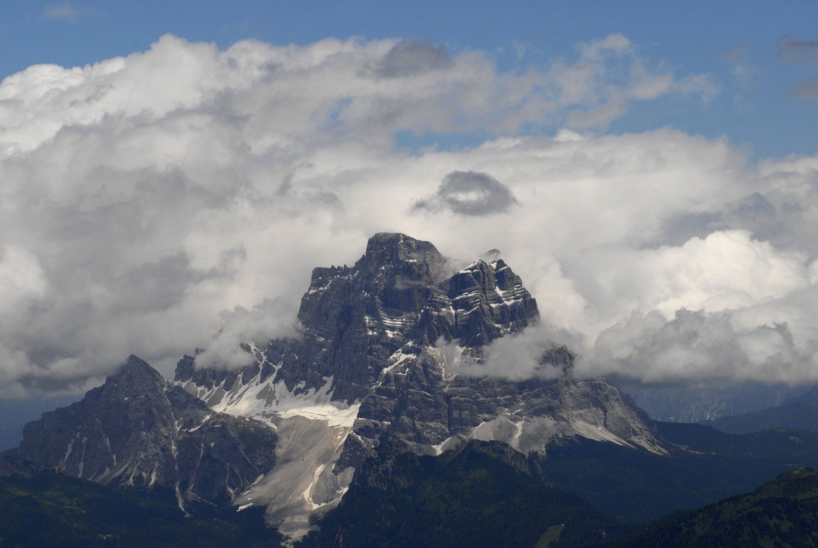
On the ferrata we ascended the Sass de Mezdi 2 727 m above sea level. All the time on the ferrata there are fantastic views of the Marmolada, Piz Boe, Monte Pelmo and other Dolomite giants.
Danger
The ferrata is well secured, there is no problem with safety on the ferrata. The ascent and descent from the ferrata is along the trails, so there is no problem here either.
Facilities
For this crossing, you need to have the classic equipment for safe routes - a ferrata set with brake and helmet. Gloves are also good to protect you from rubbing against the steel ropes.
Food
It is possible to eat at the beginning in the Rifugio E. Castiglioni hut, or before the start of the ferrata in the Rifugio Luigi Gorza hut. We settled for the cold food we had with us.
Attractions
Like many other ferratas in the Dolomites, this one is originally a WWI trail. It is therefore possible to encounter many remnants of fortifications along the way. From the ferrata there are truly spectacular views of both the Marmolada massif to the south and the Piz Boe massif to the north.
Photos