Mountain range, region / State
Ennstal Alps / Austria
Season
Summer
30. 06. 2024
Difficulty
3 / 5
Elevation
↑ 1460 m
↓ 1460 m
Length
13.2 km
7 hours
Altitude
max. 2197 m n.m.
min. 848 m n.m.
Hiking map of the Ennstal Alps
Tips for hikes in the mountain range Ennstal Alps
Climb to Hochtor, the highest mountain in the Ennstal Alps
Half-day hike in NP Kalkalpen with climbing the Kampermauer wall
Hike to the Wasserklotz lookout in Kalkalpen NP
A fair alpine trek to the Scheiblingstein mountain
Starting point
You can leave your car in the car park at the biathlon centre in Innerrosenau (free of charge).
Description of the hike
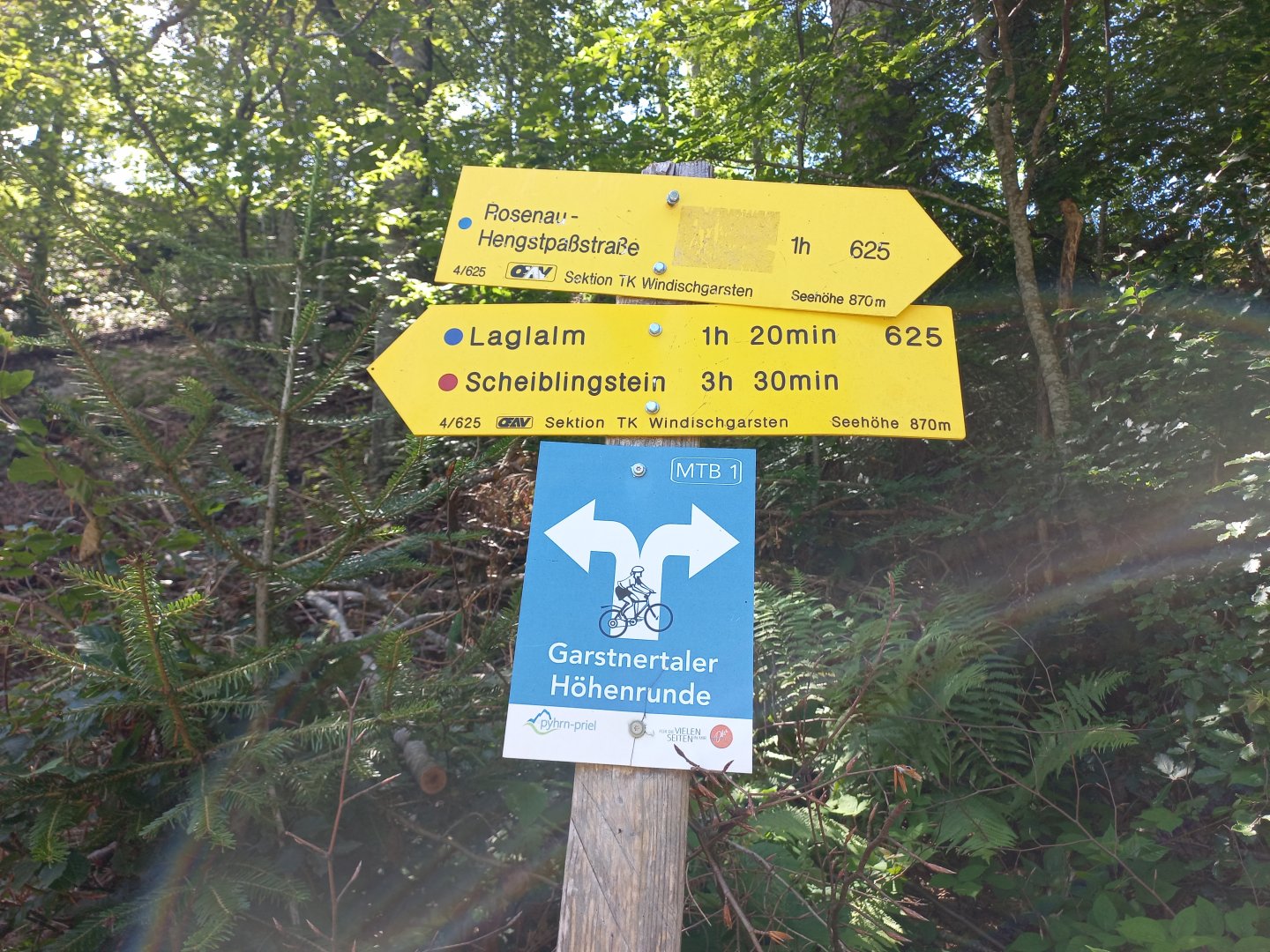
I leave my car in the parking lot of the biathlon center in the Innerrosenau valley. Parking is free, you only have to pay to use the biathlon trails in winter. The signpost just outside the car park shows 3.5 hours to Scheiblingstein, on the AV route marked with a red dot (medium difficulty).
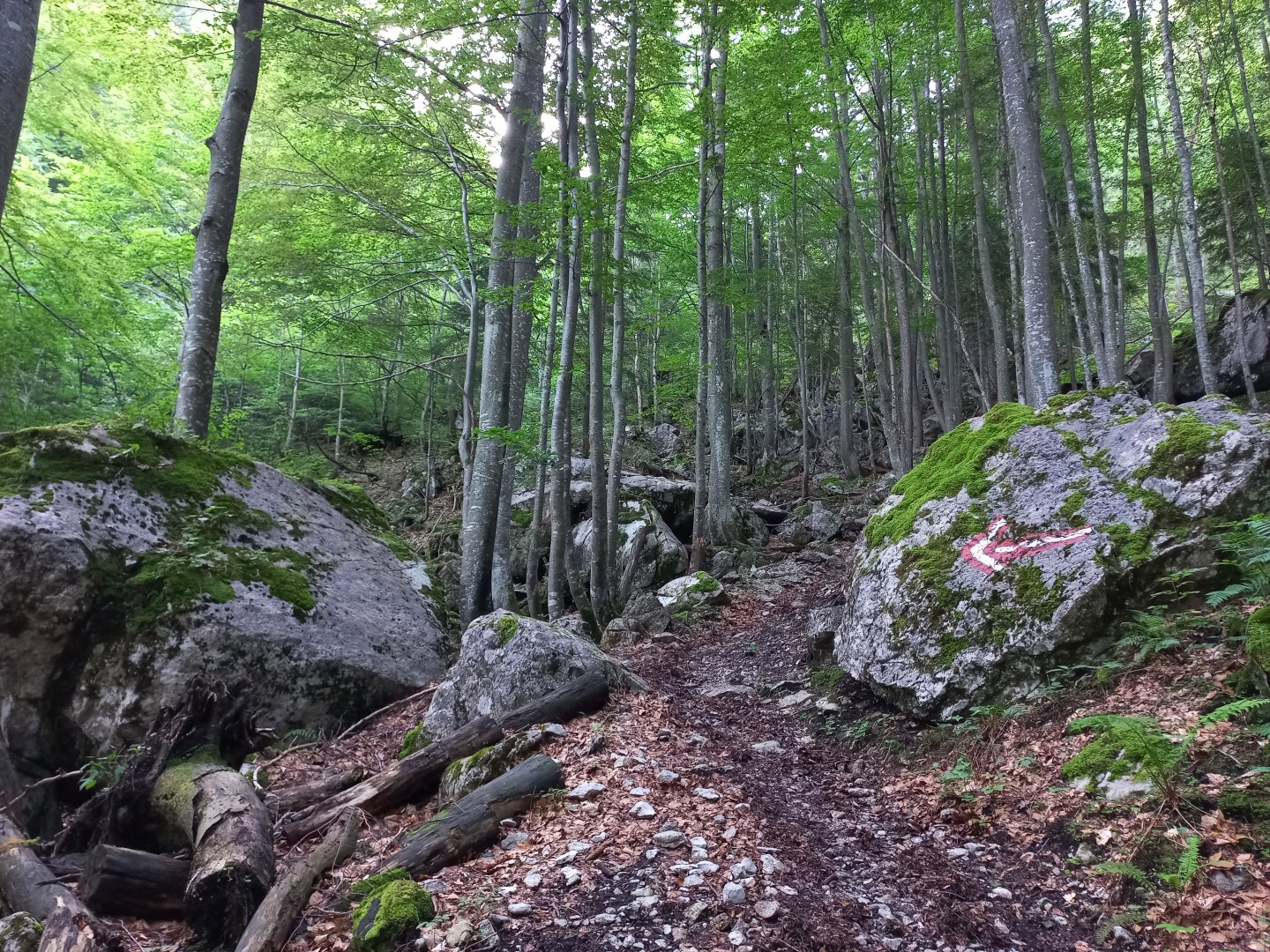
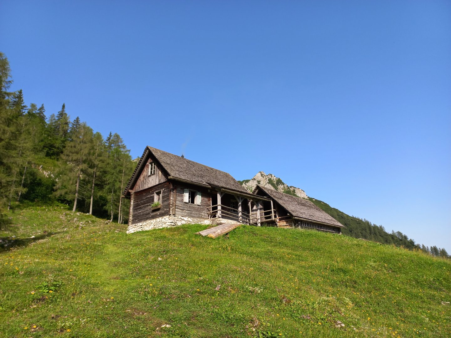
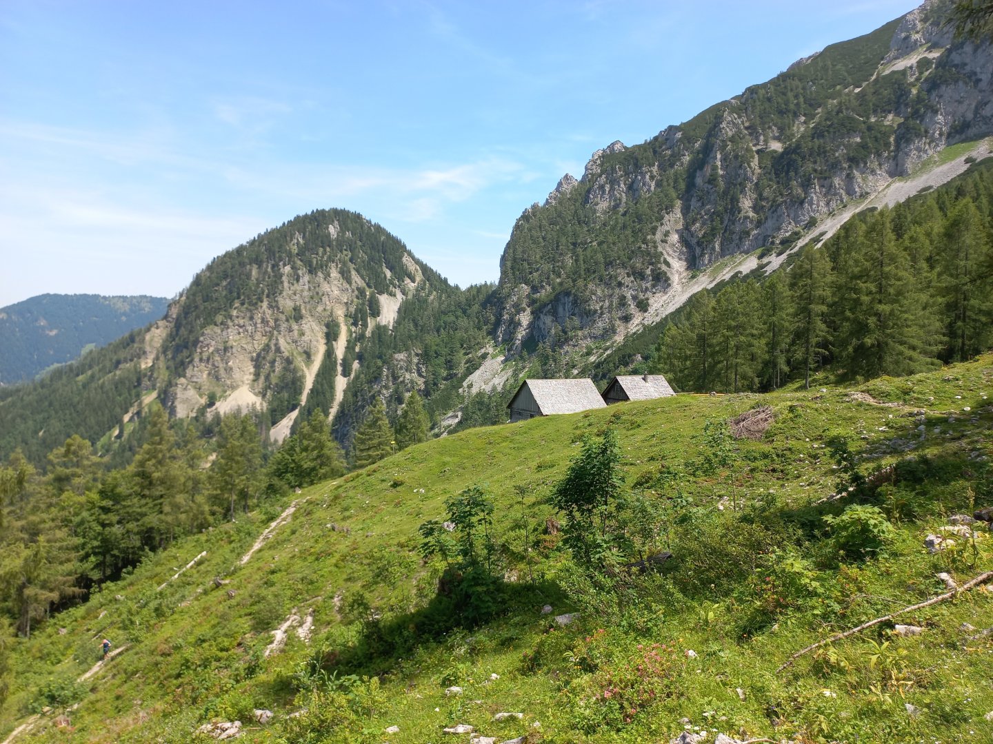
A 20-minute warm-up on a wide forest path prepares your legs for the steeper climb up a rocky path through the forest. In about an hour I come to the two cottages of Laglalm. There is a spring below with water refilling facilities. From Laglalm I continue along the marked trail towards the Mannsberg hill 1 603 m above sea level.
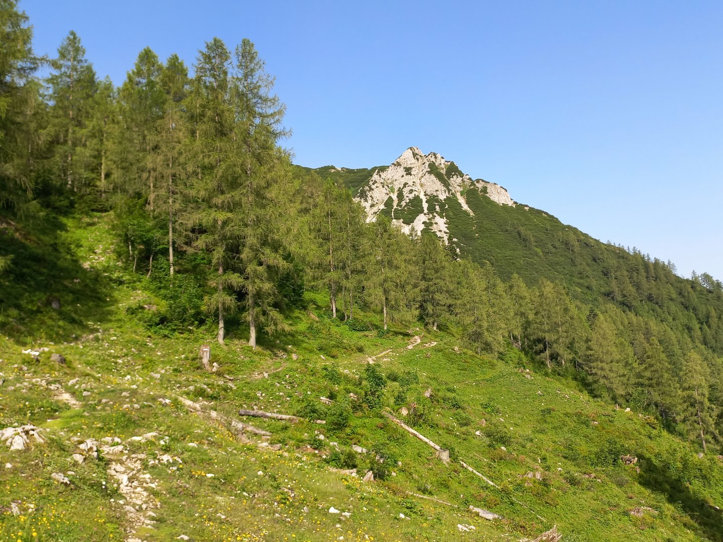
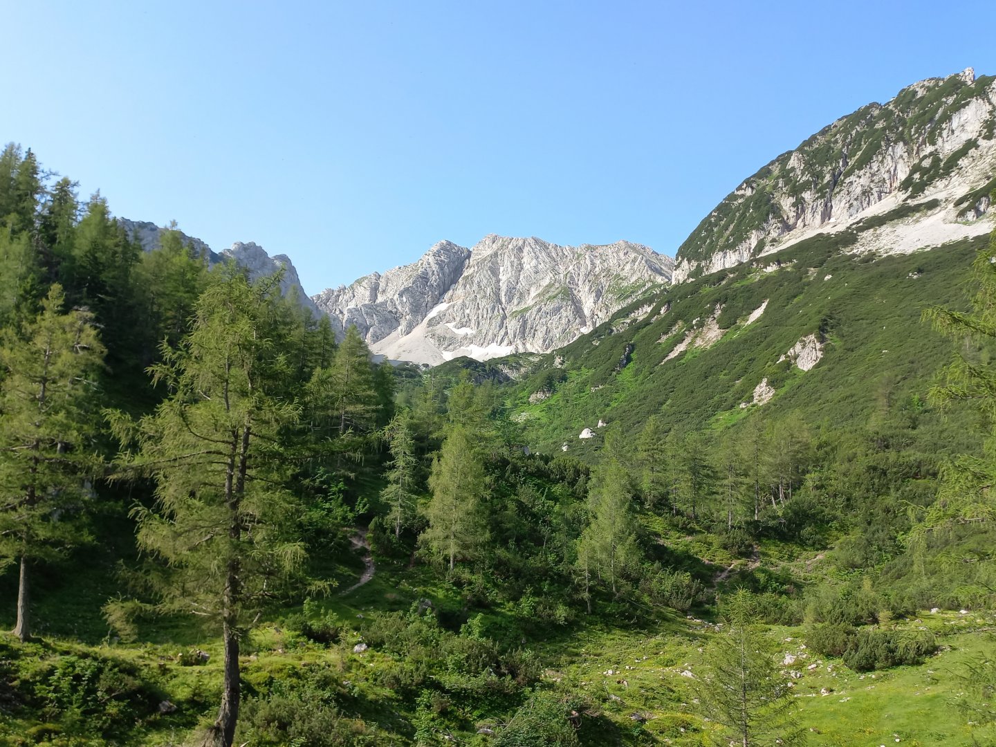
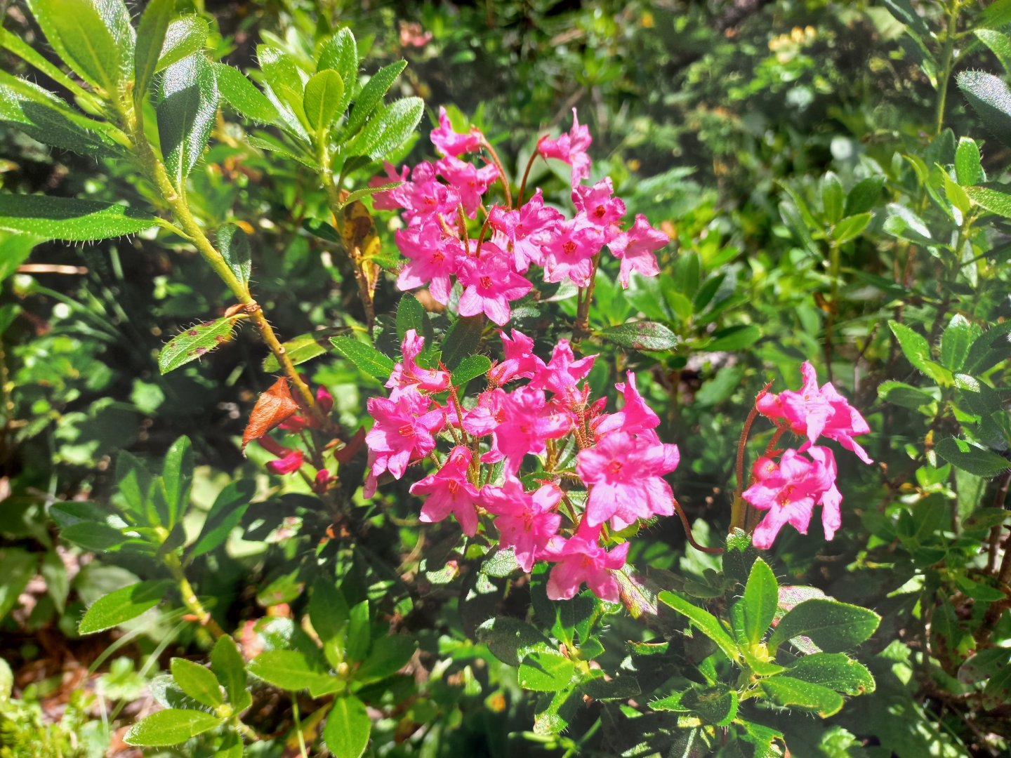
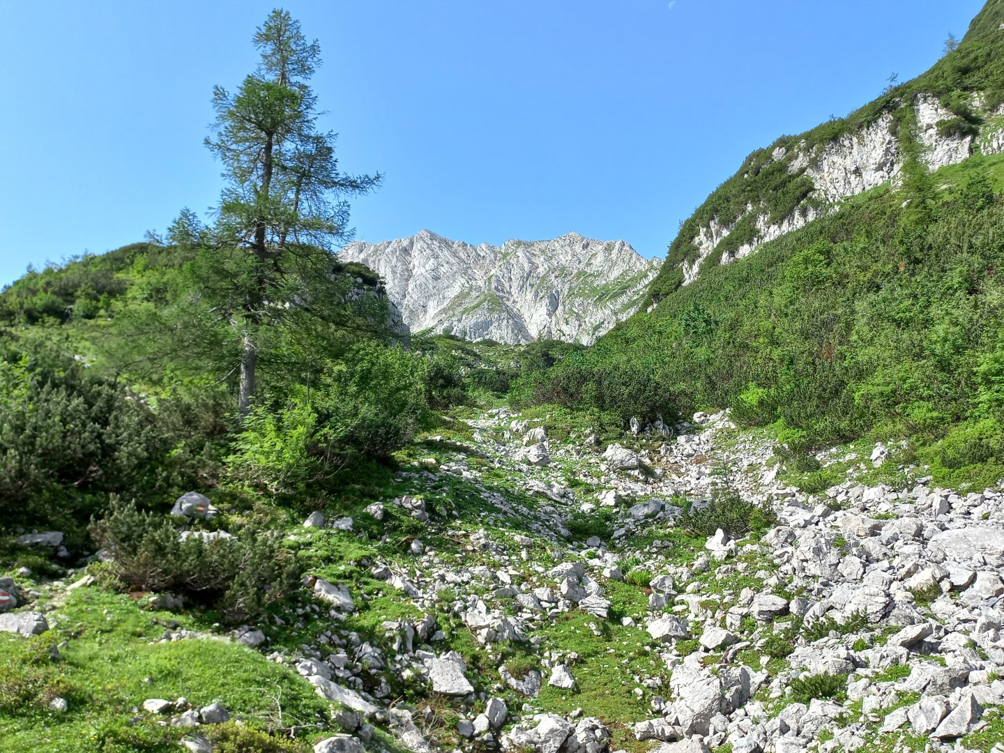
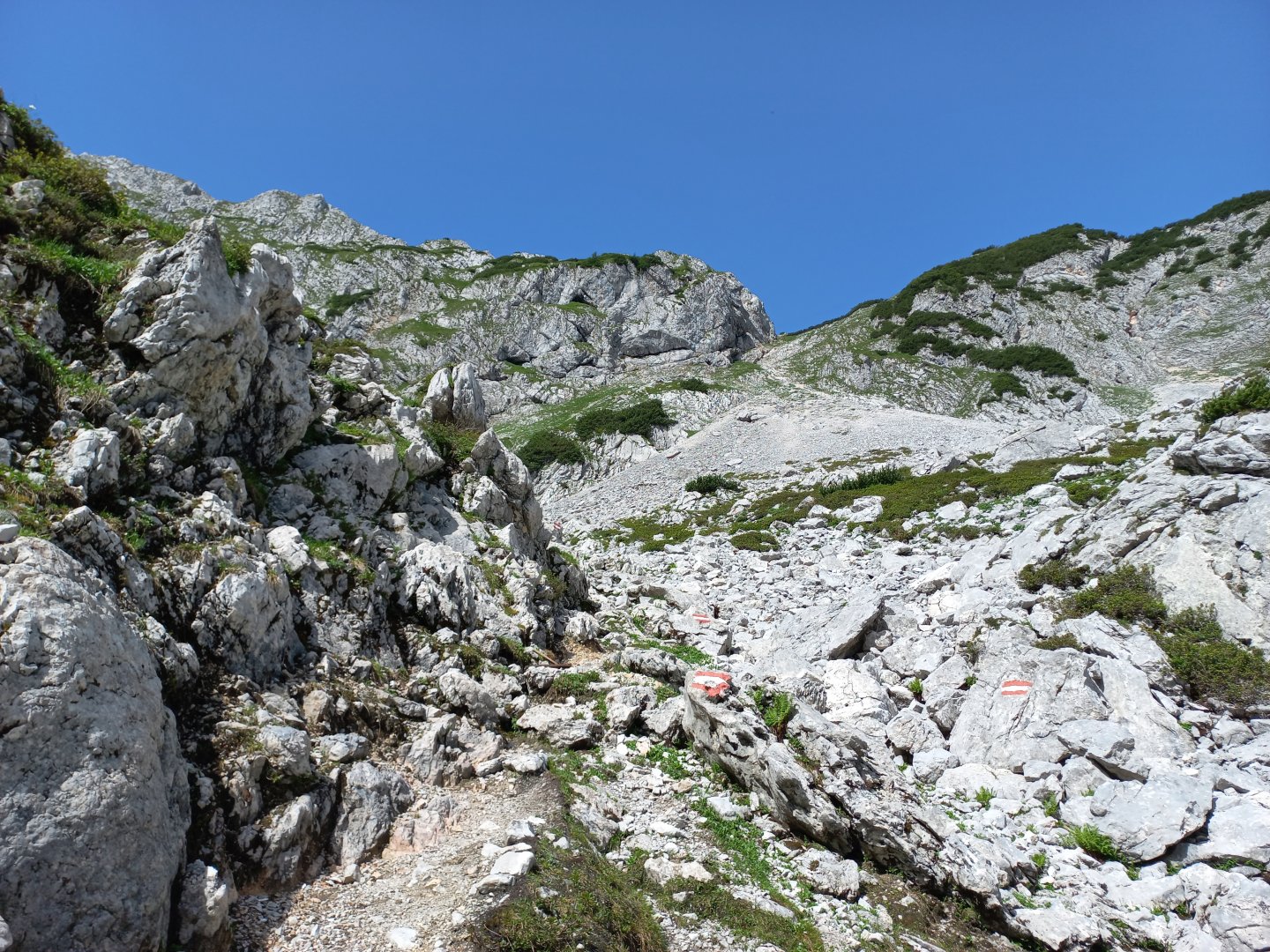
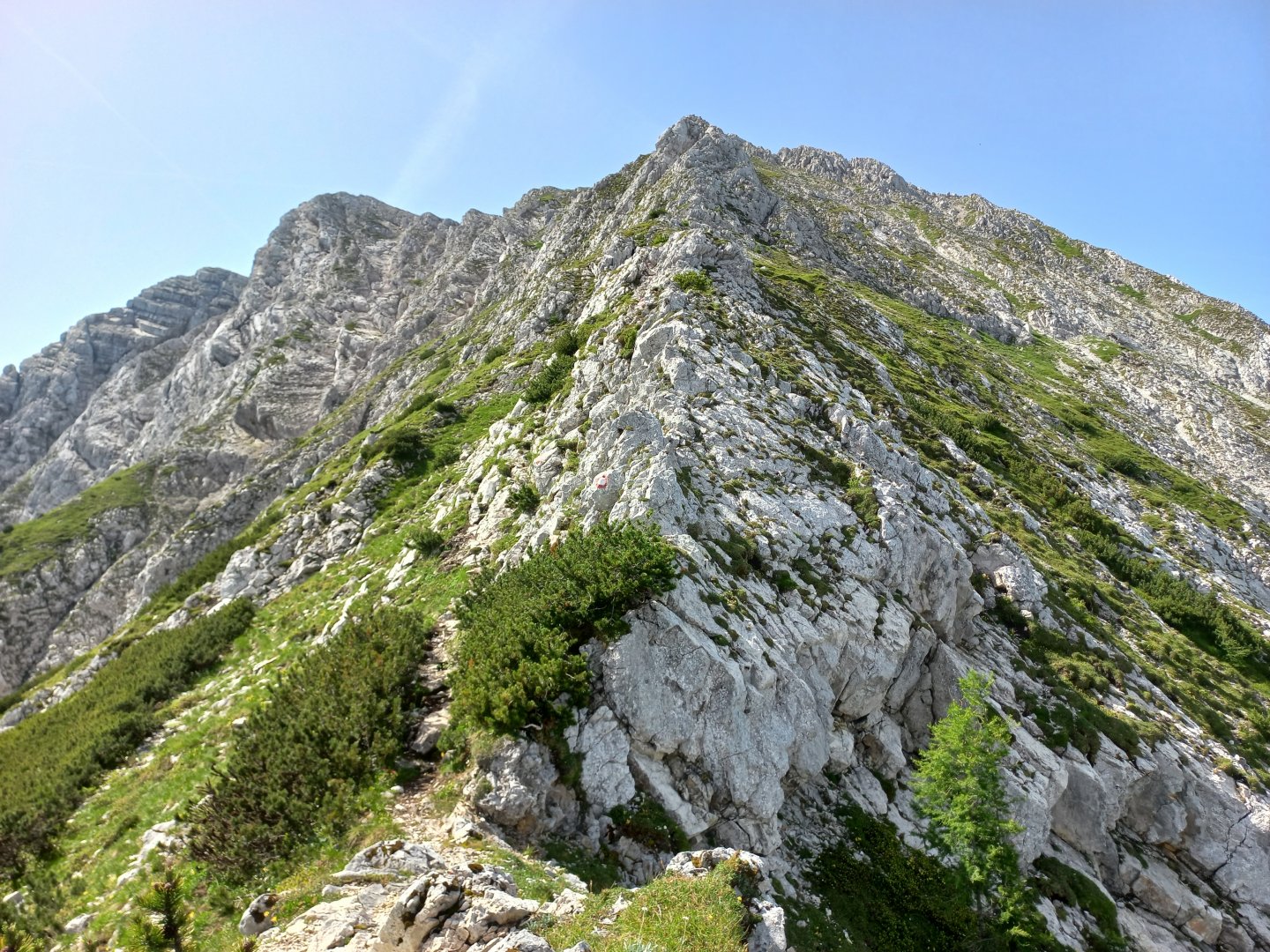
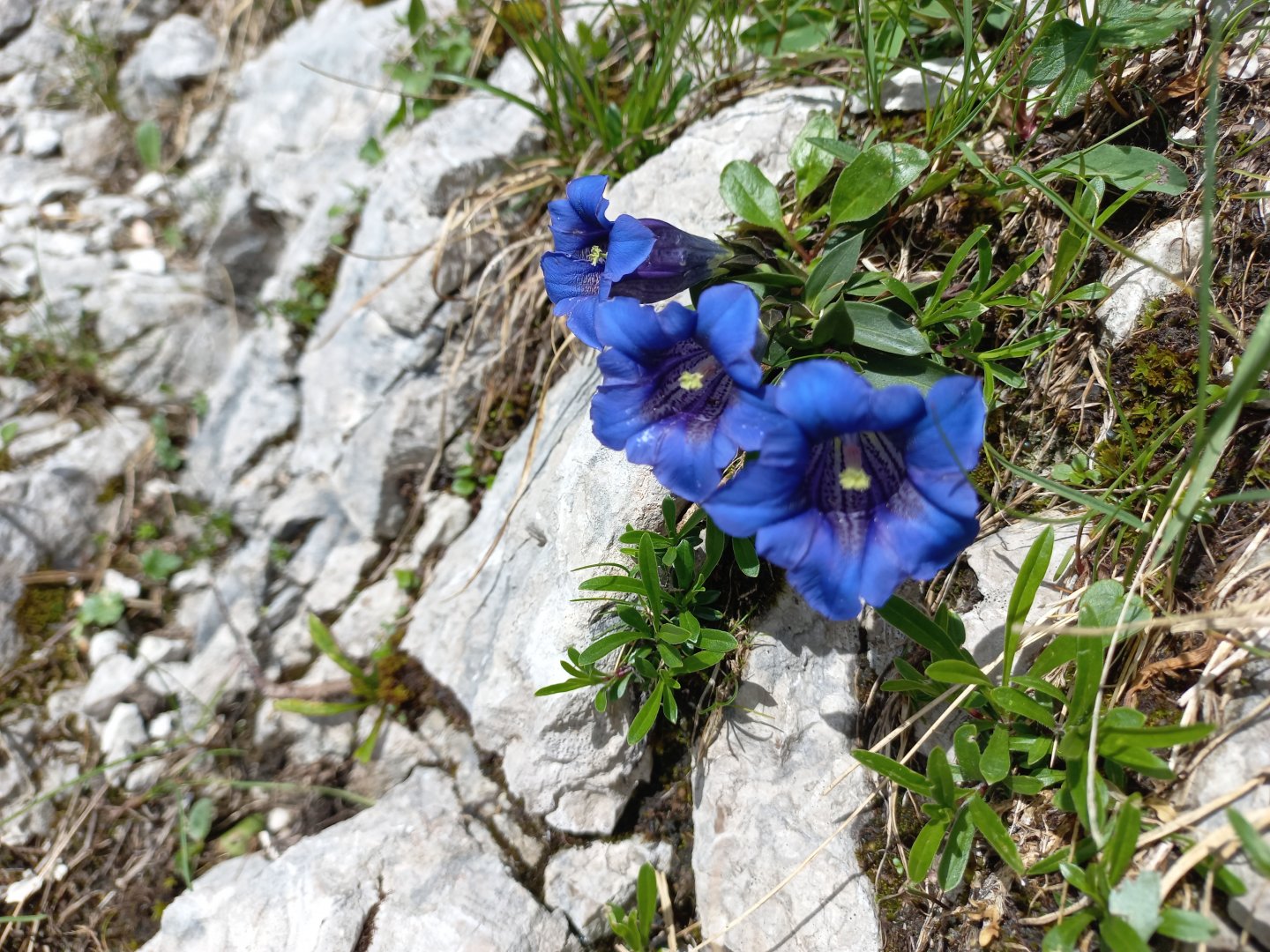
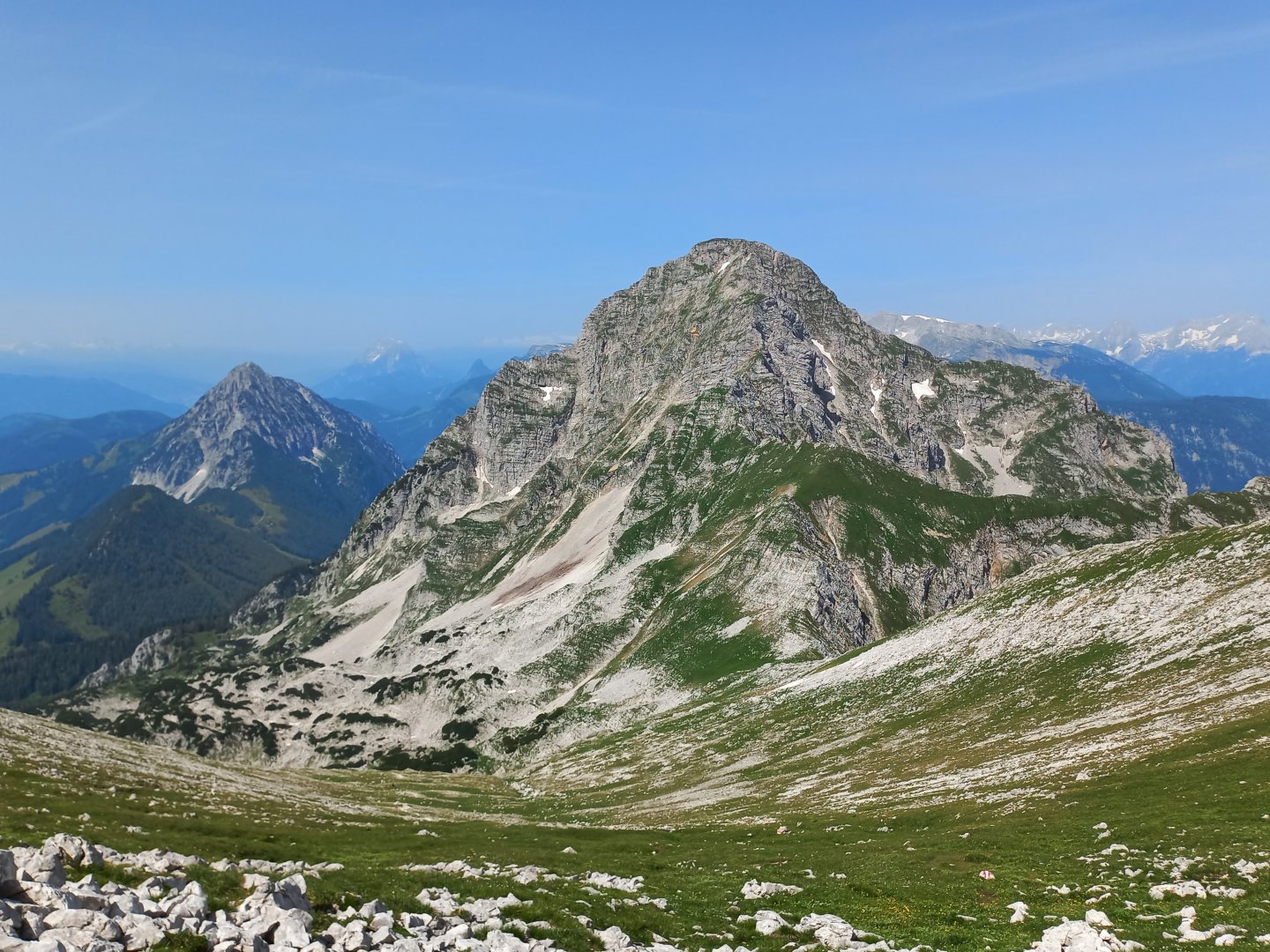
Shortly after the alm the trail turns left and finally the wrinkled massif of Scheiblingstein appears, illuminated by the morning sun. The alpine landscape begins here - dwarf larches, knees, rocks. Slowly I climb up the path to the scree field at the foot of the hill. The stone field here transitions towards the wall.
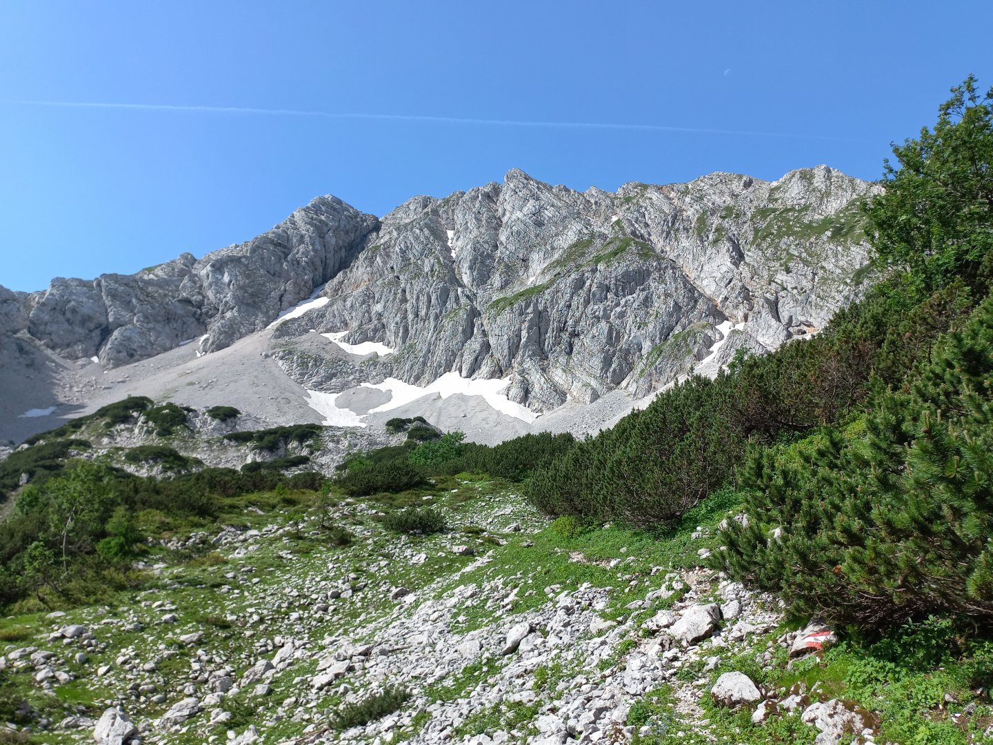
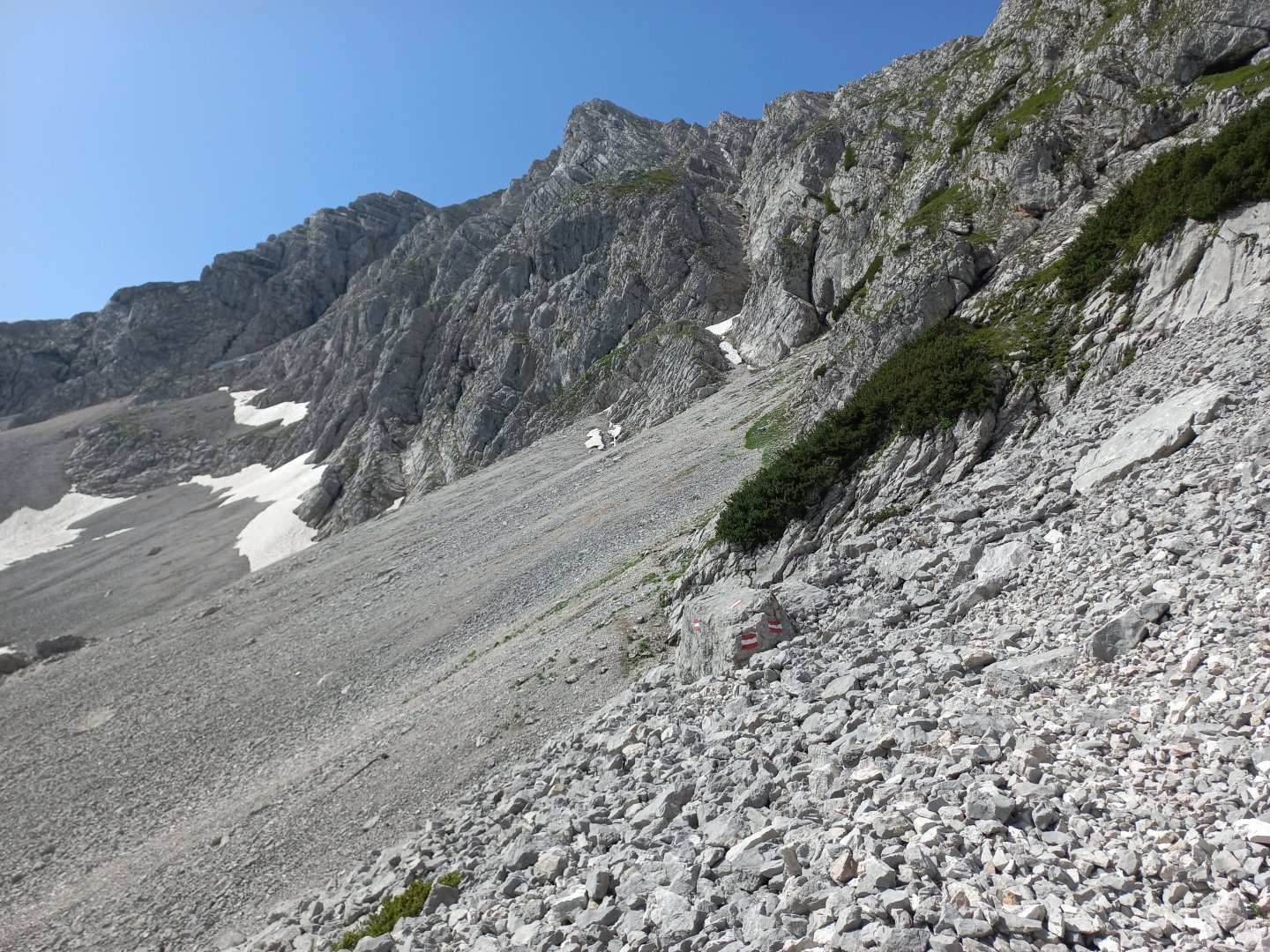
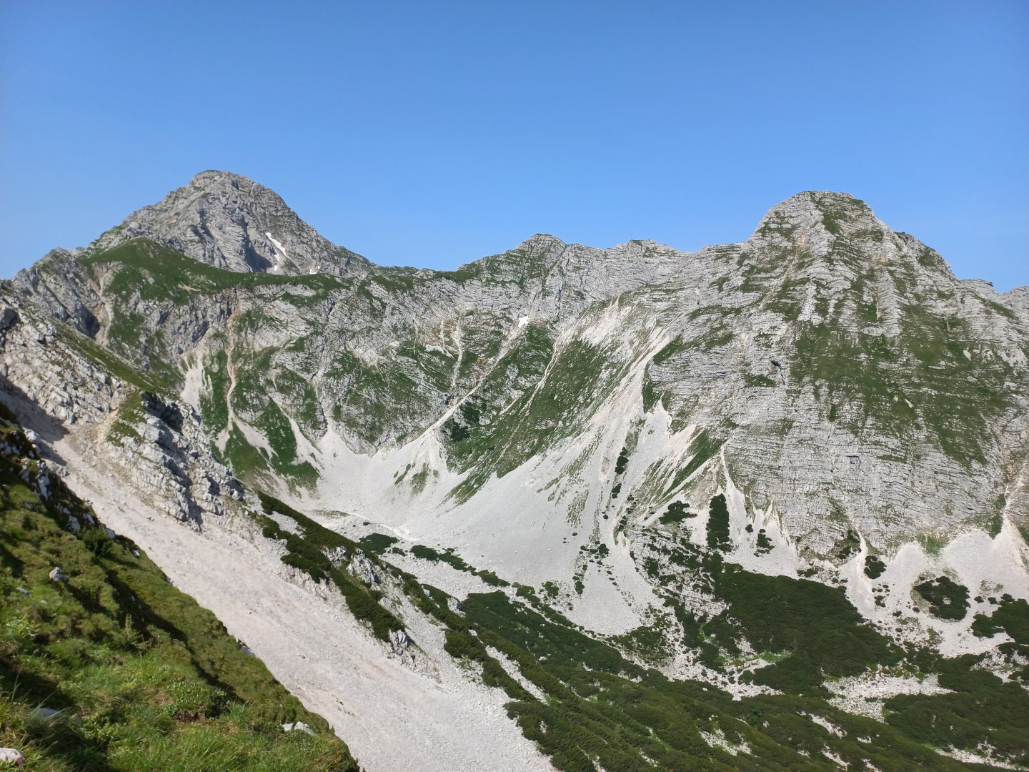
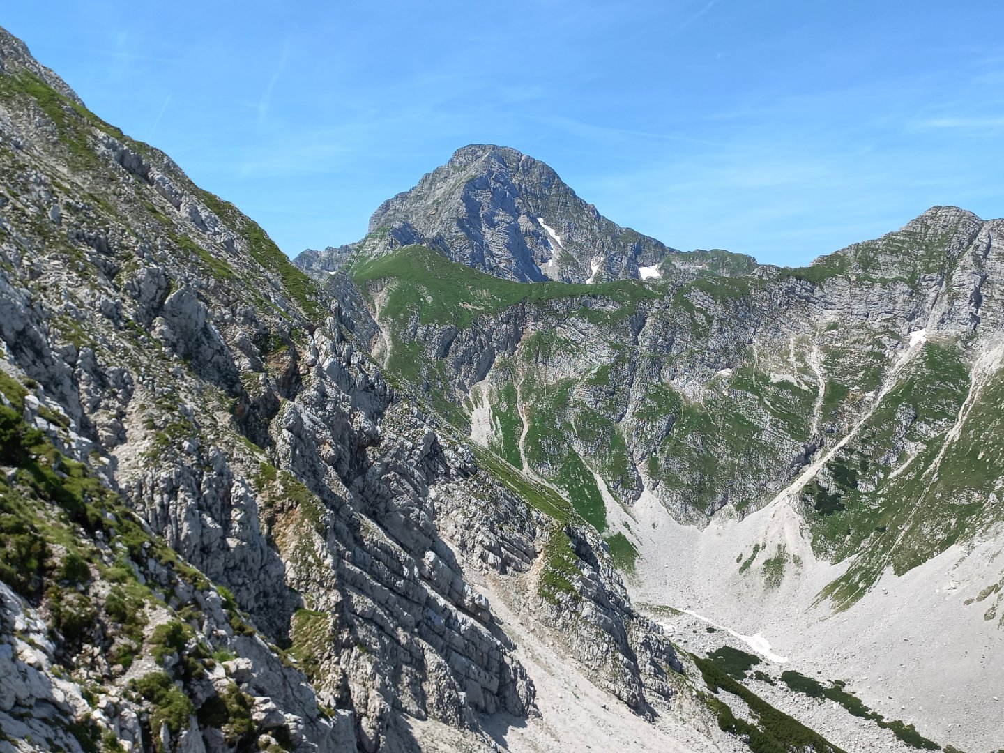
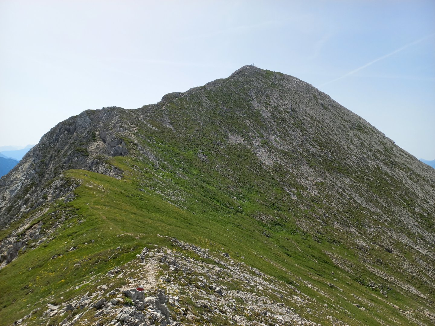
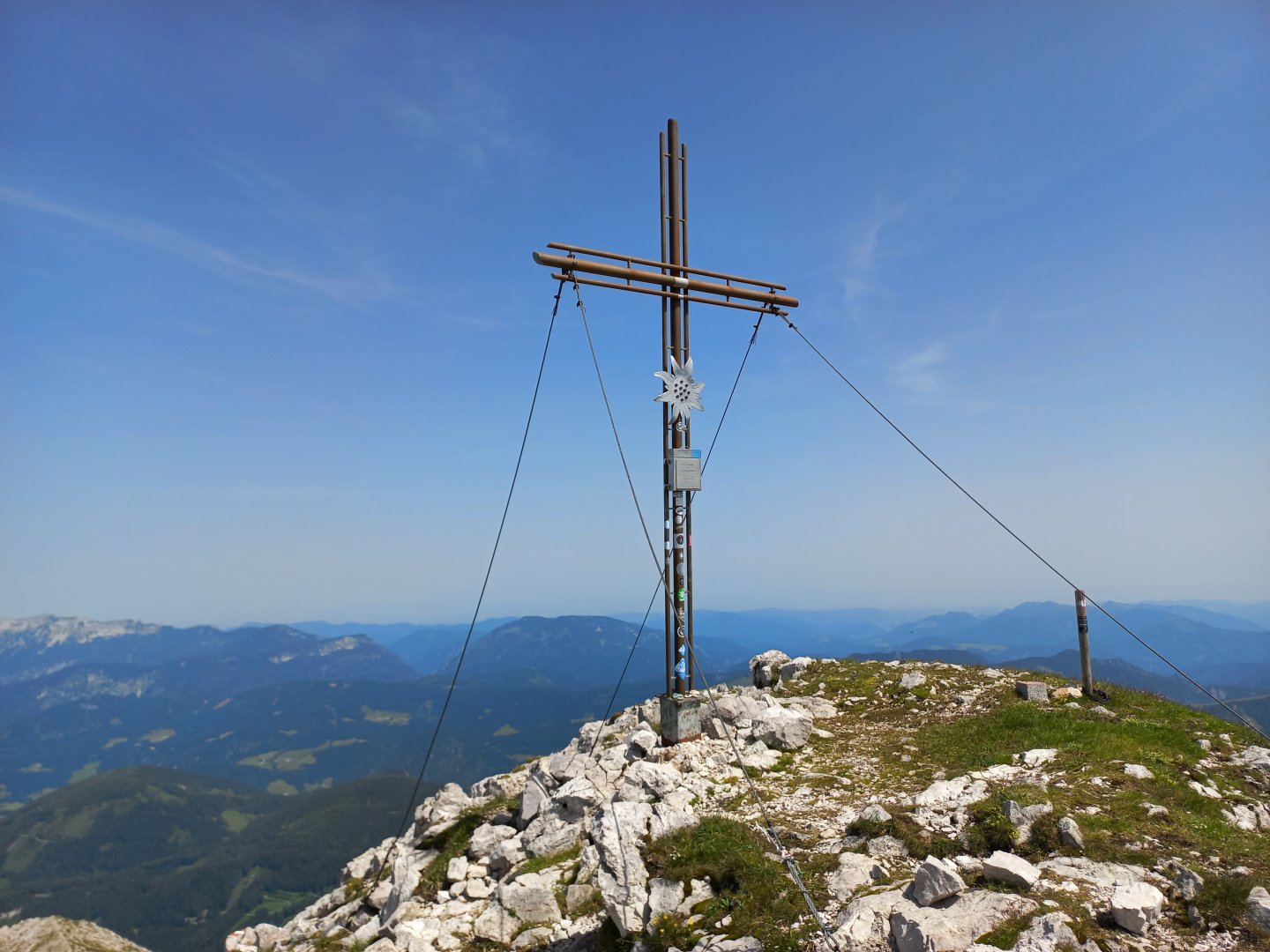
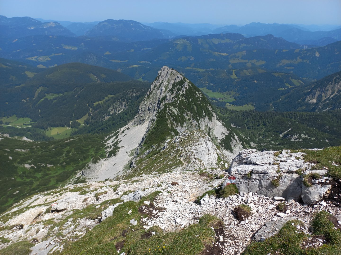
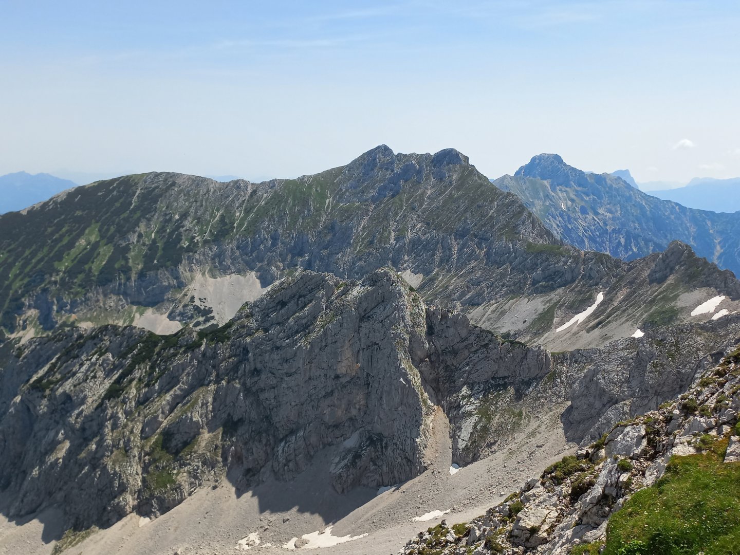
Along the wall, the path then climbs to the edge at about 1 800 m above sea level. Be prepared for the "wow effect" - Grosser and Kleiner Pyhrgas (Grosser on the left) appear in all their glory. From the edge, the more technical part of the climb follows - you walk along the steep edge, occasionally climbing over smaller rocks and need to use your hands. There is a steep slope on both sides, it can be a problem for those who suffer from vertigo. After about 500m the path straightens out, you are standing in a mountain meadow with lots of flowers and the last part of the climb to the cross is rewarding. The summit is spacious, with a few people coming in from the other side along the marked route from Admont.
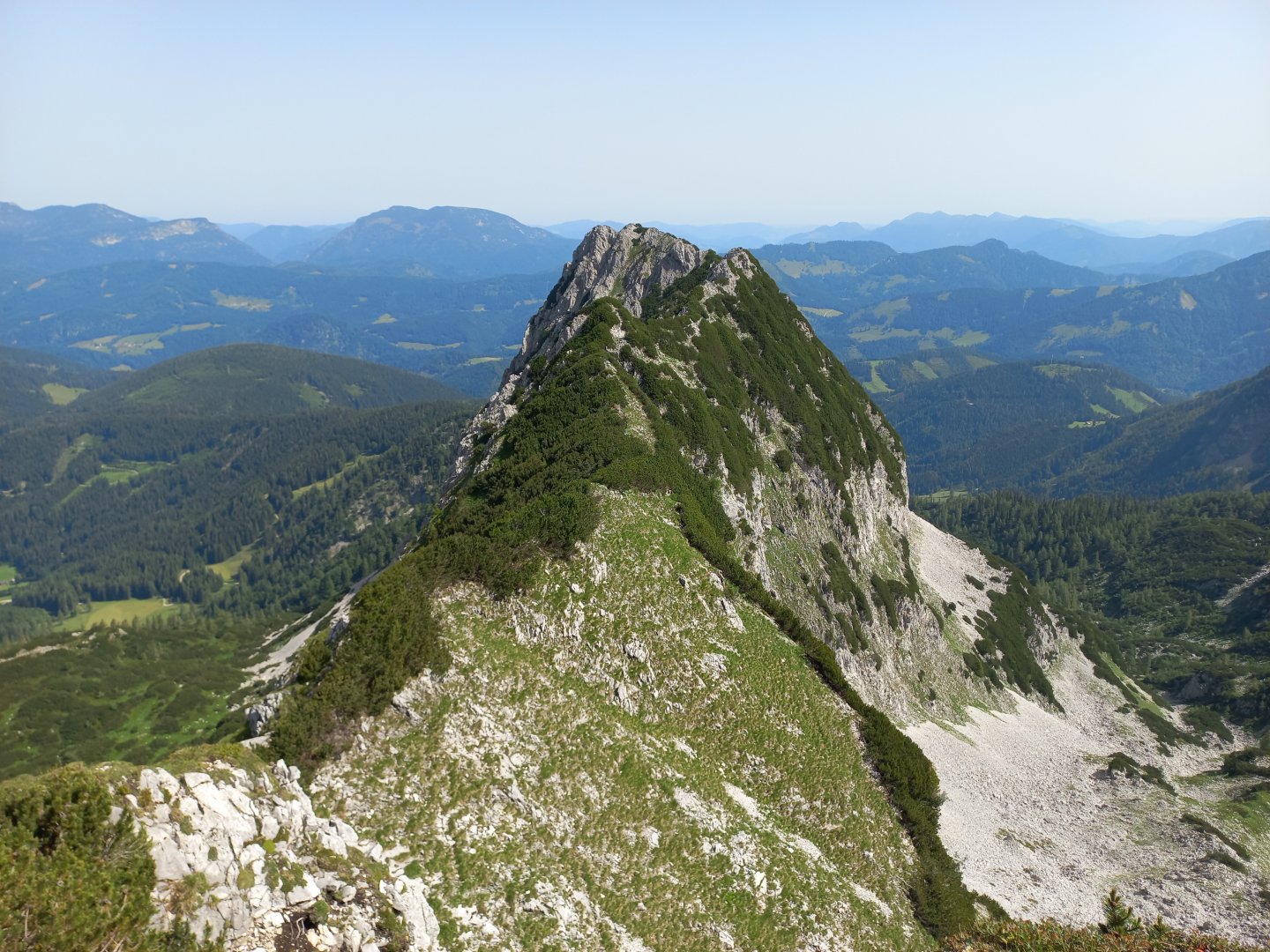
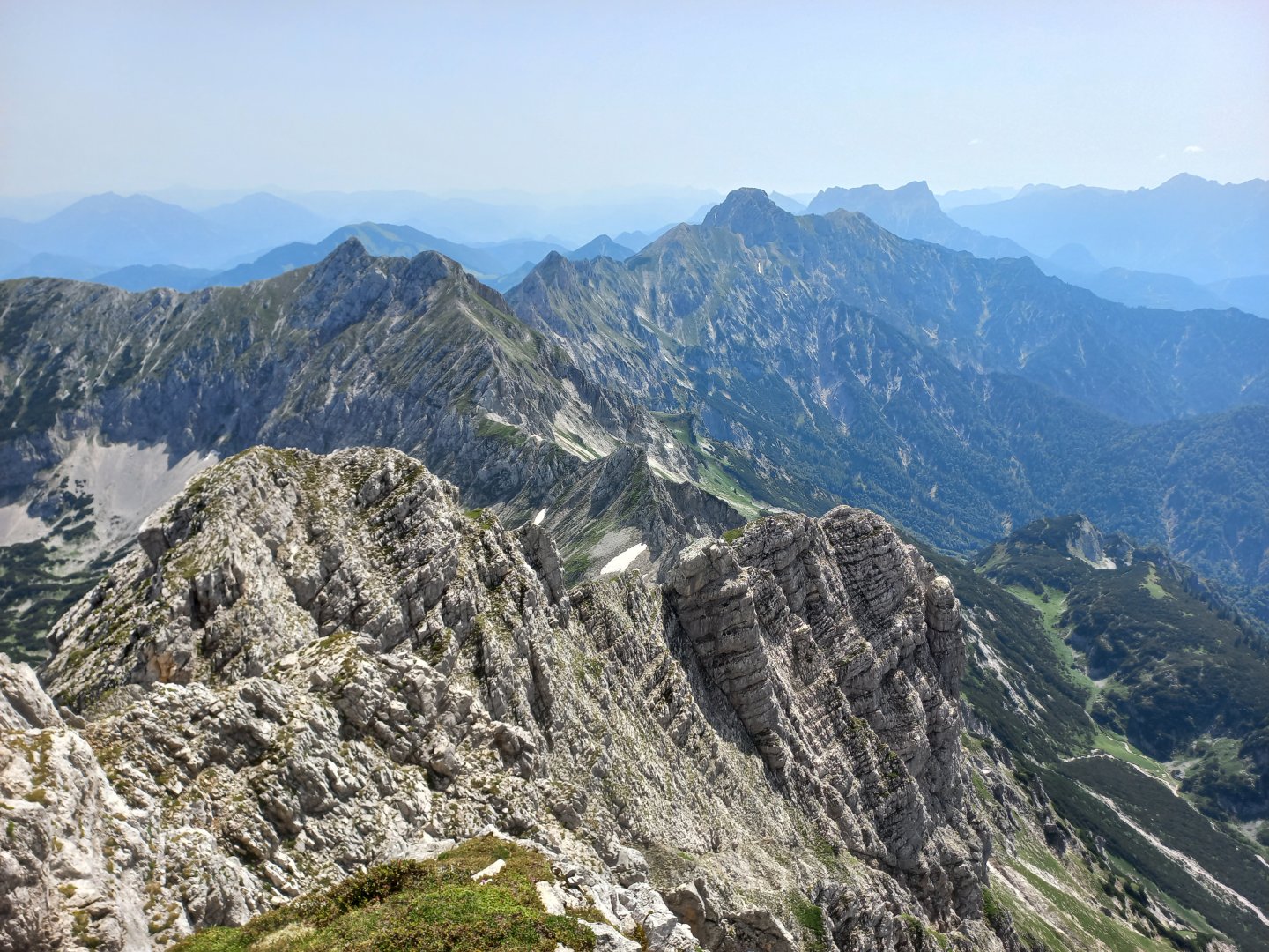
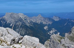
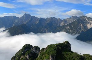
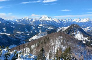
From the summit there are wonderful views of the Ennstal Alps, the Haller Mauern with the Hexenturm tower to the east, the Admontergruppe and Gesäuse behind them in the haze, the Low Taurian Mountains to the south, Pyhrgas to the west, Bosruck, then Grimming, Schladming, Dachstein, Totes Gebirge in the distance, and the Sengsengebirge to the north. After resting for a while I take the same route on the way back. The trip down takes about 2.5 hours.
Difficulty
Scheiblingstein 2 197 m above sea level is a peak adjacent to the dominant Grosser Pyhrgas 2 244 m above sea level in the Ennstal Alps, not far from Liezen. The ascent is varied - it starts in a valley in pastures, continues through mixed forest, a mountain basin covered with knees, crosses stone seas and scree, and ends with a more technical climb up a steep rocky edge to the summit (but still hiking, not climbing).
Water availability
In the car park you can get water in the toilets or at the spring under Laglalm.
Sleeping options
There is no hut on the route, overnight stay is possible in the valley.
Bivouacing in Austria
In Austria, sleeping in the open air is very limited and the rules vary from state to state. In general, sleeping in the woods is forbidden, but you can make arrangements with the owner of a meadow, for example. For more detailed information on the rules for sleeping in the wild in Austria, see our article Rules for bivouacking in Austria.
Mountain peaks
This trek has only one peak along the way, the Scheiblingstein mountain. On the way to the top, in good weather you can enjoy views of the Grosser and Kleiner Pyhrgas, the Ennstal Alps, Bosruck, Haller Mauern, Gesäuse, the Schladming Alps, Dachstein and Totes Gebirge in the distance.
Danger
The path leads along a marked hiking trail of medium difficulty - knowledge of movement in mountain terrain is necessary. In some places there is a steep slope with easier climbing.
Food
There is no lodge on the route where you can refresh yourself. Therefore, I recommend to take all the food with you.