Mountain range, region / State
/ Chile
Season
Winter
24. 12. 2019
Difficulty
2 / 5
Elevation
↑ 740 m
↓ 739 m
Length
11.3 km
4 hours
Altitude
max. 1703 m n.m.
min. 1157 m n.m.
Tips for hikes in the mountain range
Popular W Trek in Torres del Paine Park in Patagonia
Trek from Lake O'Higgins in Chile to Lake Desierto in Argentina
A short and easy trip to the Araucaria in the heart of the Chilean Andes
An easy hike to see condors and pink tarantulas in the Andes
Starting point
The hike starts at the parking lot off the R-925-S road at the southeastern tip of Lago Conguillio (marked as Sendero Sierra Nevada on Google Maps). Parking is free. The trailhead can only be reached by your own vehicle or hitchhiking. However, traffic on the roads is absolutely minimal.
Description of the hike
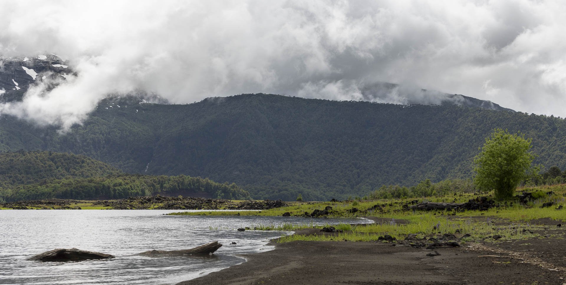
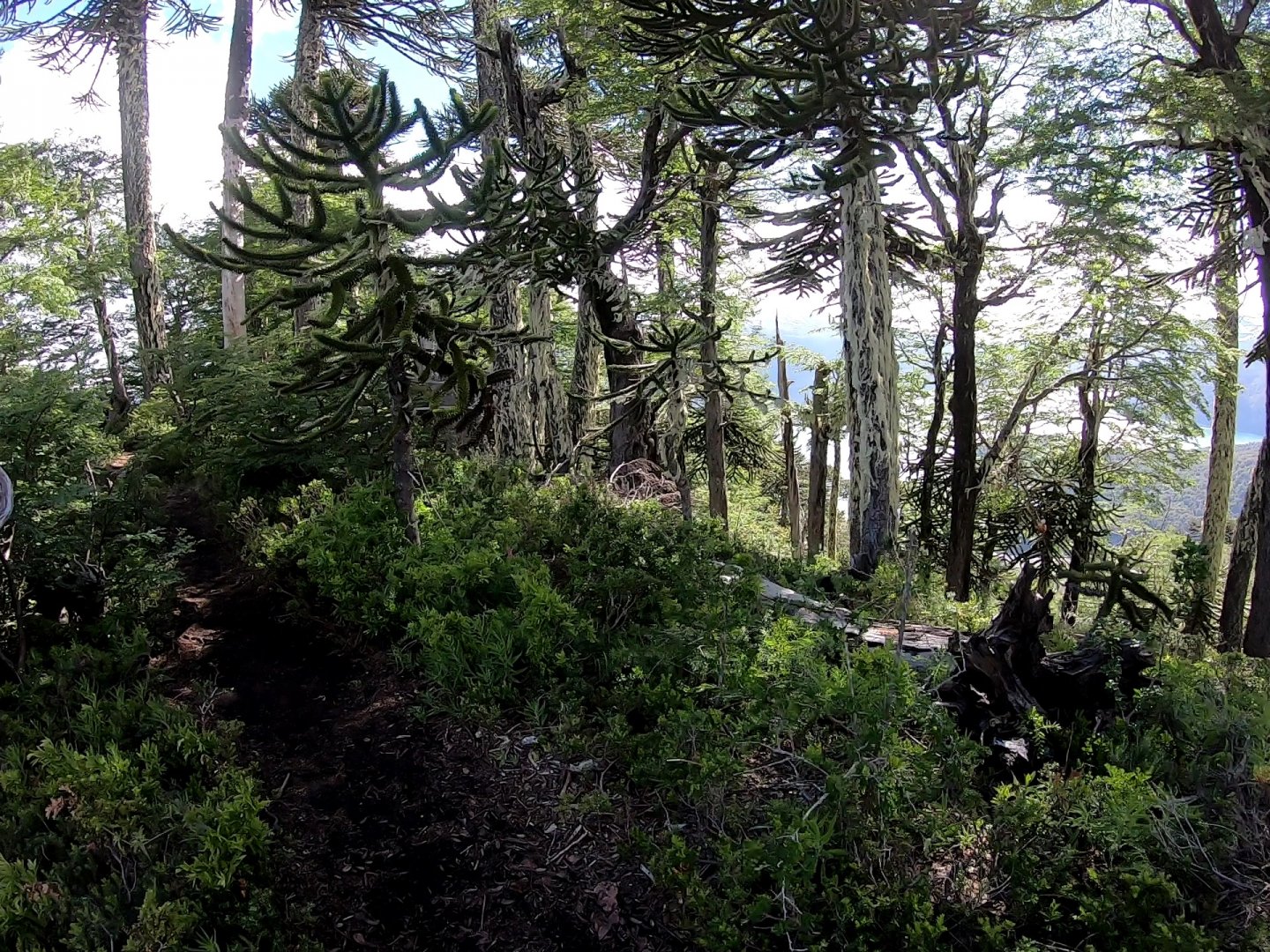
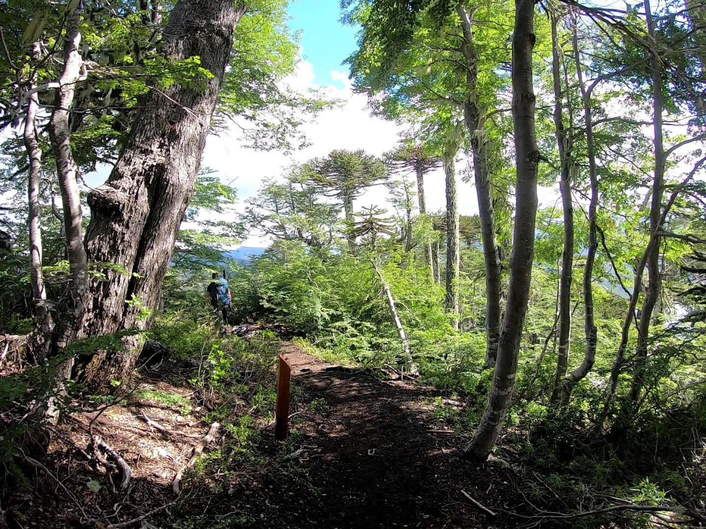
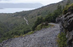
We started from the parking lot by the road in the afternoon and after about a hundred meters the trail starts to climb. The trail is sporadically marked with 15 metal bollards with distances from the start and finish. Straight sections alternate with gradual climbs and the closer you get to the first viewpoint, the steeper the climb gets.
Firm and moist clay substrate with frequent roots and rocks predominates. There are two fallen trees across the trail in the first section with cutouts to make it easier to climb. The steepest climb is just below the ridge. The reward is the first overlook, which offers a teaser of what awaits at the finish.
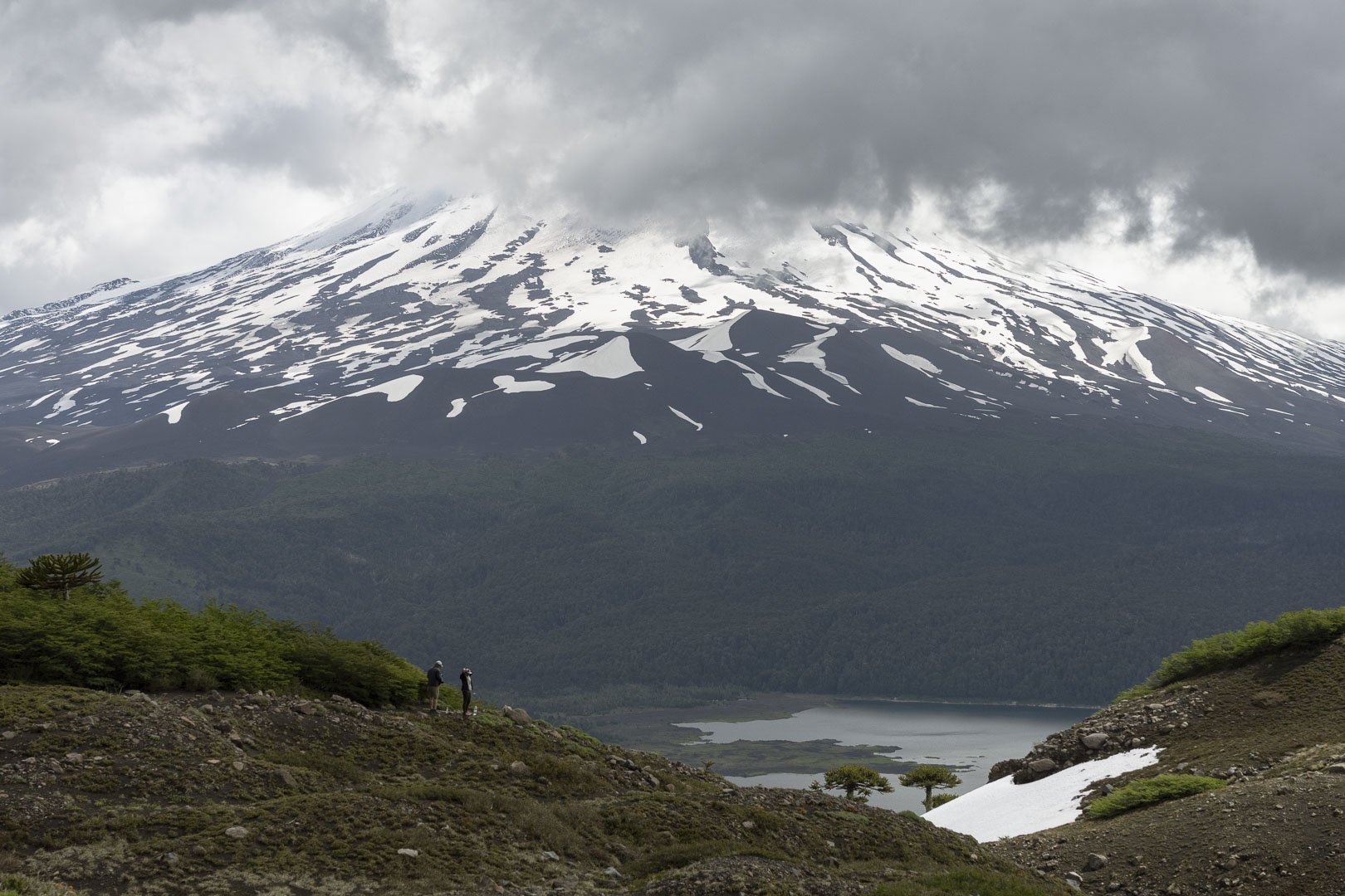
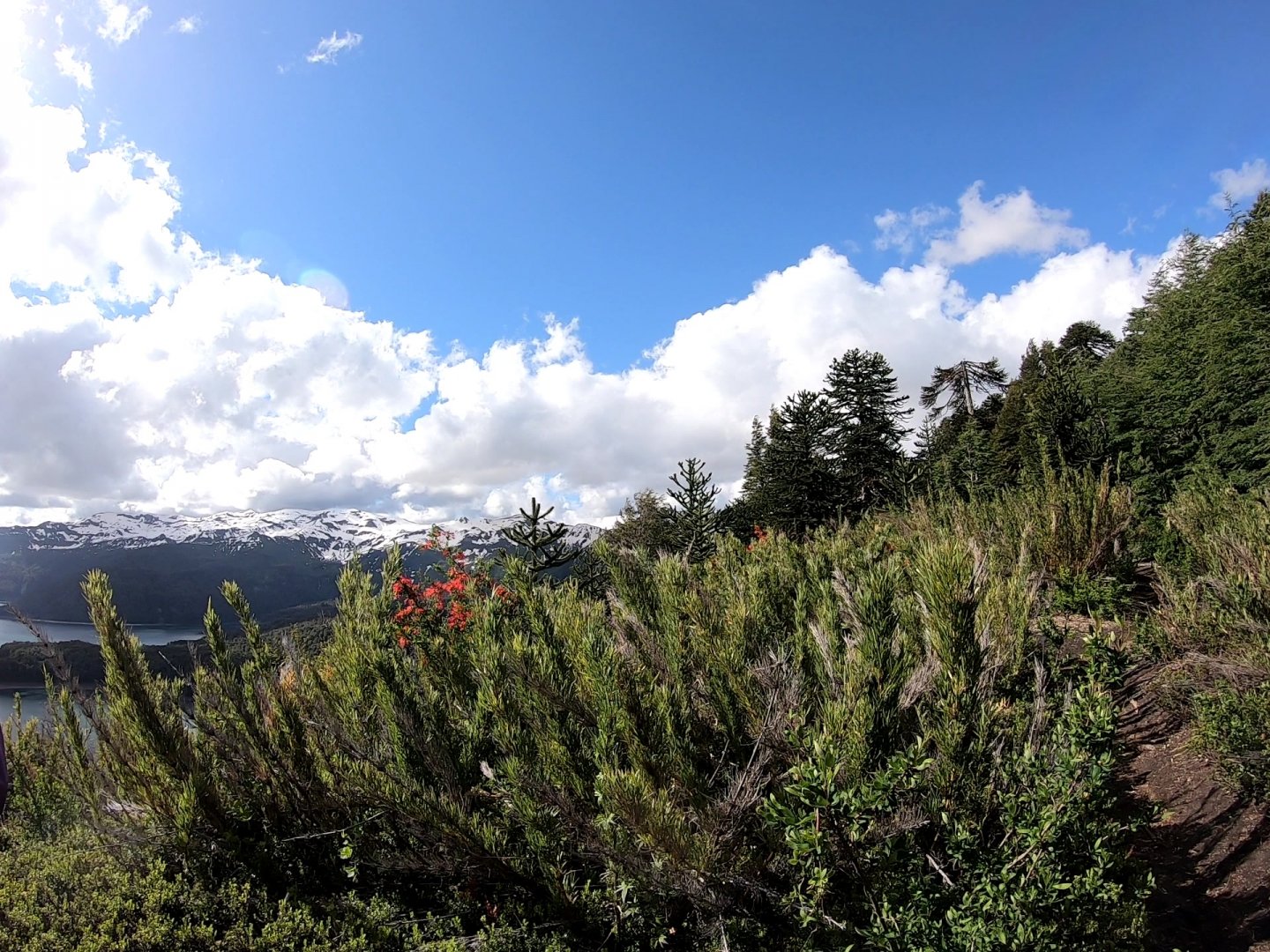
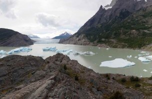
The trail continues along the ridge and climbs much more gradually. After a short time it reaches the forest boundary and offers views in all directions. About a kilometre from the finish, the trail descends to the right onto the slope below the ridge, skirting the rocky part of the ridge. There is a steep climb with the first snow field and after crossing the low vegetation, the target viewpoint can be seen.
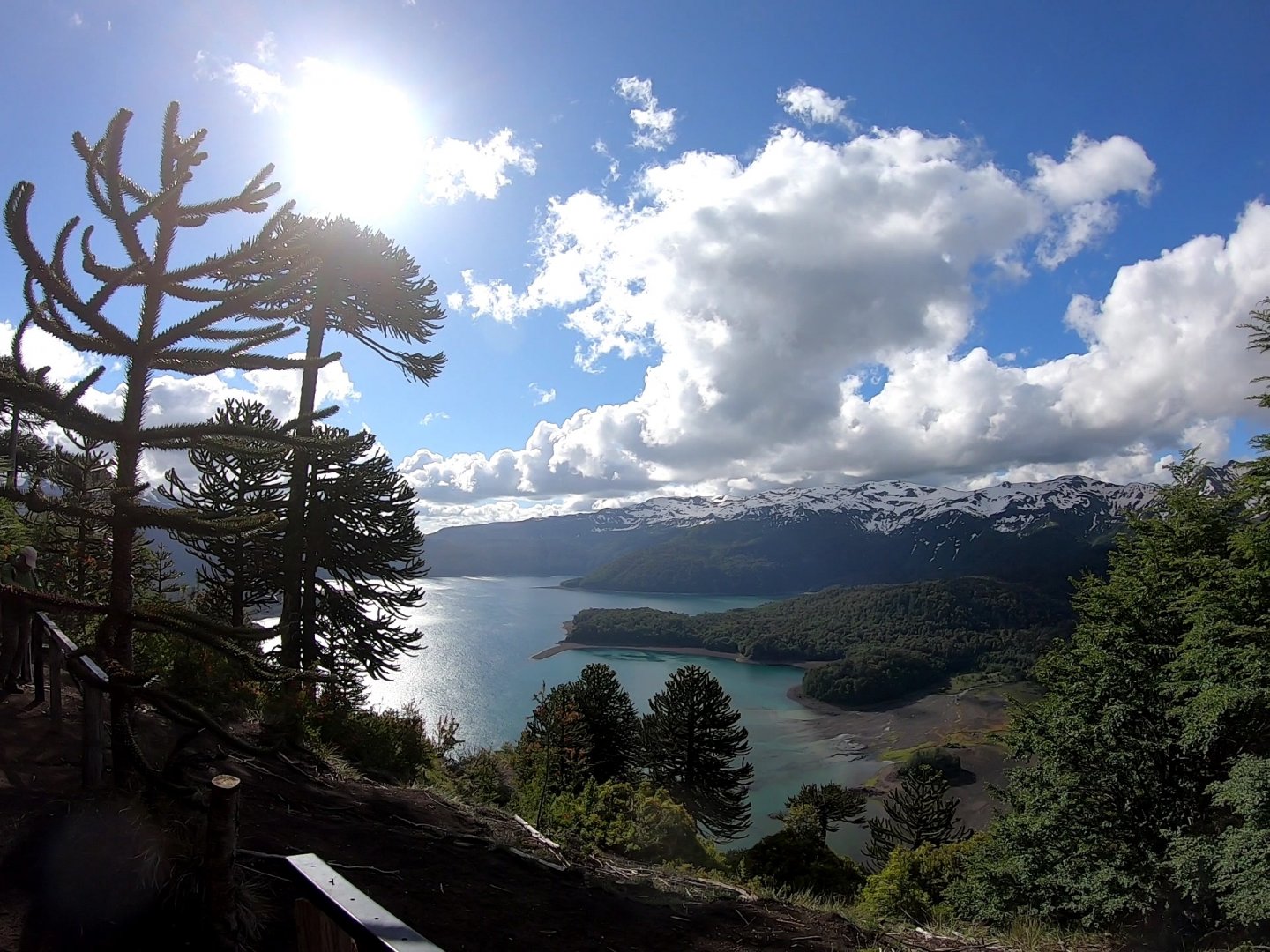
A gentle climb overcame the second snow field and we reached the fifteenth bollard. The viewpoint is not precisely marked and so everyone can find the place and angle according to his/her liking and possibilities. After a short rest and a few photos, there is nothing to do but turn around and head back the same way. From the viewpoint it is possible to continue on to the main ridge and surrounding peaks, but that is not the subject of this trek description.
Difficulty
A fairly easy trek with a long climb. Firm clay or sandy ground with roots, rocks in places, prevails for the whole length of the trek. However, the trail is not very exposed. In the first part it passes through cutouts in two fallen trees, where you have to bend properly. In the final part it passes through two snowfields (we went at Christmas 2019). Most of the route passes through the forest, until the last third goes along a ridge at the forest boundary.
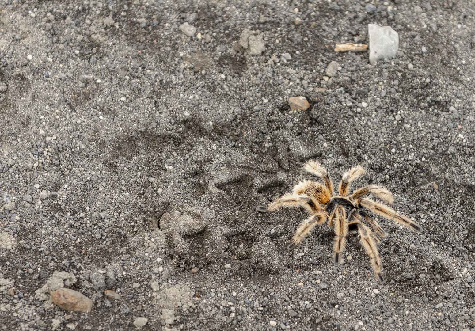
It is also possible to divide the trek into two parts, where most of the climb is in the first part and ends at Mirador Conguillio and the second is more gradual and much more enjoyable :-). The trail is dog-friendly in profile, but I'm not sure if there is a dog ban (I've encountered it in other parks in the Andes). The presence of tarantulas and their potential interaction with dogs is something to consider. The trek is totally unsuitable for children in a stroller, but almost hassle free for children in a back carrier. The only problem is two fallen trees at the bottom of the trek. I would recommend sturdy boots and hiking poles may be useful too.
Water availability
I took 0,5l of water as an emergency, another 0,5l I gave to my colleagues who used all their water. Therefore I recommend ideally 1 litre of water per person. We bought pet bottles of water at the gas station in Temucu. It is not possible to refill water on the trek route.
Sleeping options
The trek is short and can be easily reached from the town of Temuco (120 km, 1.5 hours). Or you can use the option of staying overnight at a nearby campsite on the shores of Lake Conguillio.
Mountain peaks
During the trek we will not reach any peak, it is only a trip to the viewpoint by the lake. On the way, however, you can see some of the giants of the Conguillío National Park, such as the Llaima Volcano 3,125 m above sea level, the Sierra Nevada 2,554 m above sea level and others.
Danger
There are normally no special hazards throughout Conguillío National Park in Chilla. The Llaima volcano is active and therefore, in theory, its eruption and associated earthquakes could pose a danger. However, the likelihood of sudden volcanic activity is negligible. The trekking route is in the mountains at an altitude of around 1,000 metres above sea level and therefore the influence of the weather and the season must be taken into account. The weather here can change very quickly. The Chilean pink tarantula lives on the ridge along the trek route (photo). This species is not aggressive, and has a weak venom that is not dangerous to humans.
Food
Refreshments cannot be purchased anywhere along the trek route. There is a small shop with a very limited assortment at the nearby campsite (south part of the lake). Therefore, it is better to have all the food (just a small snack and chocolate) prepared from home.
Attractions
In Conguillío National Park There are several interesting things to see along the trekking route. The biggest one is the massive and unmissable Llaima volcano at 3,125 m above sea level, which is one of the most active volcanoes in Chile.
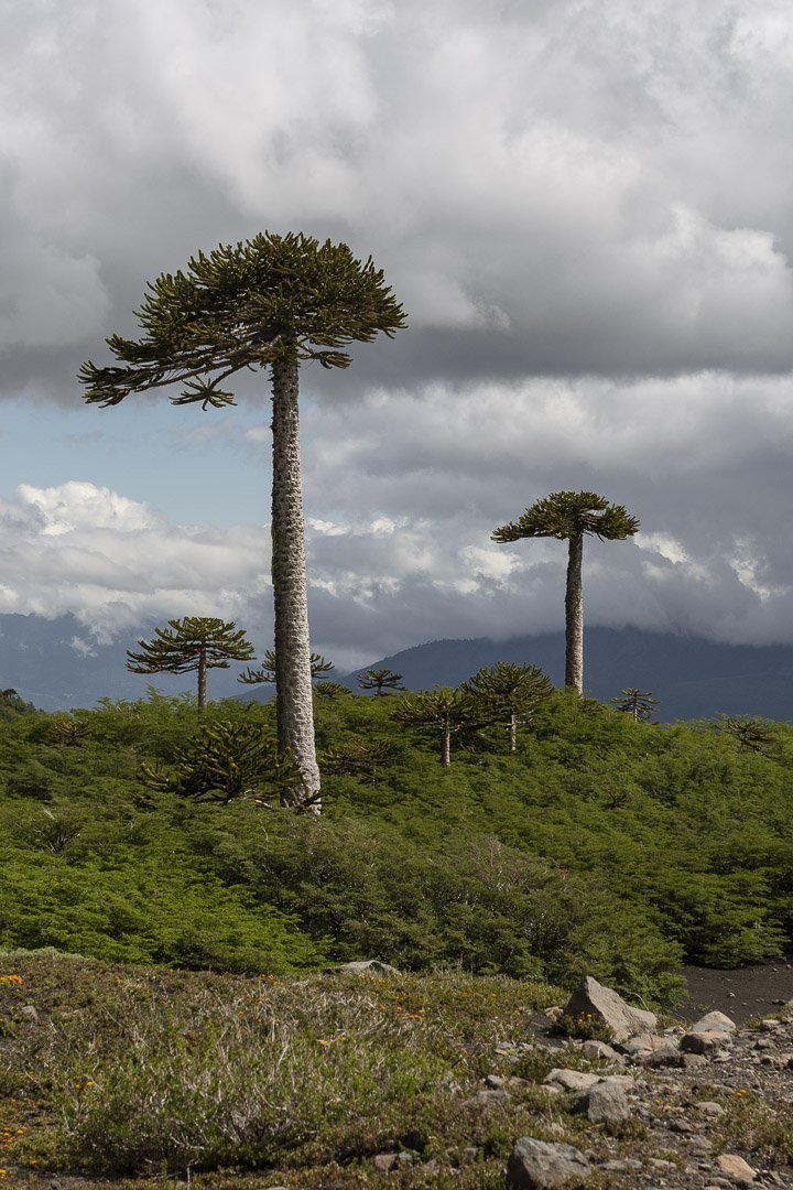
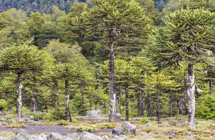
The forests that surround the trail for almost the entire length of the trek are full of aracaurias (Chilean Blahochet) trees, which are found only in a few places in the southern hemisphere. The Chilean region where the trek takes place is named after these trees - Aracuanía. The aracaurias are complemented by a wide variety of other exotic plants and several animal species. The biggest is undoubtedly the condor, which can be spotted circling around the area, and with a bit of luck can be spotted at the final viewpoint. The Chilean pink tarantula can be seen on the ridge. There are also pudu and puma in the area, but we weren't lucky enough to spot them.
Photos