Mountain range, region / State
Salzkammergut / Austria
Season
Spring
16. 06. 2024
Difficulty
3 / 5
Elevation
↑ 805 m
↓ 805 m
Length
5.2 km
4 hours
Altitude
max. 1059 m n.m.
min. 484 m n.m.
Tourist map of the Salzkammergut
Tips for hikes in the mountain range Salzkammergut
A circular hike to the mythical Leonsberg in the Salzkammergut
Round trip above Lake Traunsee in the Salzkammergut
The challenging crossing of the Schrottkamm ridge to Bad Ischl
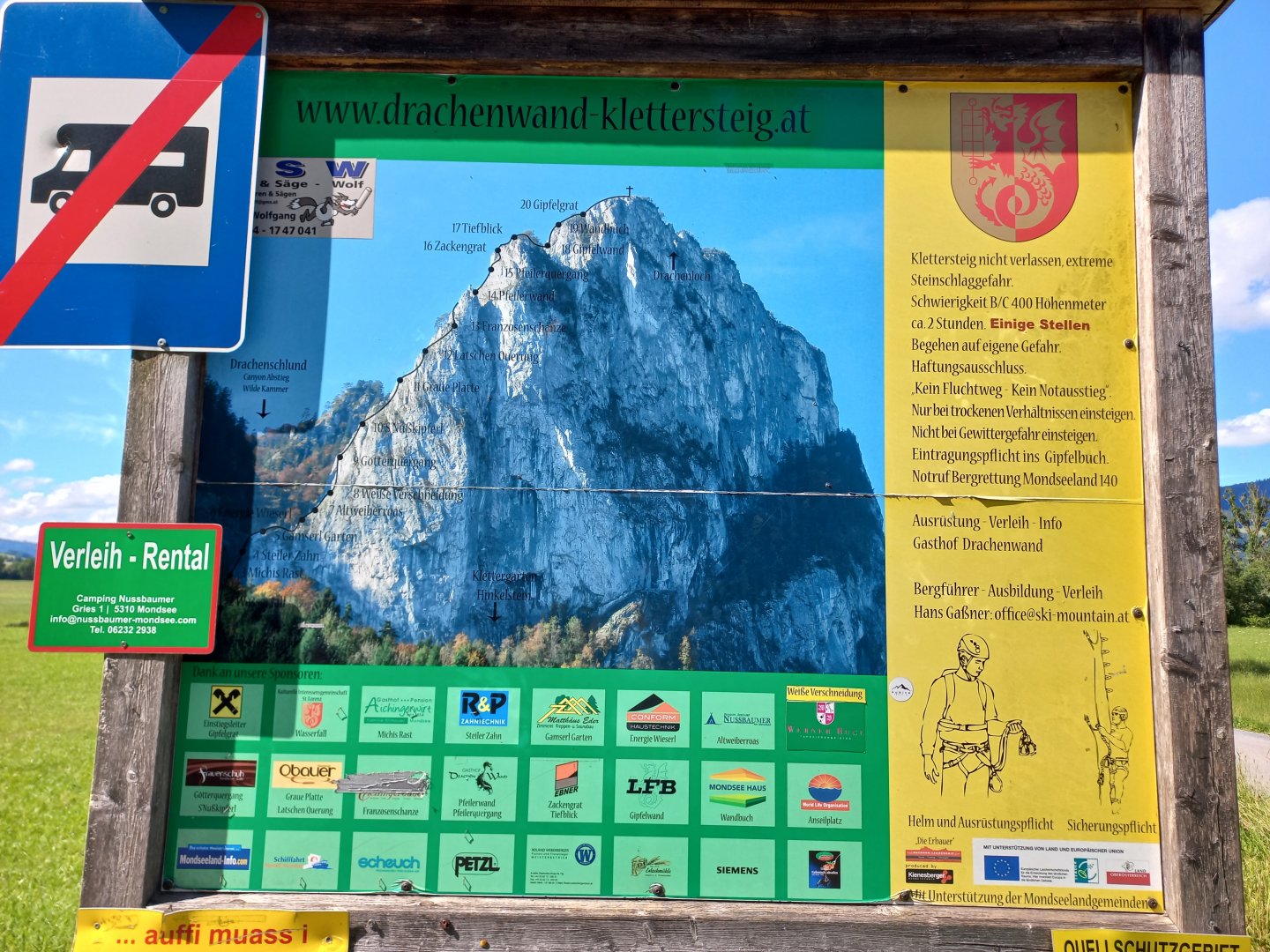
Hike up the Drachenwand wall on the hiking trail at Lake Mondsee
Starting point
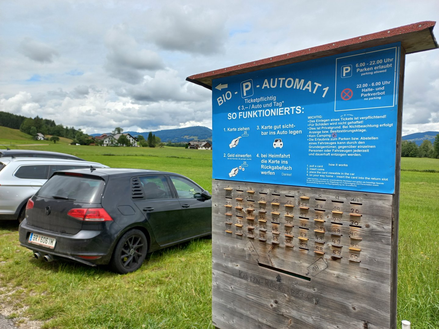
I leave my car in the paid parking lot (3 €) in Sankt Lorenz near Gasthaus Drachenwand. The parking lot has a "bio-automatic" parking meter. You remove a card with a number from a small hole in the wooden board, insert the 3€ into the vacated hole, display the card behind the windscreen and drop it into the wider lower hole when you leave :)
Description of the hike
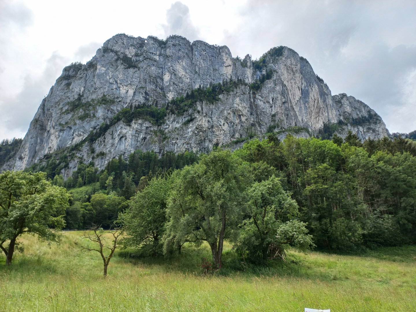
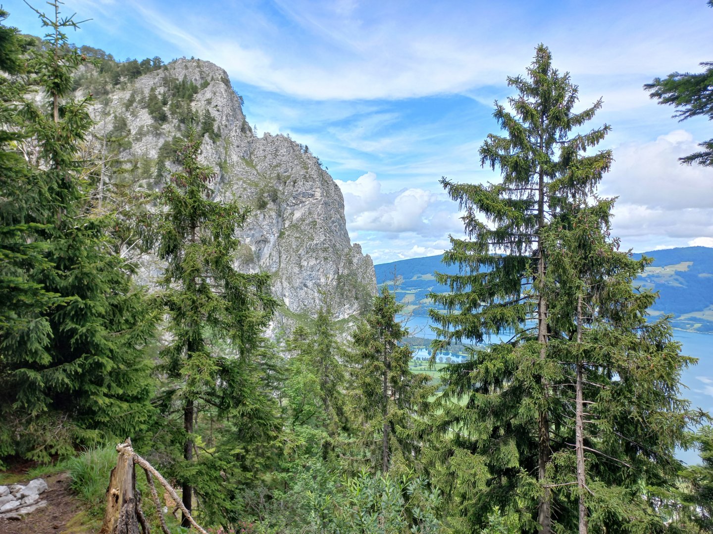
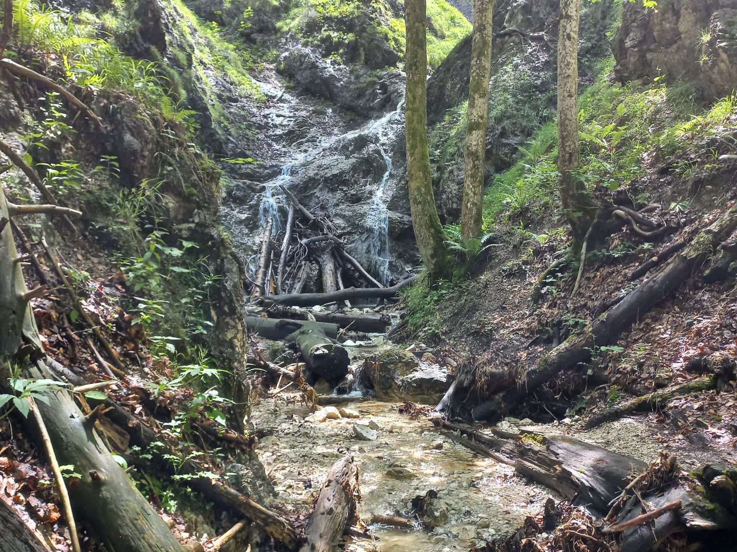
The wall of Drachenwand rises directly above the car park and, when viewed from below, appears huge and inaccessible. I set off on the marked hiking trail into the forest. Just outside the village there is a spring and a conservation area (Quellschutzgebiet). The paths are waterlogged and muddy after rain, and the streams here overflow in several places, even across the trail.
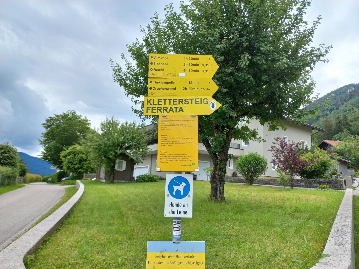
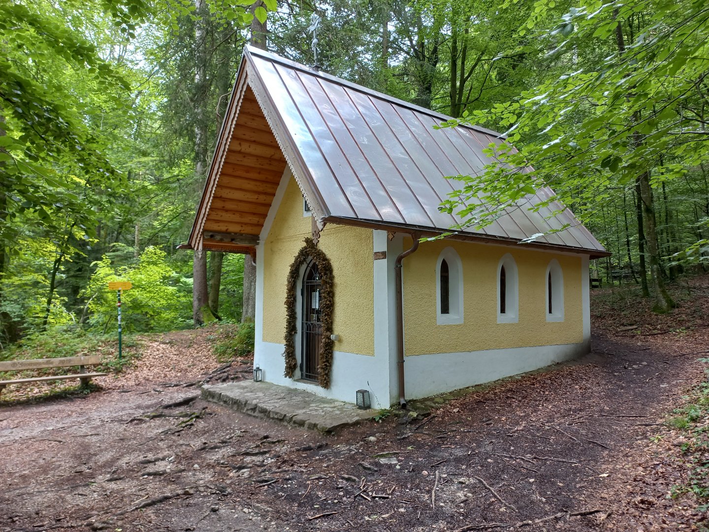
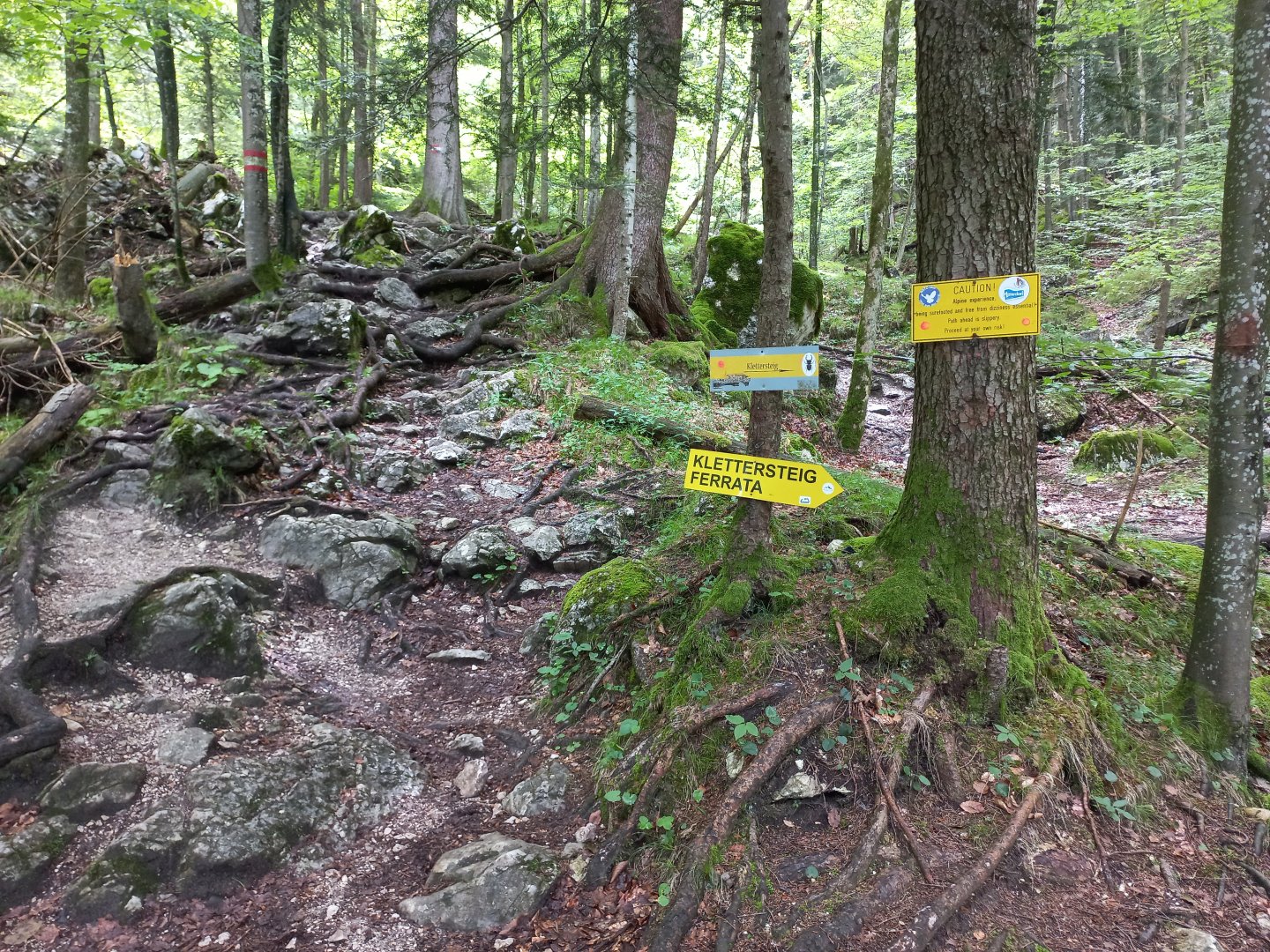
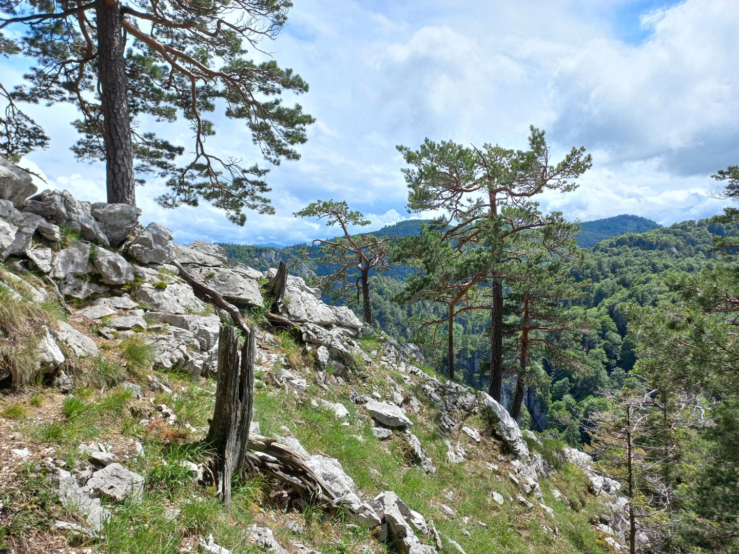
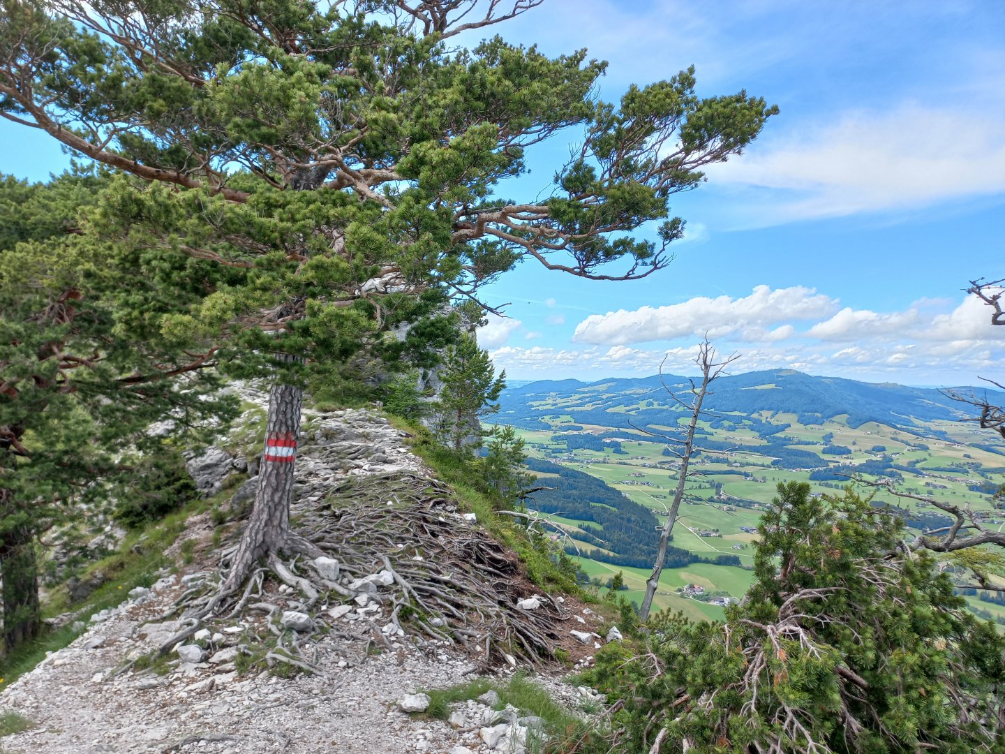
After the chapel of St. Thekla (Thekla Kapelle), the trail leaves to the left for the Almkogel lookout and a little further on the right for the secured trail (Klettersteig). The Hirschsteig starts to climb upwards. The climb is steep and challenging from the start - over roots, limestone boulders, crossing a stream bed. After a few dozen metres you come to the first wooden steps and then metal ladders.
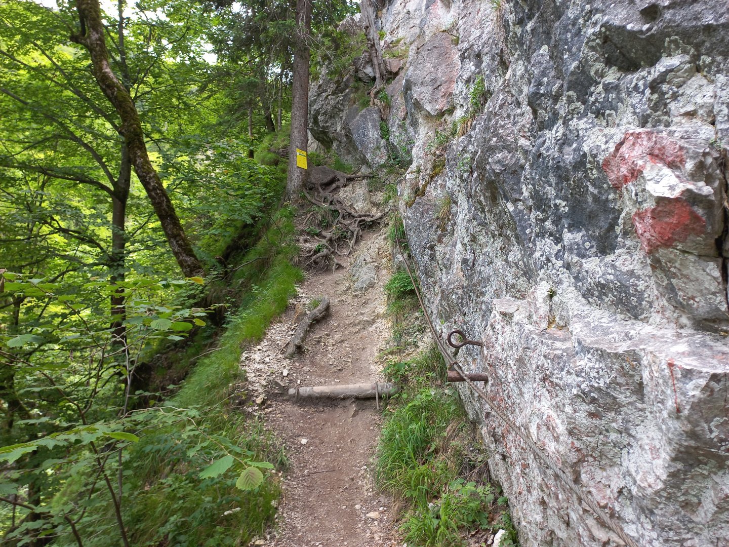
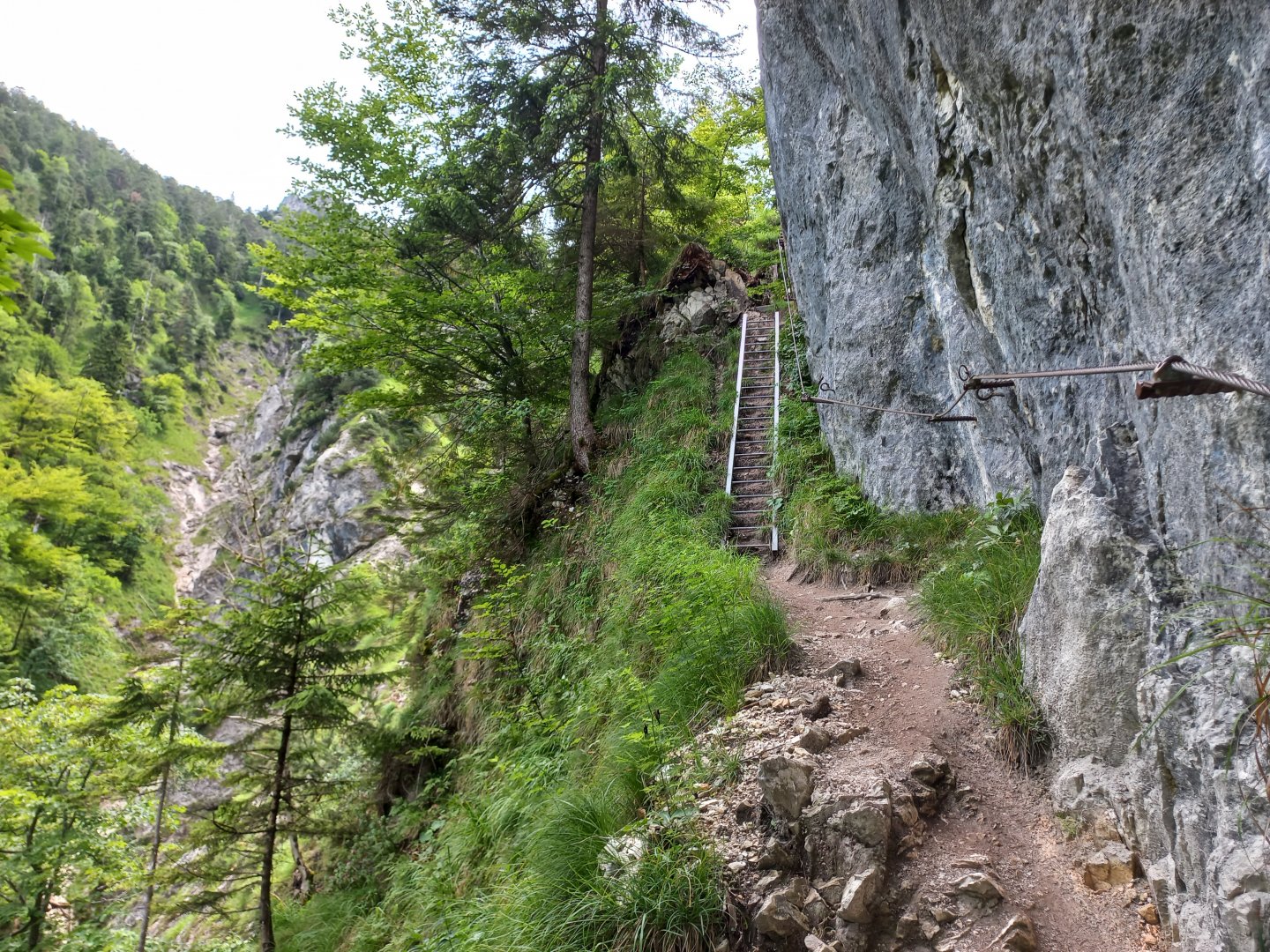
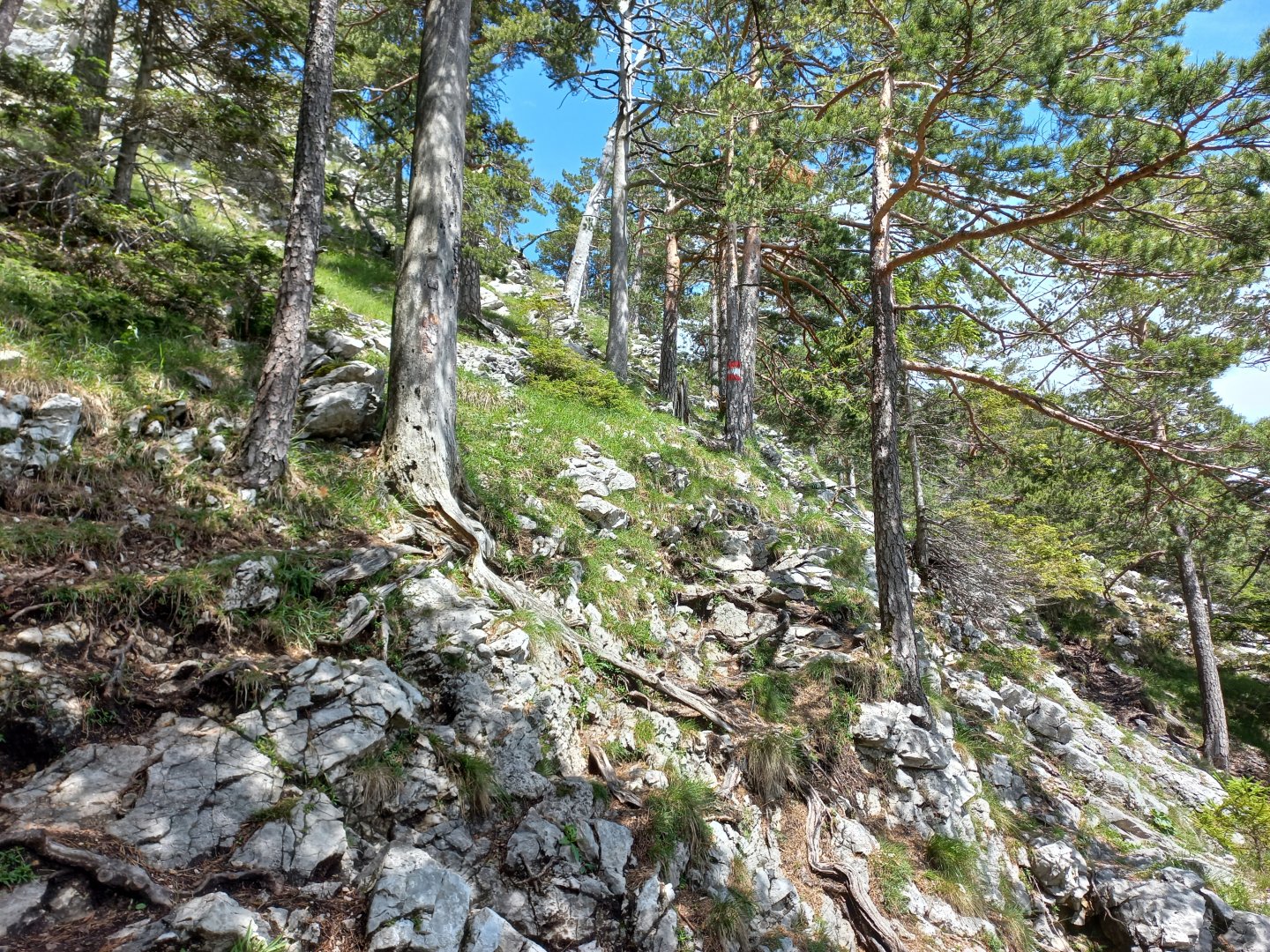
At the wall begins about 500 m of exposed section above the Saugraben ravine. The warning is repeated here that the route is difficult and belaying is recommended. On this part of the route the path runs closely along the wall, there is a fixed metal rope and several metal ladders along the whole length. A ferrata set is not necessary, but extra care should be taken.
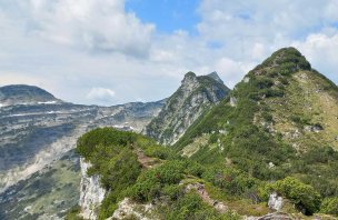
After a few hundred metres, the path turns right and away from the gully, but it is still challenging - over rocks and boulders, still over a steep slope, and in several places there are again stupas, ladders and rope belays. From the Hildesrast lookout there's a nice view of the Klettersteig - on the ferrata you can make out colourful little people clawing their way up and over the suspension bridge against the grey wall. From the viewpoint there is a short descent into the next ravine, through which the Klausbach stream flows.
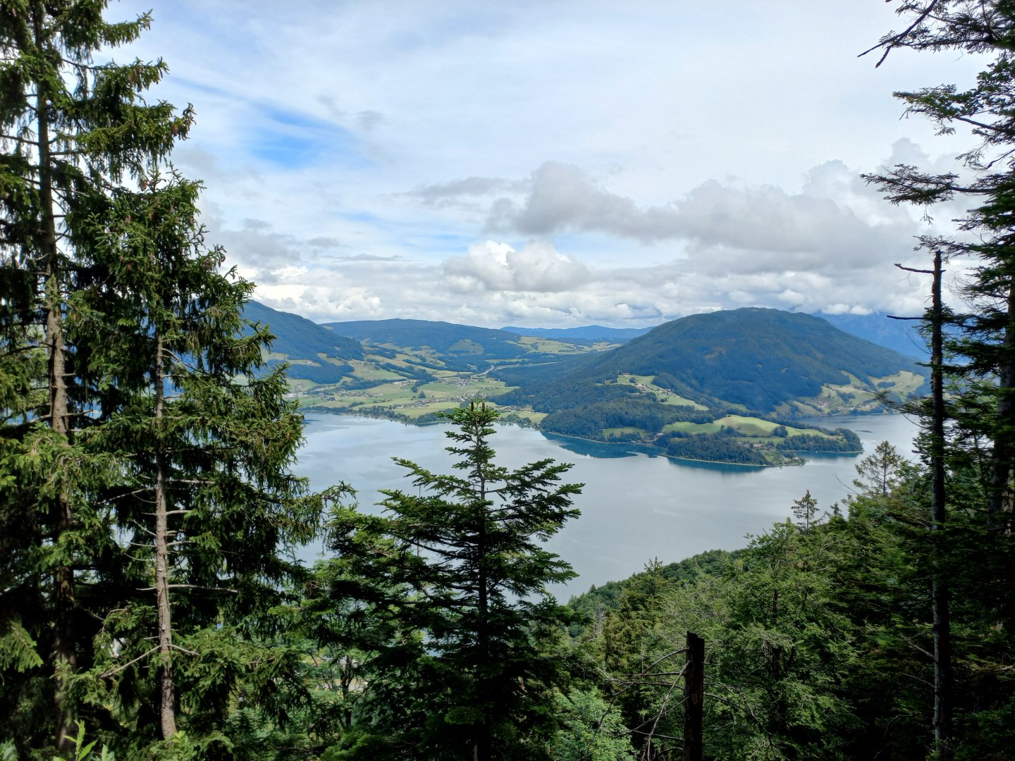
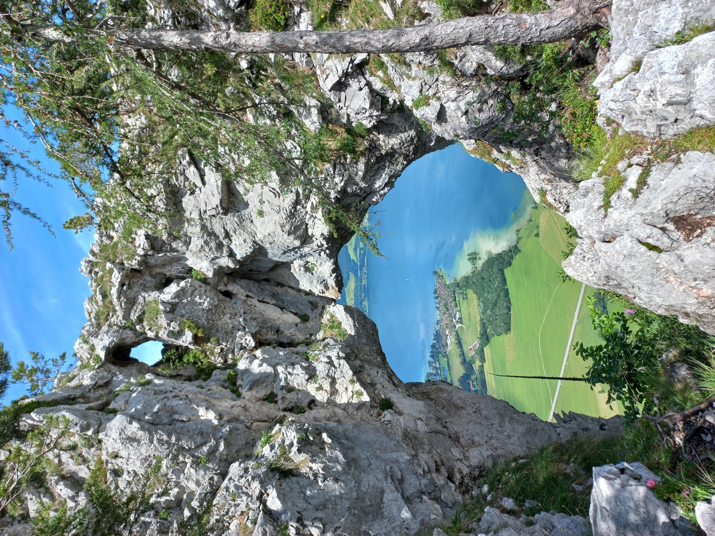
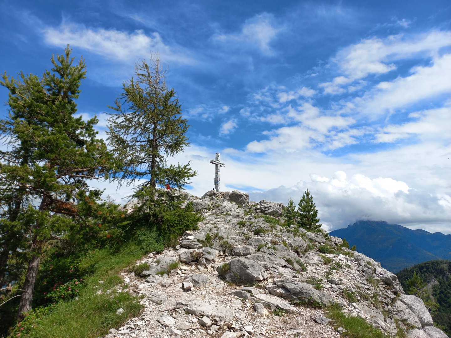
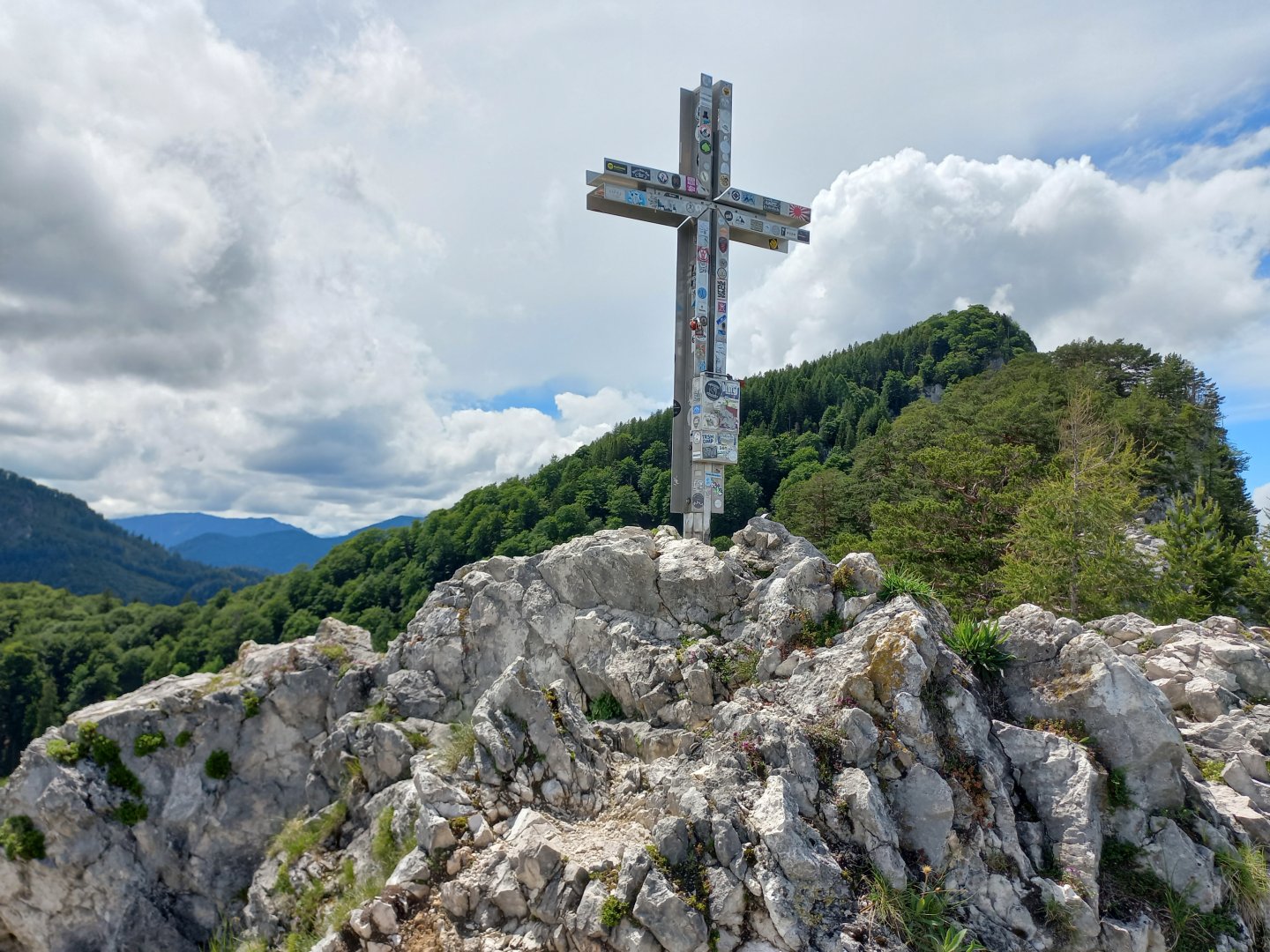
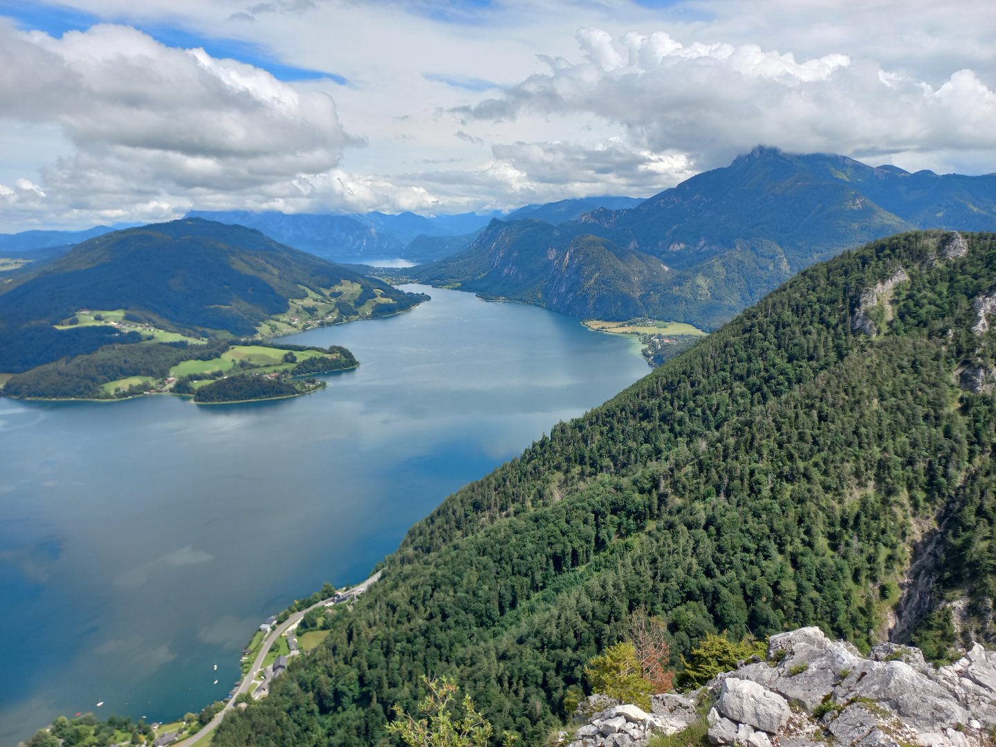
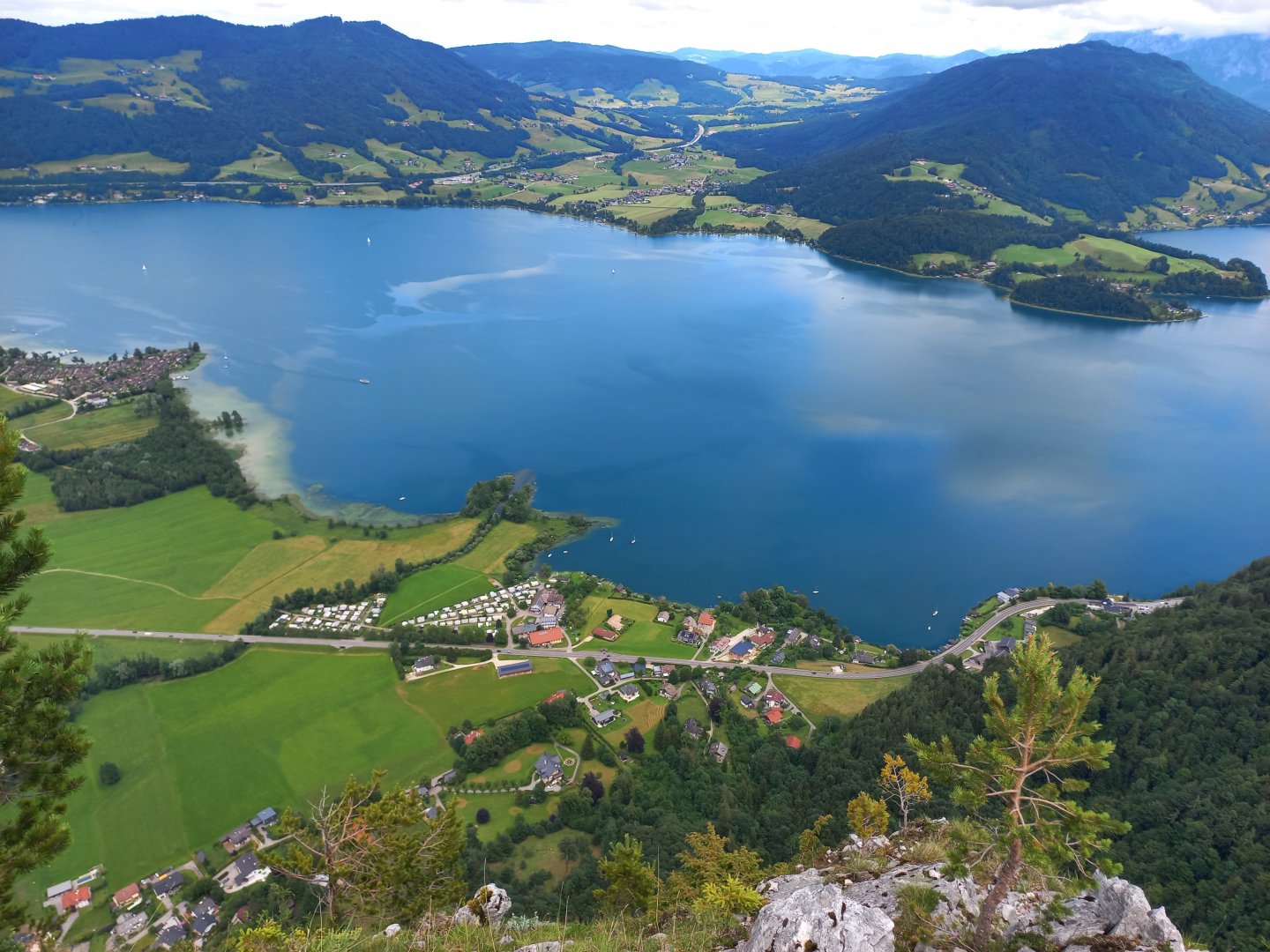
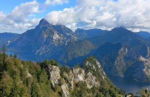
Behind the stream the path continues on a wider slope to the saddle at about 1000 m. From the saddle it is then about 200 m along the ridge to the summit cross. The ridge is rocky, covered with pine trees, at the end you will be surprised by the Drachenloch rock window with a deep view into the valley. It is only at the end of the ridge at the cross that you will enjoy the reward for the challenging climb - an absolutely captivating and unforgettable view of the landscape of the Solnohrad lakes and mountains.
Five hundred metres below you is the blue Mondsee, with miniature houses, tiny boats and a mini-boat rushing past on the road between Mondsee and Sankt Gilgen. To the right, the sloping Schafberg (1,783m, a historic cog from the Wolfgangsee) touches the clouds; beyond it you can see a bit of the Attersee and other hills and mountains of the Salzkammergut. The ascent takes about 2 hours, the descent back along the same route takes about 1.5 hours.
Difficulty
Drachenwand is a massive limestone wall above Lake Mondsee, on the border of Salzburg and Upper Austria. Two marked routes lead to the summit - the Drachenwand Klettersteig ferrata (difficulty B/C, approx. 400 vertical metres, 2 hours) and the Hirschsteig hiking route of the highest difficulty (black dot) with secured sections.
Ferratists use the Hirschsteig as a descent route. Both trails are exposed on most of the route, lead over deep ravines and there is a high risk of tripping or slipping and falling with fatal consequences. Despite the relatively low altitude - the summit cross is at 1060 m - it is advisable to have experience of Alpine terrain and a sure step.
The route is not suitable for children and beginners. Sturdy, thick-soled hiking shoes are suitable, as are hiking poles to hold you up when you get low.
Water availability
Refreshments are available at the Drachenwand Inn at the start/end of the route.
Bivouacing in Austria
Sleeping in the open air in Austria is very limited and the rules vary from state to state. In most cases, camping in forests is forbidden, but arrangements can be made with meadow owners. You can find all the details in our article Rules for bivouacking in Austria.
Mountain peaks
During the hike you will climb only one peak, the Drachenwand (Drachenstein) 1 060 m above sea level, with views of the Schafberg, lakes and mountains of the Salzkammergut.
Danger
The trail is dangerous for slipping or tripping. Ferrata Drachenwand Klettersteig has a difficulty rating of B/C - only for the experienced. NOT with children, dogs, without suitable footwear.
Food
It is advisable to take a small snack with you. Refreshments are available at the Drachenwand Inn at the start/end of the route.