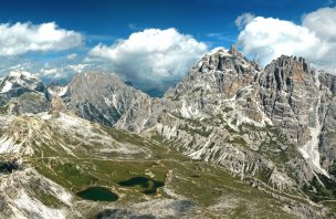
Mountain range, region / State
Dolomites in Alps / Italy
Season
Fall
27. 09. - 29. 09. 2015
Difficulty
3 / 5
Elevation
↑ 2444 m
↓ 2438 m
Length
33.1 km
3 days
Altitude
max. 2752 m n.m.
min. 1341 m n.m.
Tips for hikes in the mountain range Dolomites in Alps
6-day crossing of the Dolomites along the Alta Via 1 route
Trek with the best ferrata in the Sexten Dolomites
Circuit trek with ferrata around Monte Paterno
Relaxed hiking in the Dolomites - Fanes Sennes Braies park with a short ferry
Starting point
The starting point of the trek is at the beginning of the Fanes valley, about 4 kilometres before Cortina in the direction of Toblach, where there is a small car park just off the main road. At the time of our visit (September) the parking was free.
Description of the hike
1. day
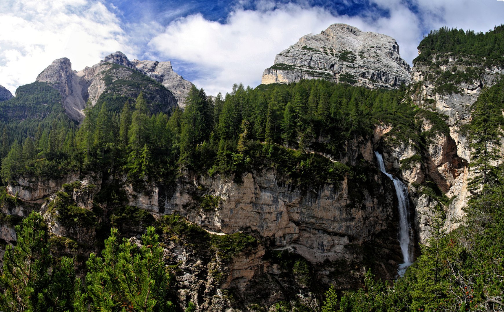
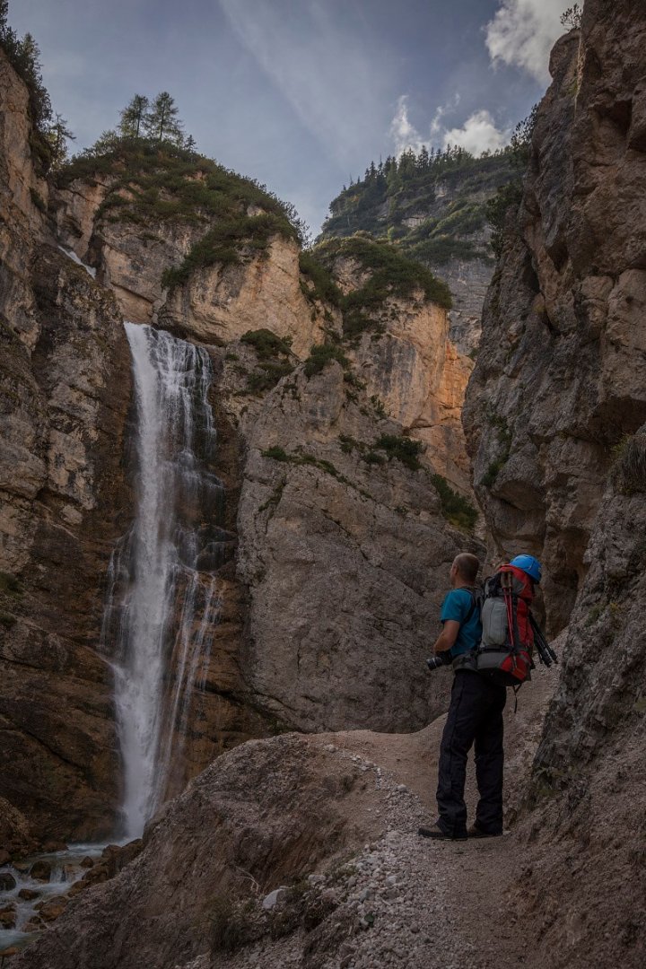
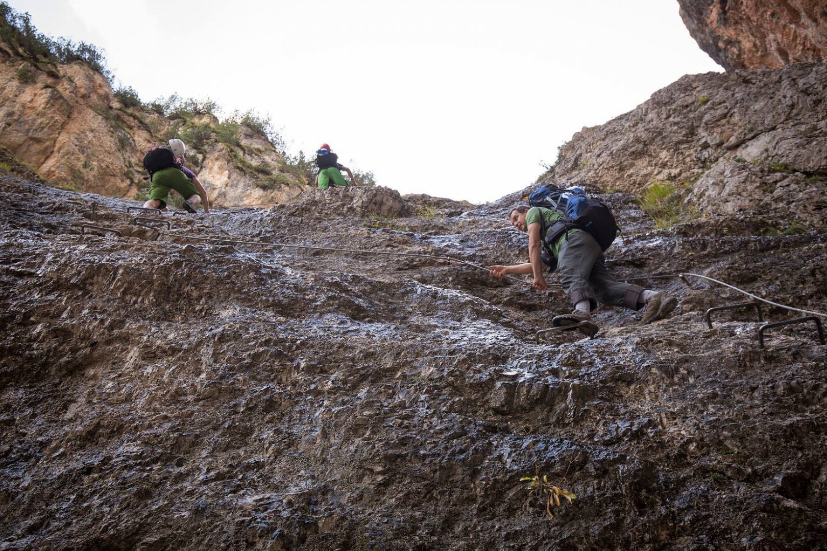
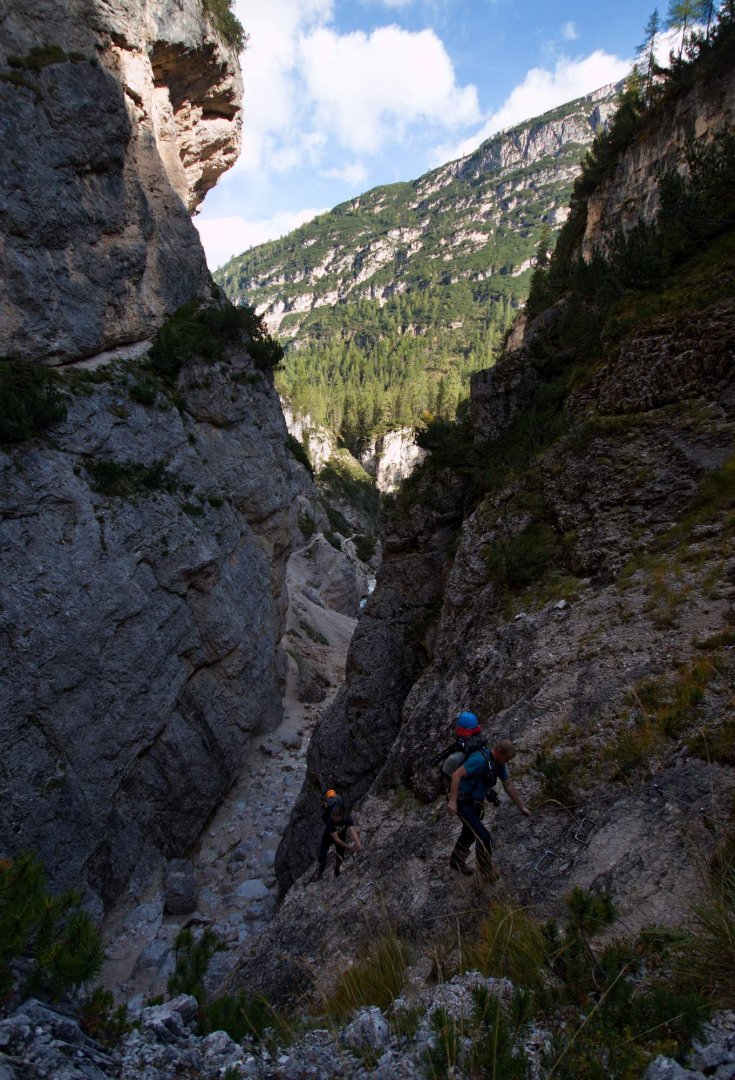
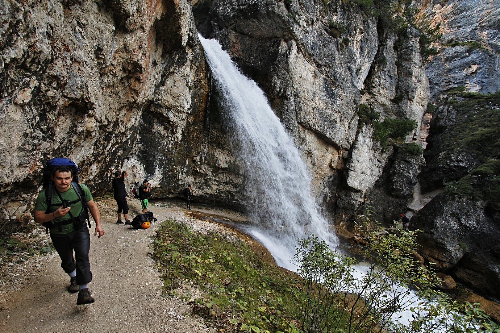
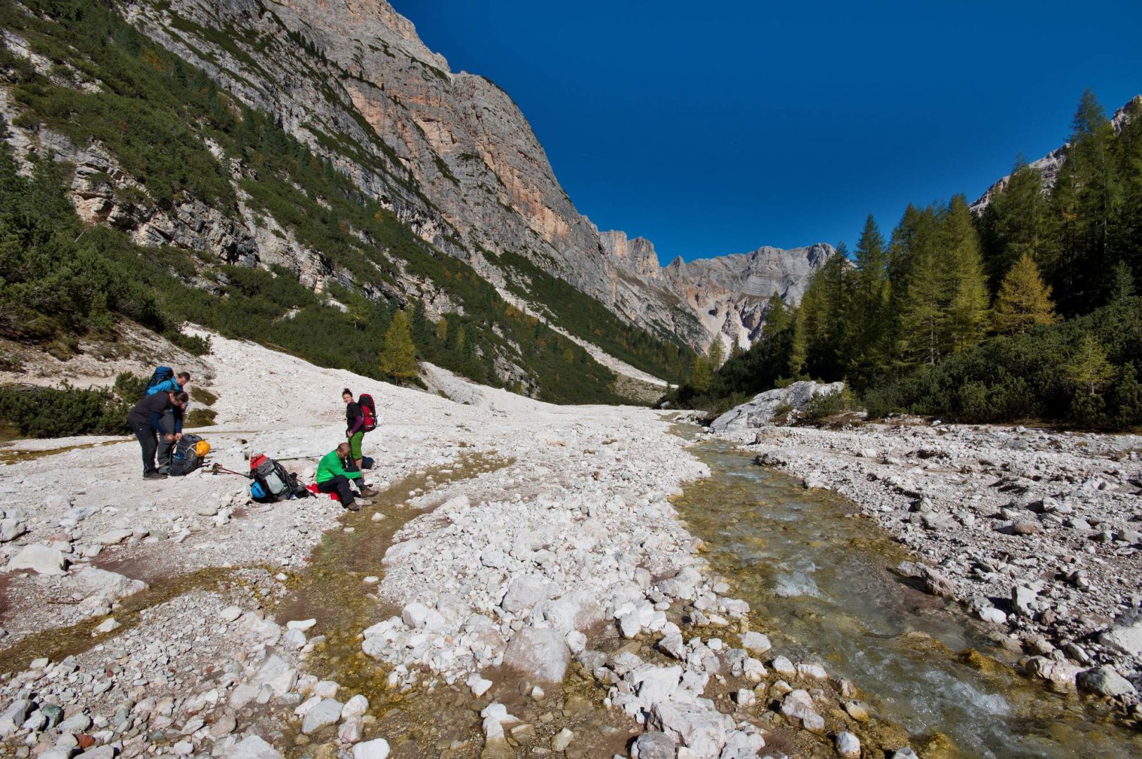
We started the trek at the mouth of the Fanes valley, a few kilometres above Cortina. At first we follow the normal asphalt road and about half a kilometer at the signpost we turn right. Then we follow a comfortable path for about two kilometres towards the Fanes waterfalls. There is a nice viewpoint on the opposite slope in front of the falls. From the viewpoint, descend a steeper and twisting trail to the bottom of the gorge below the lower falls where there is a trailhead. To the left you can follow an easy belayed path in the rock face but it is better to walk a little further along the bottom of the gorge to the next belayed section. It's a short secured rock outcrop I would guess no higher than 20 metres. It's an easy thing that even smaller children can do.
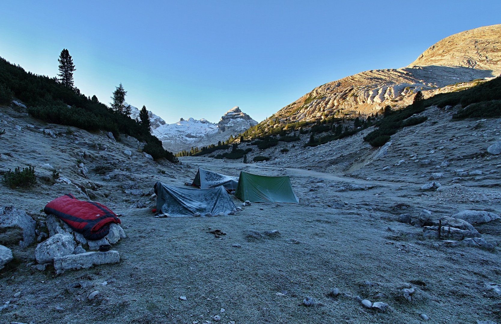
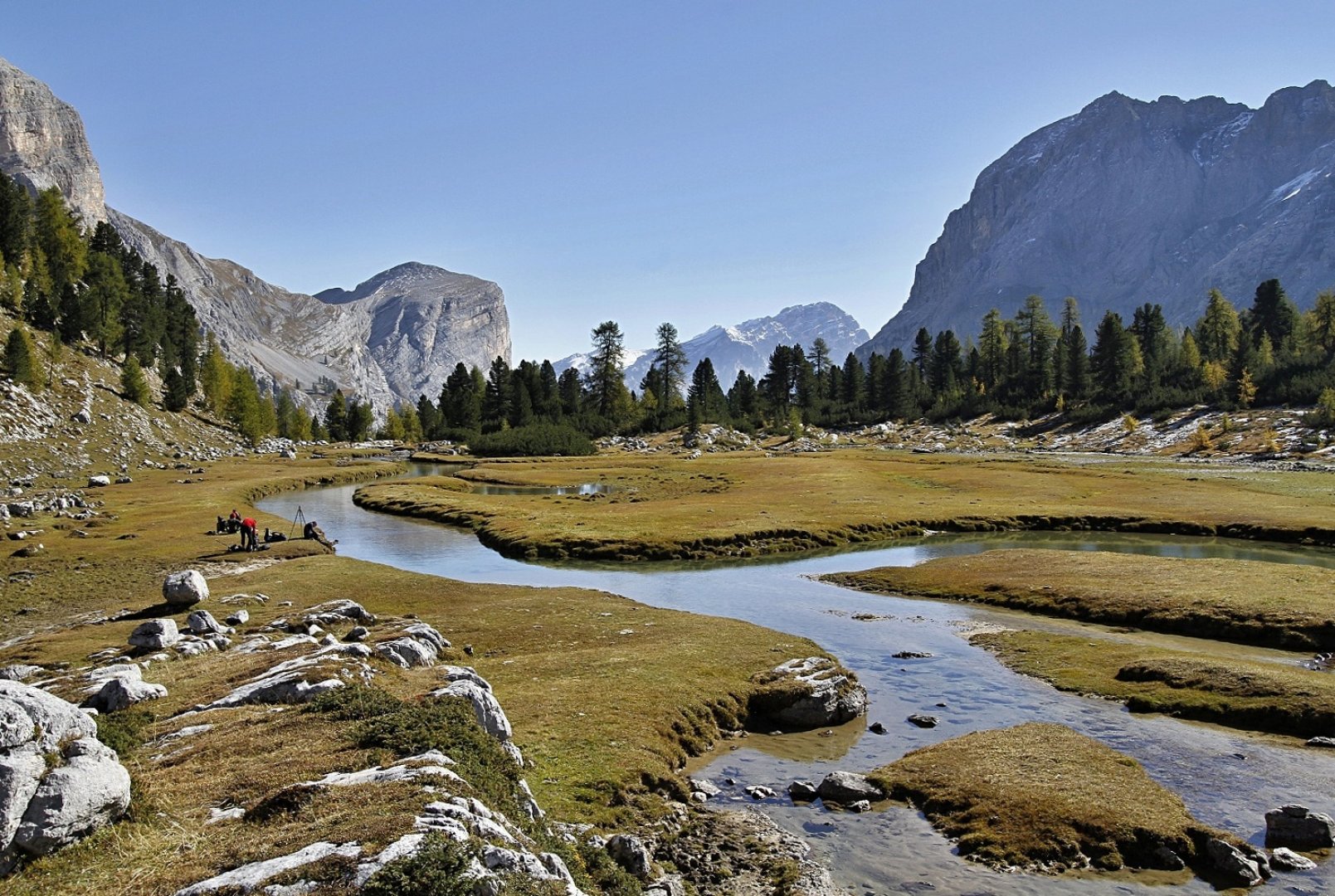
Above the secured place we then follow the trail which leads us after a few meters into a rock cleft and then follows the most attractive part of this section. Crossing behind the water wall of the upper waterfall. The section is secured with a rope because it is a slippery place, but otherwise no problems. Above the falls we then continue on a normal forest gravel road to a place called Malga Fanes Grande where we found a flat spot to sleep and ended the first day there. It's a great place by the Fanes stream with beautiful meanders.
2. day
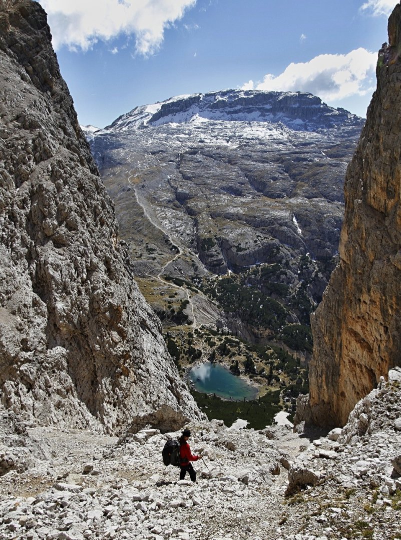
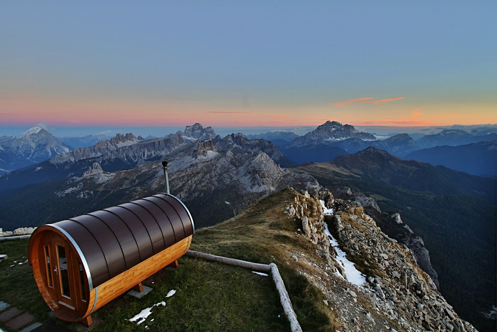
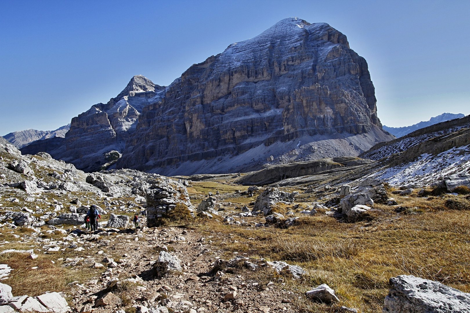
The next day we continued first on a wide path along the bottom of Val de Fanes and after about two kilometres we turned left towards the Lagazuoi hut. Here the trail climbs a bit more uphill and overcomes more elevation and after about another two kilometers of climbing, it starts to descend again in steep serpentines to Lake Lagazuoi. From Lago di Lagazuoi we then continued along a comfortable and wide path to the rifugio Lagazuoi. We had planned to spend the night on top of the Lagazuoi mountain but due to the strong and cold wind we decided not to sleep under the open sky and to use the huts for the night instead.
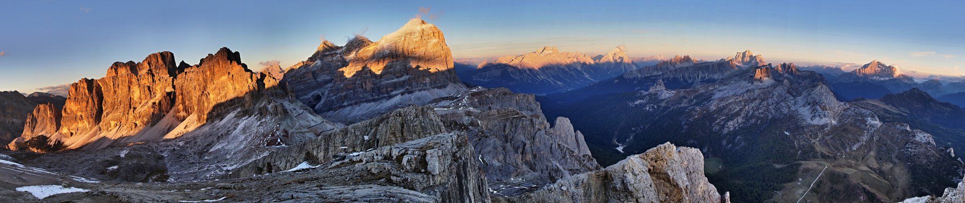
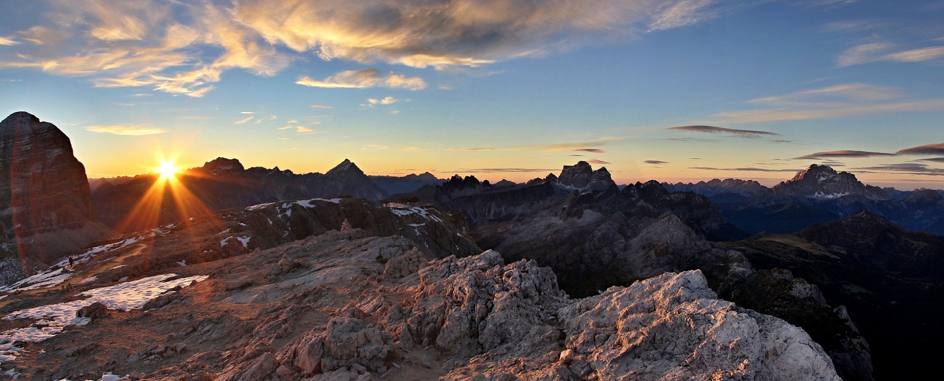
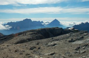
The cottage owner let us sleep in the basement of the cottage which does not look like a basement but more like a luxurious winterraum with toilets and for a fee with a hot shower. At least we could take pictures of the sunset and sunrise and have a beer at the cottage. Due to the date (end of September) the cottage was half empty. The situation will be different in high season, when you will meet a lot more people - also thanks to the fact that there is a cable car leading to the hut behind the Falzarego saddle. I was there once in August and it was really crowded especially with Japanese. Otherwise, Lagazuoi has great views in all directions.
3. day
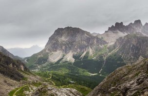
On the third day we basically just walked downhill through the long but beautiful Val Travenanzes valley. It's about a 12- 14 km long valley and we didn't meet a single person during the whole descent. The valley empties into another valley, the familiar Fanes valley near the waterfalls and from this point we continued on the normal path to the car park.
Difficulty
The trek is not technically difficult, the paths are mostly comfortable - only a few sections are narrower and steeper. The only slightly more technical spot is at Fanes Falls, where there is a short, narrow ferrata. There's no need to take gear for the ferrata, it's really just a few metres of rope and if you take your distance you don't even need a helmet. My kids climbed it like squirrels in minutes years ago. My daughter was 8 at the time and did it perfectly fine. Just keep in mind that the trail at the falls is still wet and it can be slippery. If you don't want to go over the falls, they are easy to get around on the normal trail. The rest of the trek is without much tricky stuff. Part of the trail is on a rocky path the rest is on mountain trails.
Water availability
There is water at several points along the route. Especially in the Fanes valley there is plenty of it, but it needs to be filtered because the whole area is used as pasture. You can buy water at the Lagazuoi hut. In the Travenazes valley you can use water from the stream without any problems.
Sleeping options
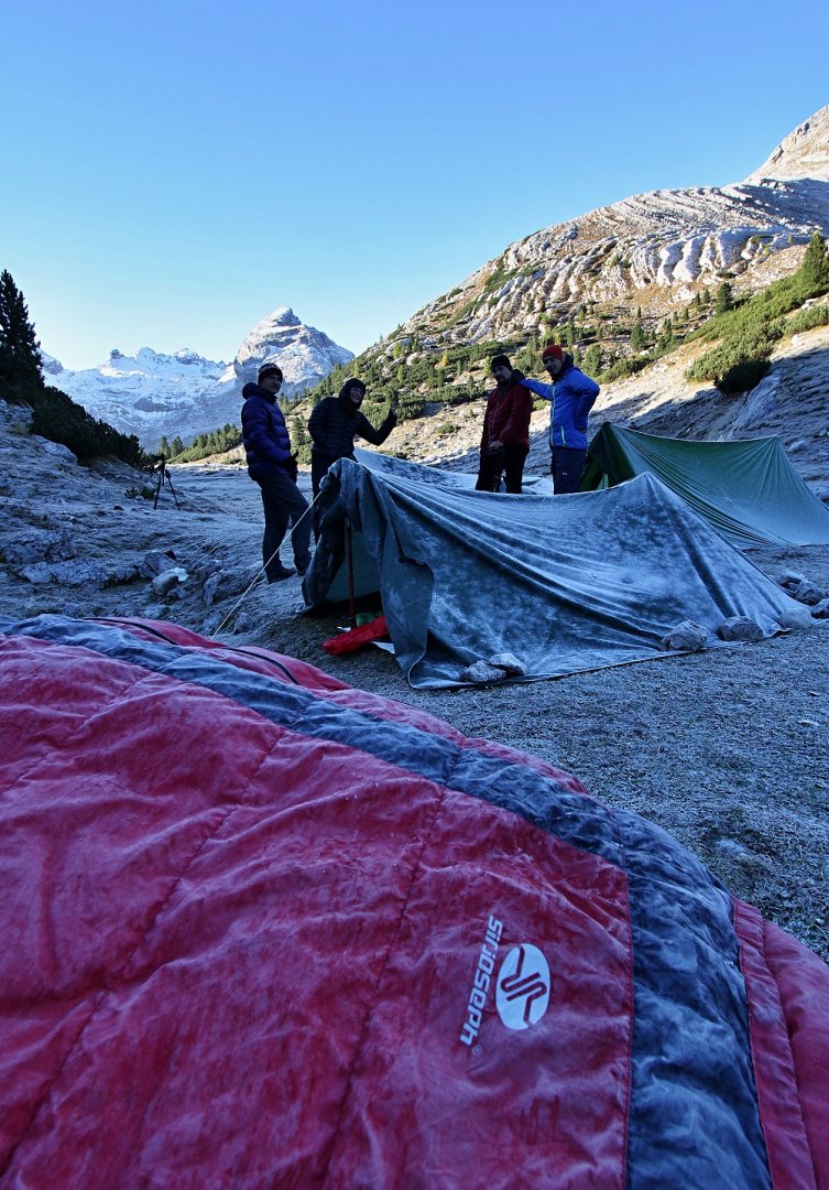
The first night we slept under the open sky in Malga Fanes. The second night we used the basement of the Lagazuoi hut for 18 Euro/person/night.
Mountain peaks
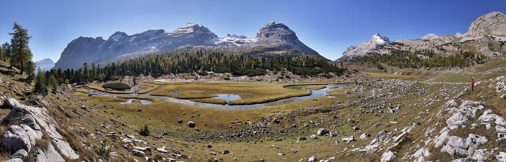
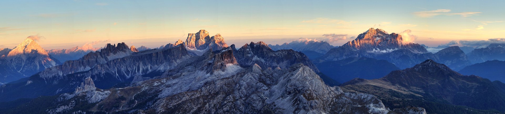
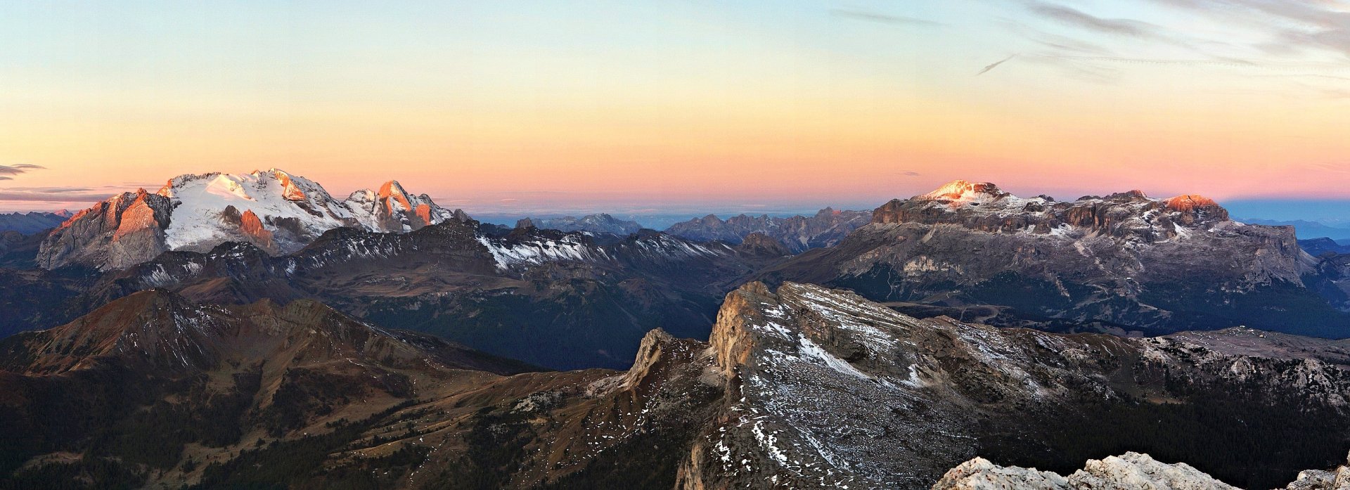
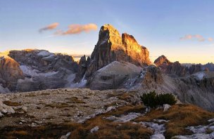
The highest point of the route is Piccolo Lagazuoi 2 778 m.a.s.l. From Lagazuoi there is a great view of Marmolada, Tofany, Monte Pelmo, Civetta and other giants of the Dolomites.
Danger
There is basically no danger on the route under normal conditions (i.e. good weather). Only at the waterfalls you need to be careful of slippery rocks, but otherwise it is a perfectly relaxing affair for the more experienced mountain hiker.
Food
After years of trying, we end up taking, for example, oatmeal from Lidl, you can buy excellent instant soups in health food stores, it weighs nothing and you eat quite well. We also tried dehydrated food, but I didn't like it very much. Otherwise, classic protein bars, chocolates and always at least one beer in a can. Of course, we always take our used cans back to civilization . Besides our own supplies, you can eat at rifugio Lagazuoi, which is open all year round.
Attractions
The trek goes through the Fanes Sennes Braies Nature Park, and there are many things to see along the way. Worth mentioning are the Fanes Falls, the highest waterfalls in the Dolomites, and the Lagazuoi peak alone would make for several pages of reading. This point was fiercely fought over in World War 1 and the longest tunnel in the Dolomites used by soldiers was dug in its massif. The routes in the area can be combined in various ways , from easy to challenging on assured routes with proper equipment.