Mountain range, region / State
Dolomites in Alps / Italy
Season
Summer
24. 06. 2011
Difficulty
3 / 5
Elevation
↑ 1348 m
↓ 1348 m
Length
9.9 km
6 hours
Altitude
max. 3298 m n.m.
min. 2017 m n.m.
Tips for hikes in the mountain range Dolomites in Alps
6-day crossing of the Dolomites along the Alta Via 1 route
Circular trek at the waterfalls in the Fanes Sennes Braies park in the Dolomites
Trek with the best ferrata in the Sexten Dolomites
One-day trek to the next peak of Marmolada - Punta Rocca 3 309 m above sea level.
Starting point
Parking at the Lage di Fedaia dam near the Rif hut. E. Castiglioni between Mount Marmolada and the Padon ridge.
Description of the hike
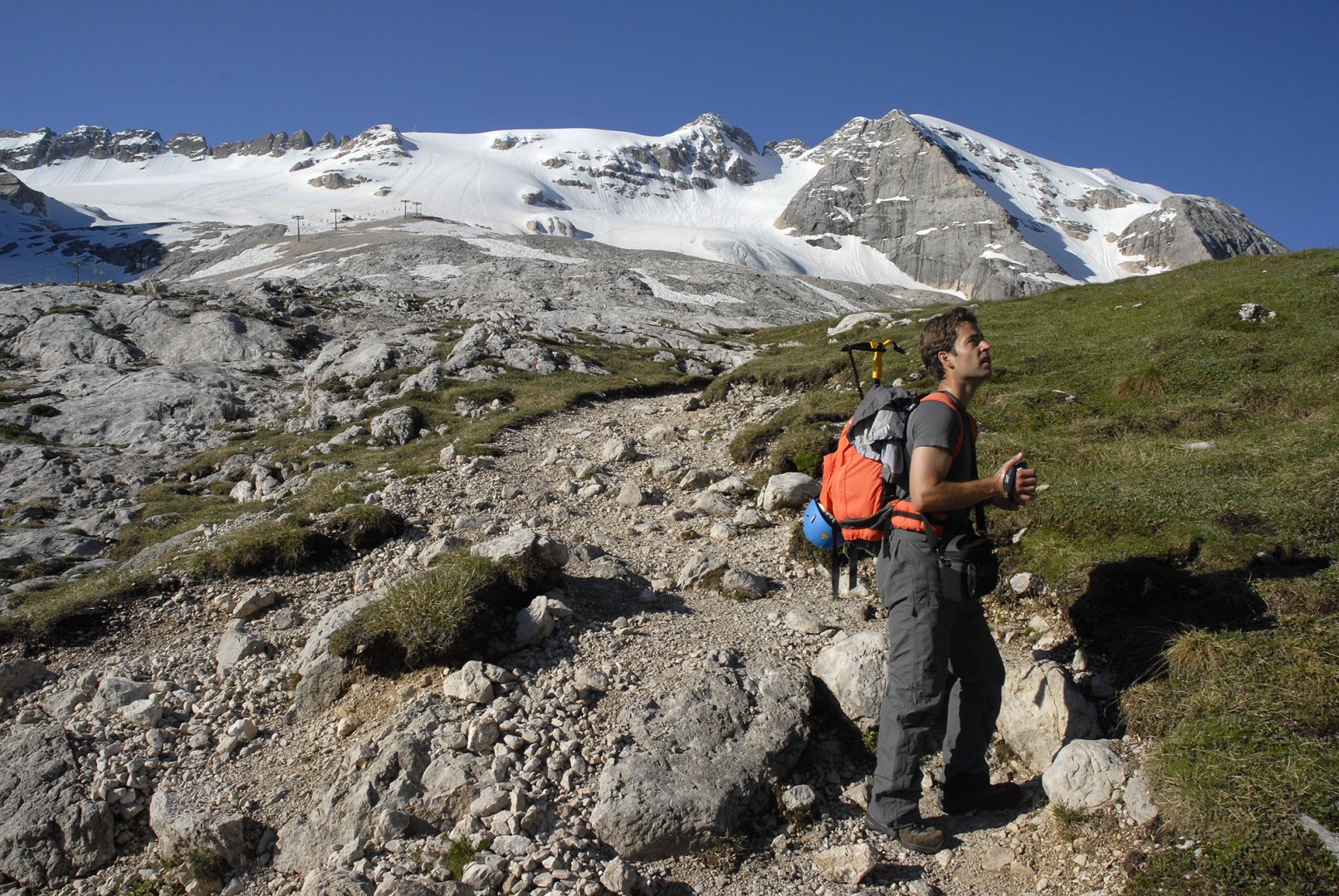
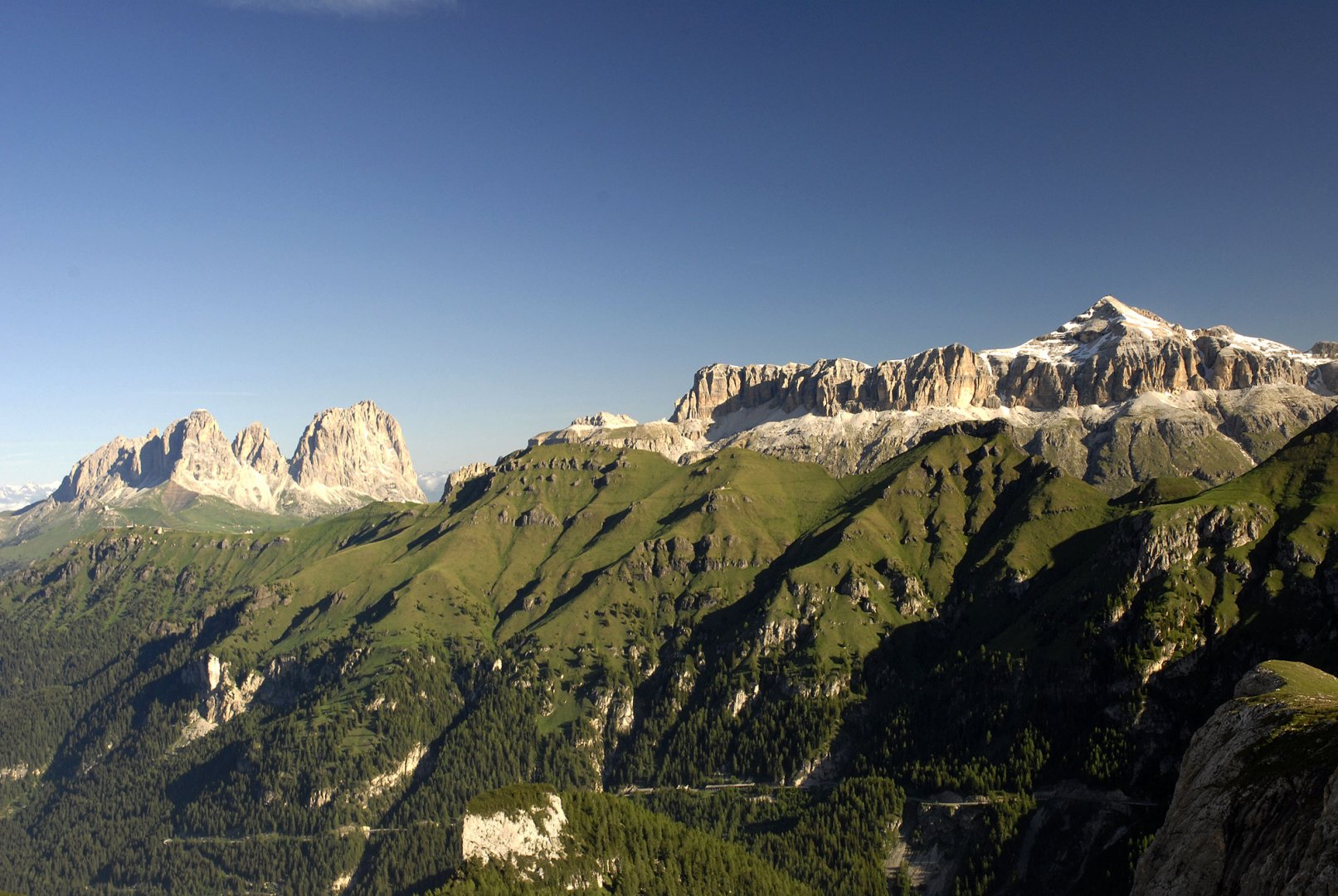
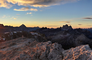
We started our ascent to Marmolada 3 343 m above sea level at the parking lot of the Lago di Fedaia dam. We left the car at the Rifugio E. Castiglioni hut. Since we started early in the morning, the cable car was not yet in operation. Therefore, we started to climb the path under the cable car on foot. But the journey was very pleasant. (photo) The climb is not steep and it did not take long, and new views kept opening up as we went along. (photo) The trail gradually turned into stone fields, which we followed to the beginning of the Marmolada glacier. (photo)
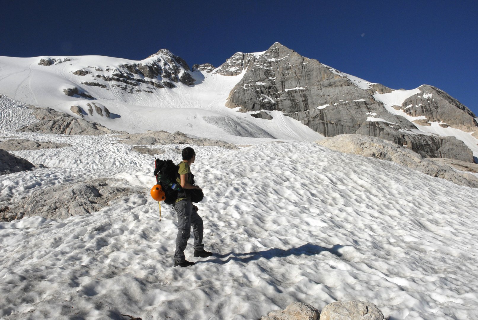
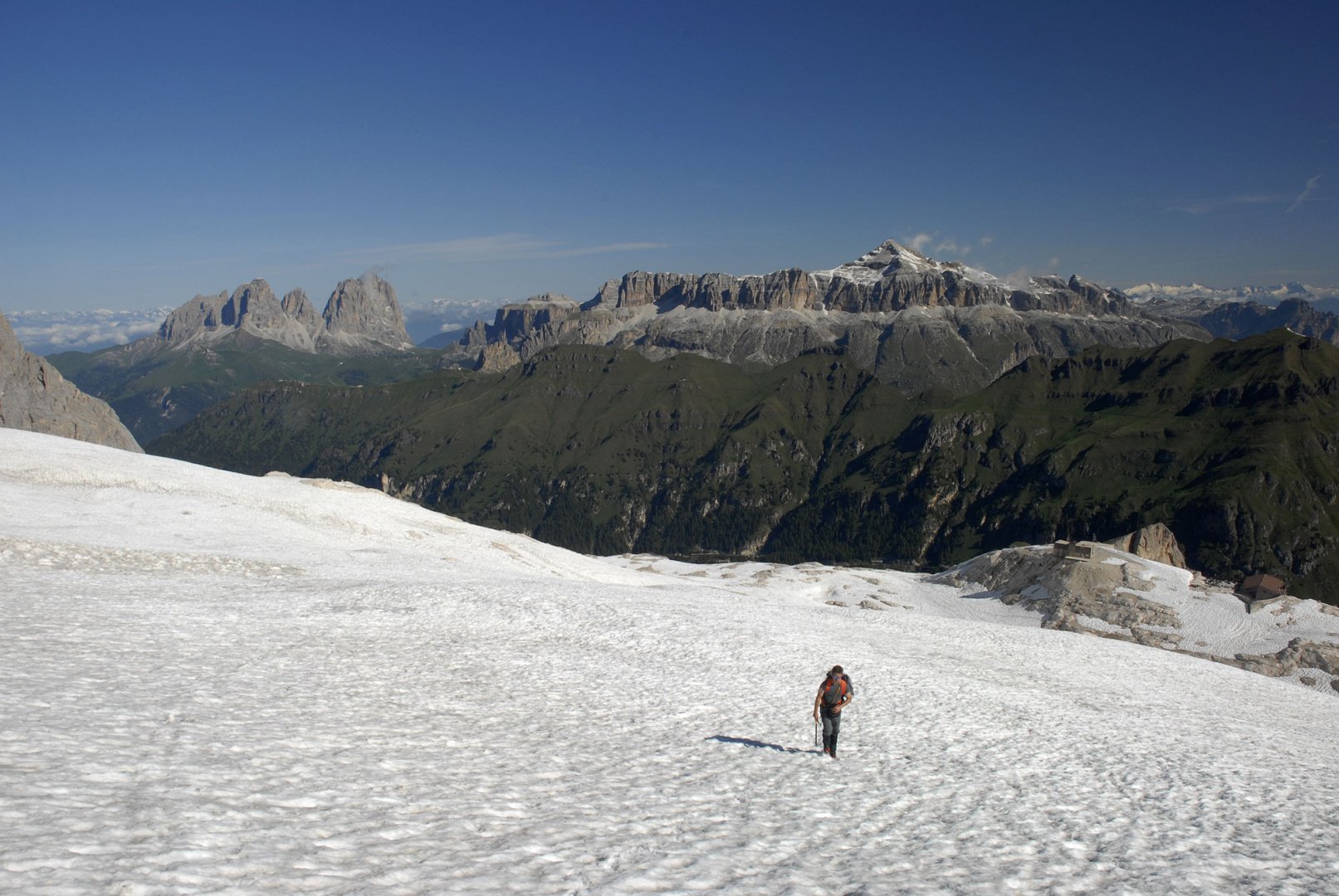
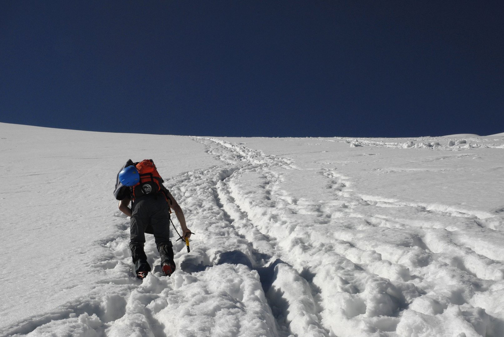
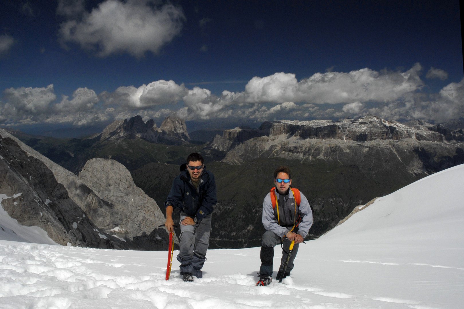
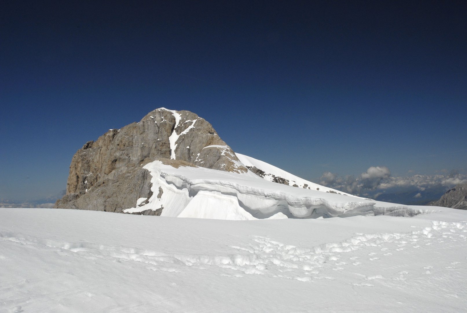
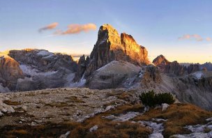
After a short rest, we put on our glacier gear and headed out. And this is where the mistake happened. Since we went in June, the path to Marmolada was not well trodden. Therefore, we were confused by the tracks that led to the summit ridge east of the highest point of Marmolada. Unfortunately, the correct ascent route led through the middle couloir between the rock ribs. (photo) Therefore, we gradually started to climb up the glacier more to the left than the correct route. Anyway, it still went very well. There was still a lot of snow on the glacier, so we climbed without any problems even in the steepest point, (photo) just below the summit ridge. When we reached the ridge a short distance from the top station of the cable car coming from the other side, we discovered our mistake.
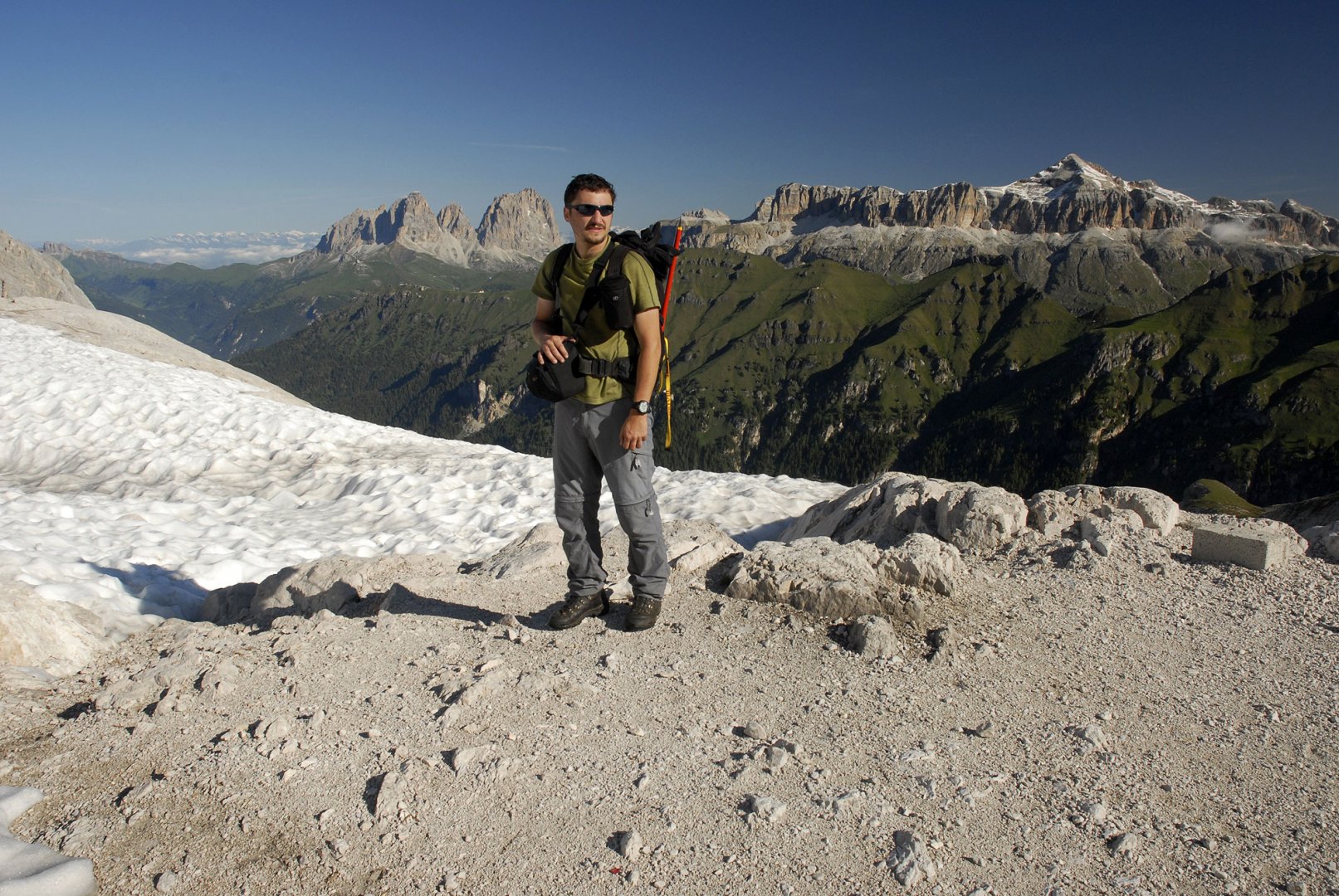
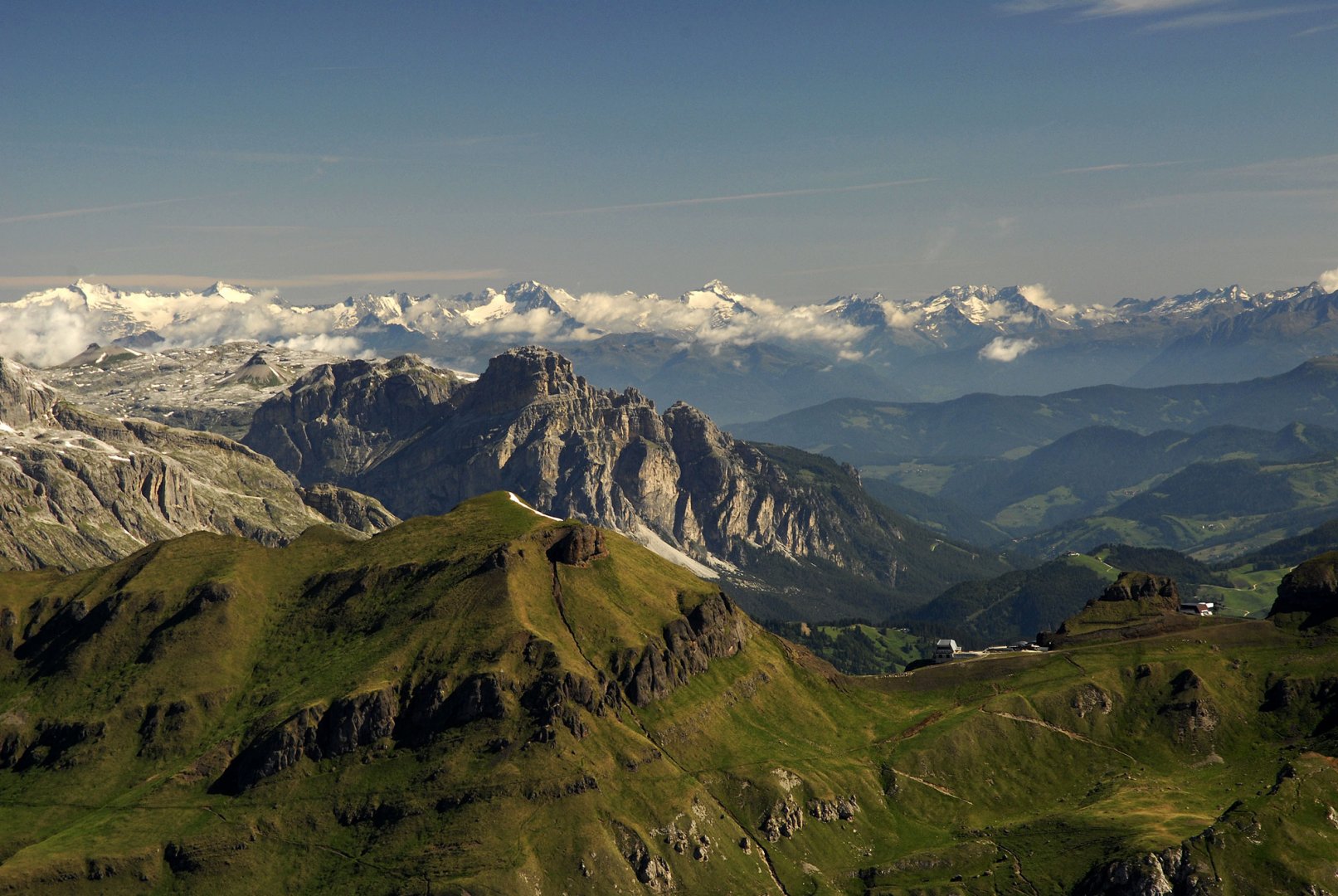
Therefore we decided to climb at least the next peak of Marmolada - Punta Rocca 3 309 m above sea level (photo) After the ridge we came to the rocks. We started climbing up them. Unfortunately, there was still too much snow and so we turned our attempt to climb the peak around 10 meters below the summit. Still it was worth it. The views in all directions are impressive. After a short rest we started to return. Eventually, due to fatigue, we abandoned our attempt to connect to the proper ascent route to Marmolada and descended the glacier to its base. Here we had a good rest. Then we just ran back to the car in the parking lot. Although we didn't manage to climb Marmolada, it was certainly not a bad trek. Even the weather was good.
Difficulty
Moderately difficult climb mostly on glacier. The first part of the ascent is on trails and stone fields, there is no problem here. After that there is a climb up the glacier, which is quite steep in places. Technically it is not a difficult trek. We didn't end up summiting the highest point of Marmolada because we accidentally went in the wrong direction. Therefore, we tried to climb the next peak, Punta Rocca. In the end, we were about 10 vertical metres short of the summit. There is no road to this peak and due to the amount of snow it would have been very dangerous to try to climb to the top.
Water availability
There is no spring on the road, so we had all our water supplies with us.
Mountain peaks
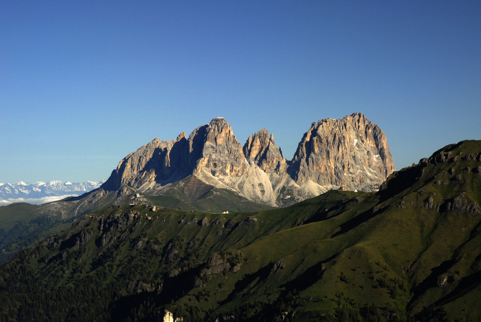
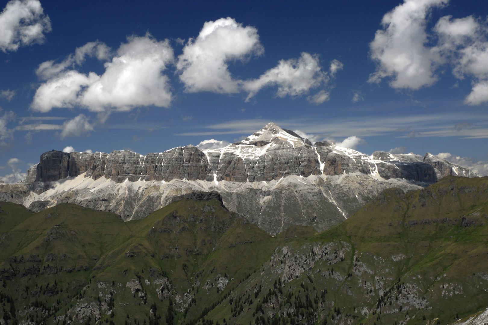
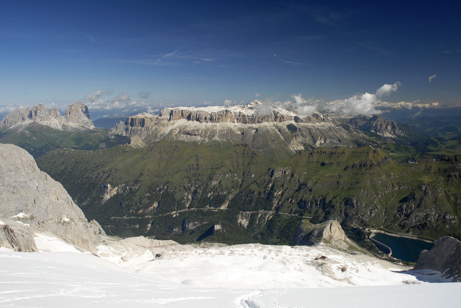
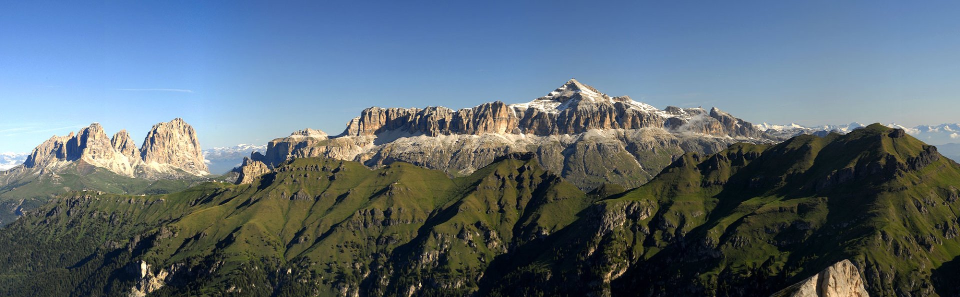
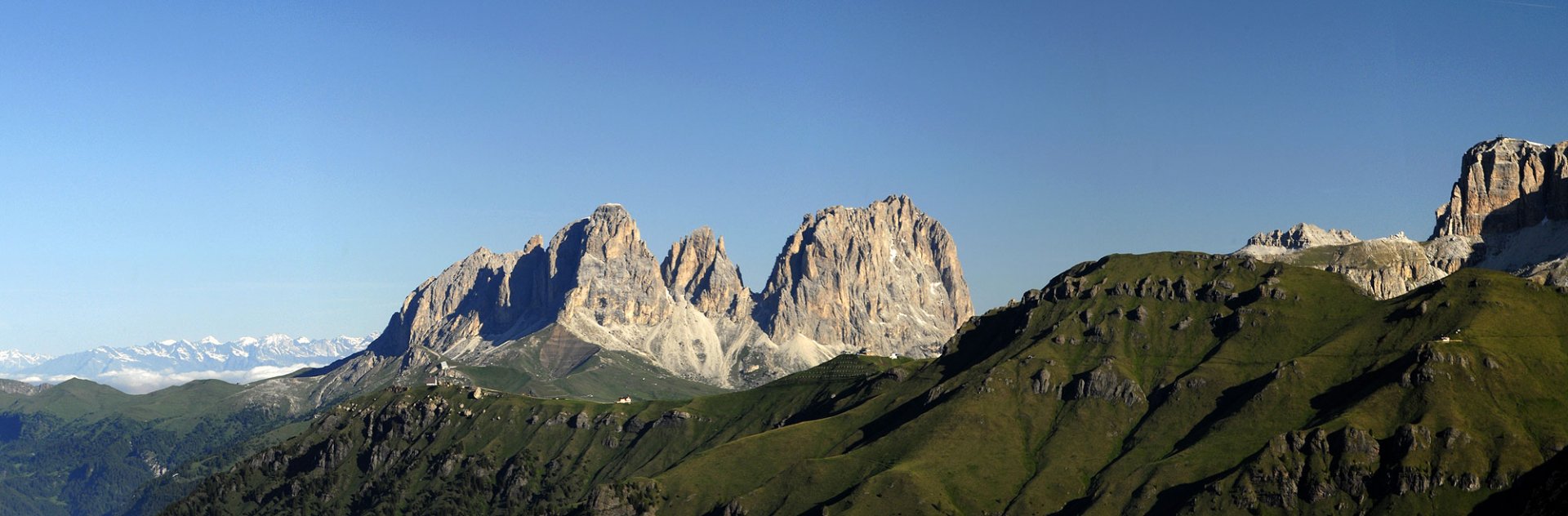
On our route it is possible to climb the Punta Rocca peak 3 309 m above sea level, otherwise the main goal is of course the Marmolada peak. From the ascent there are beautiful views of the Sela massif with Mount Piz Boe, Sassolungo and the more distant Tofan group and other Dolomite giants.
Danger
The first part of the trail leads along paths and stone fields. The glacier on Marmolada is safe, there are no crevasses. The ascent is only quite steep in places. We didn't end up scrambling to the top of Punta Rocca as there was still a lot of snow and no path. That's why we ended up about 10 meters below the summit.
Equipment
To climb the Marmolada you need glacier equipment, at least crampons and an ice axe. There are no cracks on the way. Good sunscreen and sunglasses are also necessary.
Food
There is no hut on the route, so it is necessary to have all food supplies with you. You can buy provisions at the starting point at the parking lot of the Lage di Fedaia dam or at the Rifugio E. Castiglioni hut.
Attractions
The main goal of our trip was to climb the highest mountain of the Dolomites - Marmolada. Unfortunately, we went quite early and the path on the glacier was not well trodden. Therefore, we mistakenly headed to the next peak, Punta Rocca. We weren't at the highest point of the mountain range, but it was still worth it and the views are really unique.
Photos