Mountain range, region / State
Rätikon / Liechtenstein
Season
Summer
18. 07. - 21. 07. 2021
Difficulty
4 / 5
Elevation
↑ 3803 m
↓ 3802 m
Length
34.4 km
4 days
Altitude
max. 2937 m n.m.
min. 1361 m n.m.
Trek through three countries in the Rätikon Mountains
Starting point
Free parking in Malbun with plenty of spaces.
Description of the hike
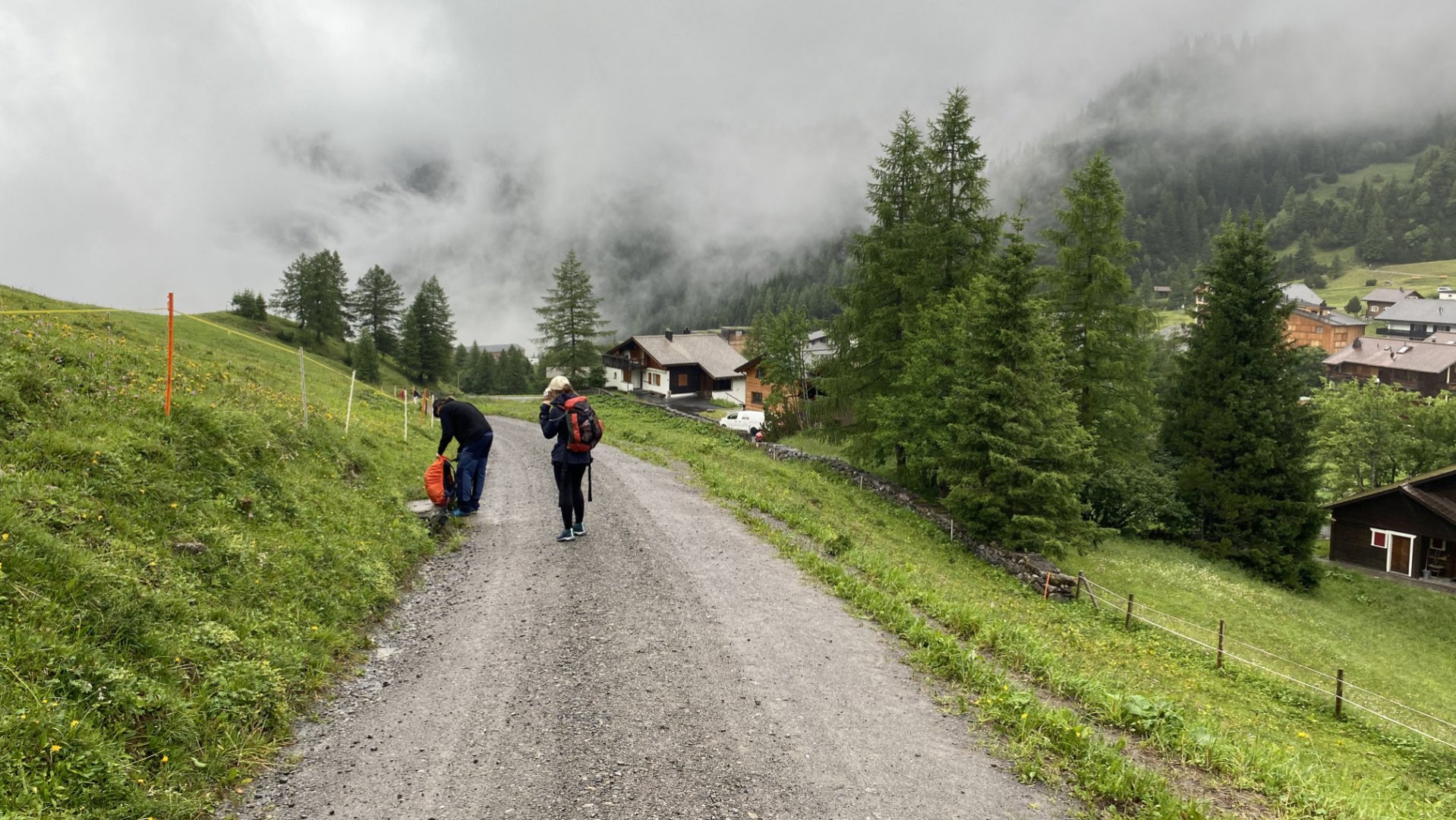
1. day
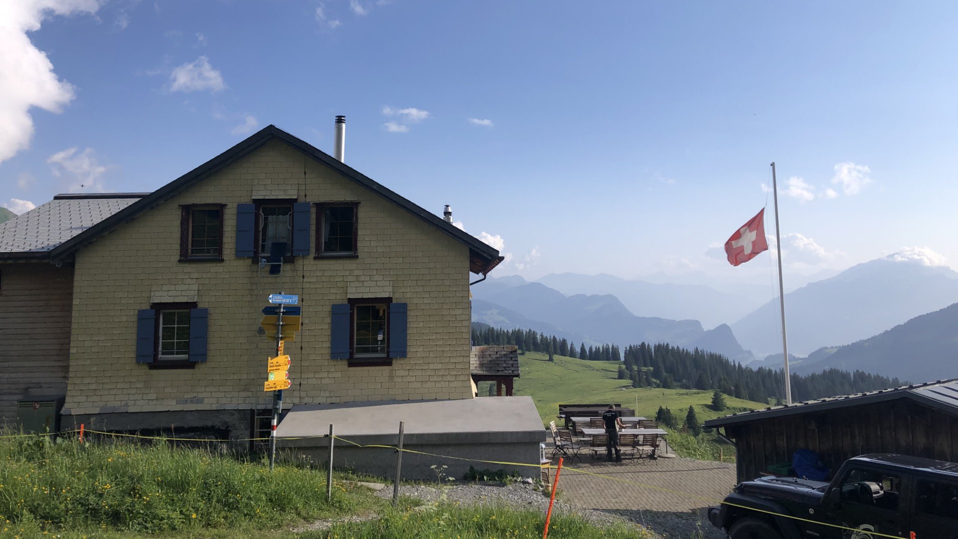
The trek starts with a very pleasant climb along a wide path up to the first hut, Pfälzerhütte (2,108 m). The hike takes about 3 hours, so you just need to go in the afternoon. you can still climb to the top of the Naafkopf (2 571 m above sea level) at the hut.
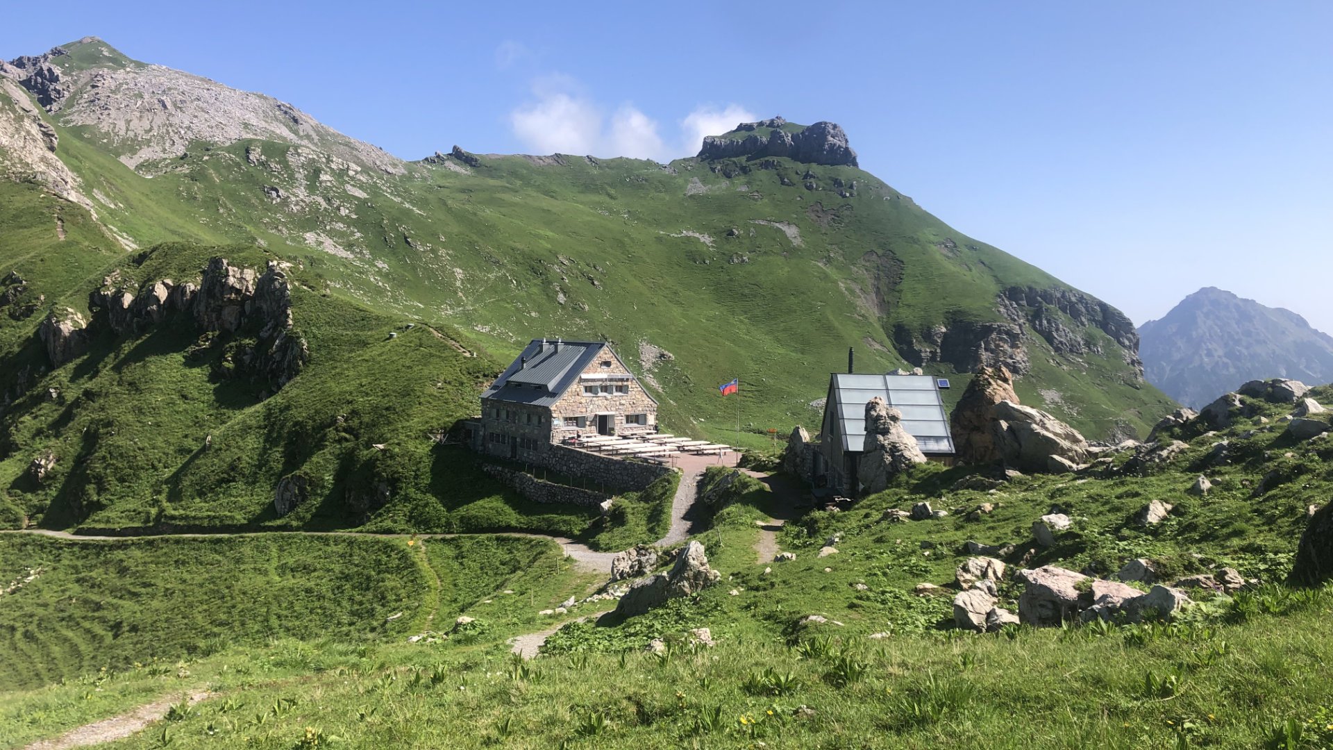
2. day
The second day is marked by the transition from the Pfälzerhütte hut (2 108 m above sea level) to the Schesaplanahütte hut (1 908 m above sea level).
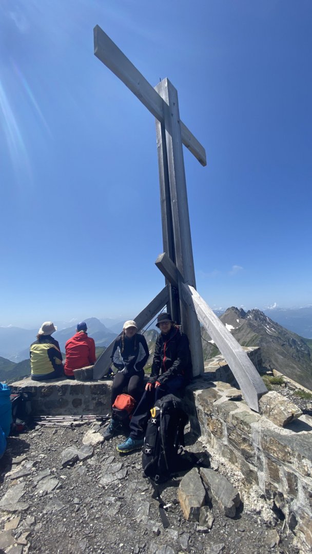
3. day
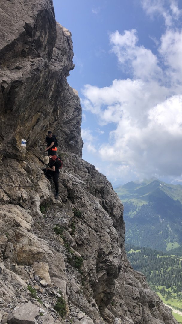
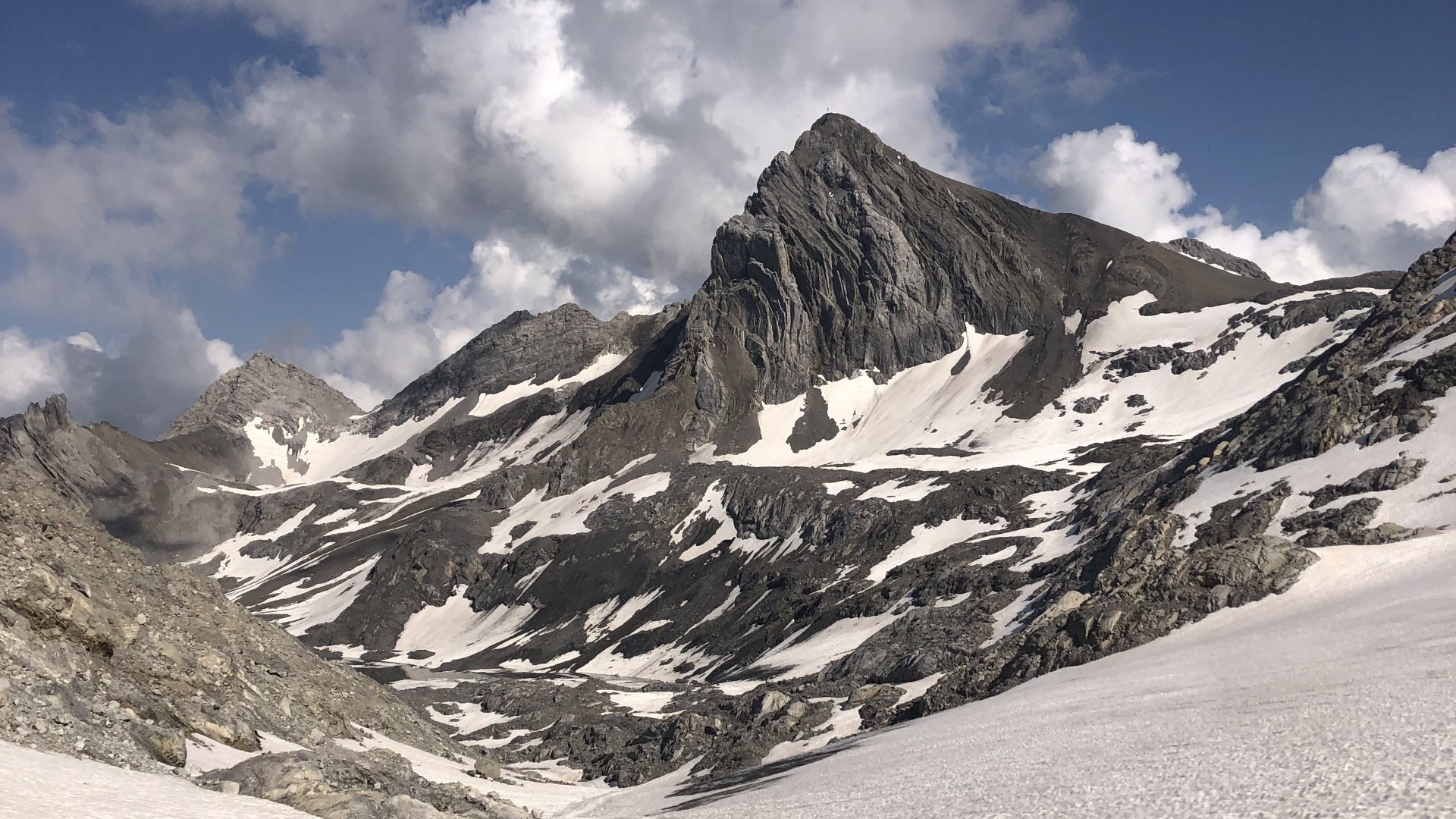
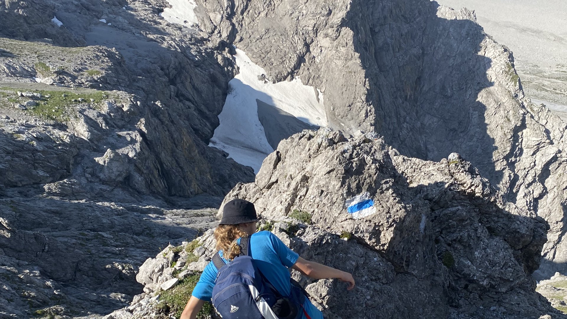
The steepest climb is right from the second hut Schesaplanahütte (1 908 m above sea level) up to the top of Schesaplana (2 965 m above sea level) where you climb a little over 1 000 vertical metres in about 3.5 kilometres. The start is on a mountain path followed by rocks where you will enjoy occasional climbing on all fours, part of the way is an unpleasantly exposed path with loose surface.
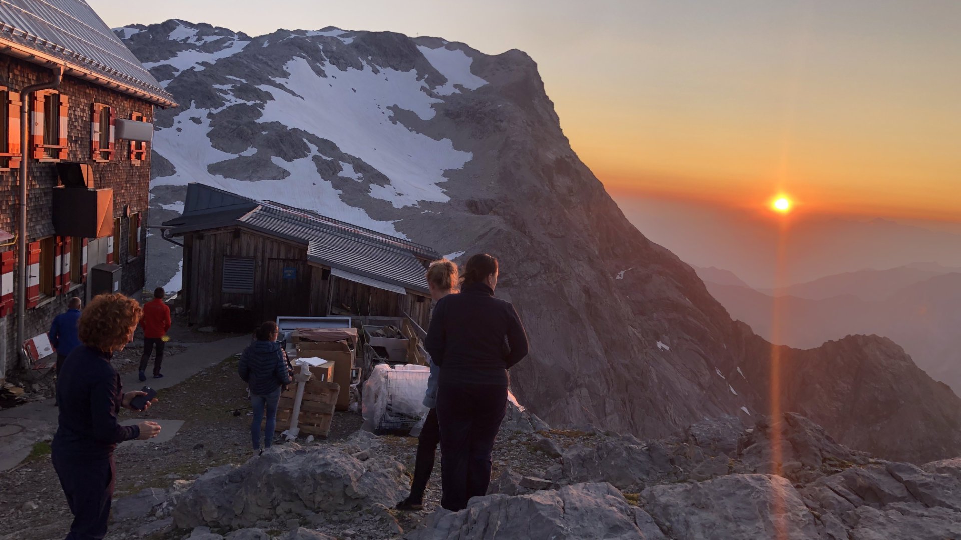
As a reward, you will reach the beautiful summit from the signpost on the Swiss-Austrian border via a pleasant mountain path. On the way to the Mannheimer Hütte (2,679 m above sea level) you will have a pleasant crossing over a glacier.
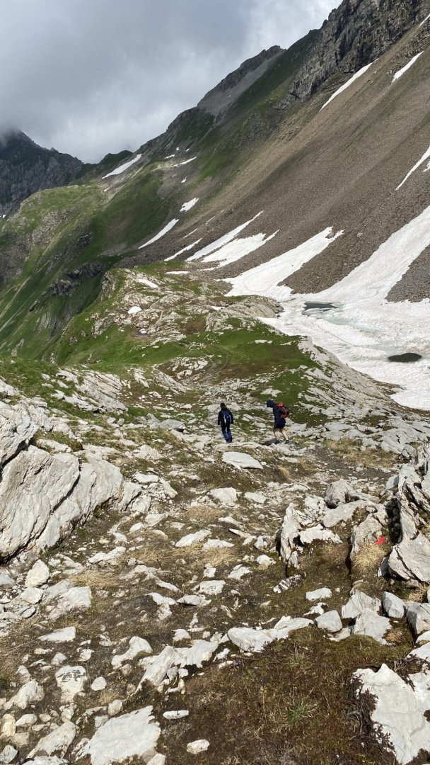
4. day
Next, you will have a technical section over rocks, where you will meet some chains and ladders, you will descend on a gravel road to the valley, and then you will only have to walk back to Malbun on a pleasant road, which is already quite long after three days. On the way, you can stop for a meal or coffee in the Nenzinger Himmel valley.
Difficulty
We managed the whole trek without any special equipment (just good shoes and clothes for the mountains). The trek starts with a very pleasant climb up a wide path to the first hut, where the path disappears and the terrain becomes more challenging. The steepest climb is right from the second hut Schesaplanahütte to the top of Schesaplana.
The start is on a mountain path followed by rocks where you can enjoy occasional climbing on all fours, part of the way is an unpleasantly exposed path with loose surface. As a reward, you will reach the beautiful summit from the signpost on the Swiss-Austrian border via a pleasant mountain path. On the way to the Mannheimer Hütte, you will have a pleasant crossing of the glacier. Then there is a technical section over rocks, where you will also encounter some chains and ladders, you will descend on a gravel path to the valley, and then you can just walk back to Malbun on a pleasant path.
Water availability
We took water at the huts and sometimes in the mountain springs which were clean, without the need for filtration, 3l bag per person should be enough.
Sleeping options
You can stay at the huts along the Pfälzerhütte trail (2,108 m above sea level) or at the Schesaplanahütte (1,908 m above sea level).
Danger
No wildlife will threaten you on this hike. The only danger, as with most mountain ridge treks, can be the weather and underestimating your equipment or your fitness.
Food
For your refreshment you can use one of the listed mountain huts on the trek. Of course, you have to have your own equipment for the hike itself (snacks, chocolate, plenty of water - you can get it at the huts).